Image: U.S. Geological Survey
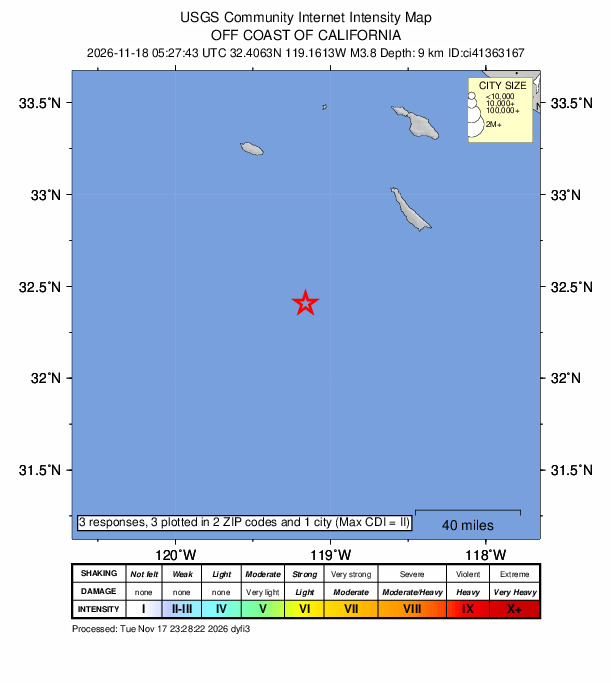
A magnitude 3.8 earthquake rumbled beneath the Pacific Ocean off Southern California late Tuesday, far enough offshore that only a handful of people on the mainland reported feeling it, according to the U.S. Geological Survey.
The quake struck at 9:27 p.m. PST Tuesday, Nov. 17, which was 11:27 p.m. CST and 05:27:43 UTC Wednesday, Nov. 18. The USGS placed the epicenter about 87 kilometers, or 54 miles, southwest of the northwest tip of San Clemente Island, the southernmost of California’s Channel Islands. It was about 89 kilometers (55 miles) from the island’s southeast tip and about 98 kilometers (61 miles) from San Nicolas Island.
On the mainland, the closest cities listed by the USGS were Torrance, about 176 kilometers (109 miles) away; Huntington Beach, about 179 kilometers (111 miles) away; and San Diego, about 193 kilometers (120 miles) away.
The USGS reported the depth at 9.8 kilometers, or about 6 miles. The magnitude was calculated at 3.84 by the Southern California Seismic Network, which is operated by Caltech and the USGS. The USGS lists the event as reviewed.
USGS shaking estimates were far below levels associated with damage, and the agency did not issue a PAGER alert, the automated system it uses to estimate potential fatalities and economic losses after significant quakes.
Weakly Felt on The Mainland
Three people submitted reports to the USGS “Did You Feel It?” system, which collects public accounts of shaking. The highest community intensity reported was II, which corresponds to weak shaking on the Modified Mercalli Intensity scale.
According to the USGS data, one report came from the Rancho Santa Margarita area in southern Orange County, about 198 kilometers (123 miles) from the hypocenter, and rated the shaking at intensity II. A report from Mission Viejo, about 193 kilometers (120 miles) away, was rated intensity I, or not felt. A third report came from Mexicali in Mexico’s Baja California state, more than 340 kilometers (210 miles) from the quake, and was also rated intensity II.
The USGS ShakeMap, which estimates ground motion using seismic stations and models, showed a maximum instrumental intensity of about 1.3 at recording stations, a level generally considered not felt. The map’s estimated shaking for the open ocean directly above the quake was higher but still in the weak to light range.
Because the quake occurred so far offshore, few people were close enough to notice it. The reviewed ShakeMap shows the epicenter in open water, with San Nicolas and San Clemente islands the only land in view.
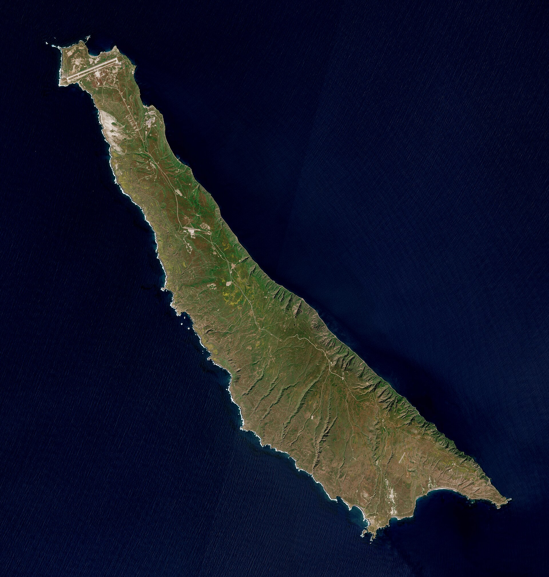
Image: Copernicus Sentinel-2, ESA
No Tsunami Threat
The USGS listing for the quake shows no tsunami flag. A quake of this size is far below the magnitude that typically generates a tsunami.
Location Details
The epicenter was calculated at 32.406 degrees north and 119.161 degrees west. The USGS said 56 seismic stations were used to locate the quake, with the nearest about 0.77 degrees, or roughly 85 kilometers (53 miles), away. The location carries a horizontal uncertainty of about 1.9 kilometers (1.2 miles) and a vertical uncertainty of about 1.1 kilometers (0.7 miles).
The azimuthal gap, the largest angle between stations as seen from the epicenter, was 274 degrees. That large gap reflects the quake’s position well out at sea, with the recording stations concentrated on the mainland and islands to the north and east. Seismologists generally consider locations with large azimuthal gaps less well constrained than those surrounded by stations.
The magnitude carries an uncertainty of about 0.23 units, the USGS said, and was calculated from 23 stations.
An Uncommon Event for This Patch of Ocean
Earthquakes are frequent across Southern California, but this one stood out for its location.
A search of the USGS earthquake catalog found only one other earthquake of magnitude 3 or greater within 50 kilometers (31 miles) of Tuesday’s epicenter since Jan. 1, 2000: a magnitude 3.1 quake on July 31, 2007, local time, which the catalog lists as 88 kilometers southwest of the island’s northwest tip.
Widening the search to 100 kilometers (62 miles) turned up 21 quakes of magnitude 3.5 or greater since 2000. The catalog lists three quakes of magnitude 4.5 or greater within 100 kilometers since 1990: a magnitude 4.7 in October 1993, a magnitude 4.5 in June 1997 and a magnitude 5.0 in October 2005, the largest of the three, about 44 kilometers south-southeast of San Clemente Island’s southeast tip.
Seismic monitoring far offshore is less dense than on land, so smaller quakes in the region may go undetected or be recorded with larger uncertainties, and catalog counts there should be read with that limitation in mind.
No other earthquakes of magnitude 1 or greater were recorded within 120 kilometers (75 miles) of the epicenter during the 20 hours before 12:26 UTC Wednesday, according to the USGS catalog, meaning the quake was not accompanied by any detected aftershocks or foreshocks in that period.
Faults Beneath the Sea
The seafloor off Southern California, known to geologists as the California Continental Borderland, is crossed by a series of faults. The USGS has studied several of them, including the San Clemente and Catalina faults, using high-resolution marine geophysical data.
According to the Southern California Earthquake Data Center at Caltech, the San Clemente fault zone is at least 210 kilometers long, with right-lateral and vertical offsets, and is essentially continuous with the San Isidro fault zone off the coast of Mexico. It forms a scarp on the east side of San Clemente Island, lies about 70 kilometers off San Diego and has a slip rate of roughly 1.5 millimeters per year. Its most recent surface rupture occurred in the Holocene, the geologic epoch spanning the past roughly 11,700 years.
Tuesday’s quake, however, was centered well southwest of the island, and the USGS event page does not attribute it to a specific fault.
Be Prepared
Small quakes like this one can serve as a reminder to prepare for larger ones. The Earthquake Country Alliance, a statewide public-private partnership focused on earthquake preparedness, recommends that people “Drop, Cover and Hold On” when shaking begins.
People who felt the quake can still submit reports through the USGS “Did You Feel It?” page for the event, which helps scientists map how shaking was distributed.
