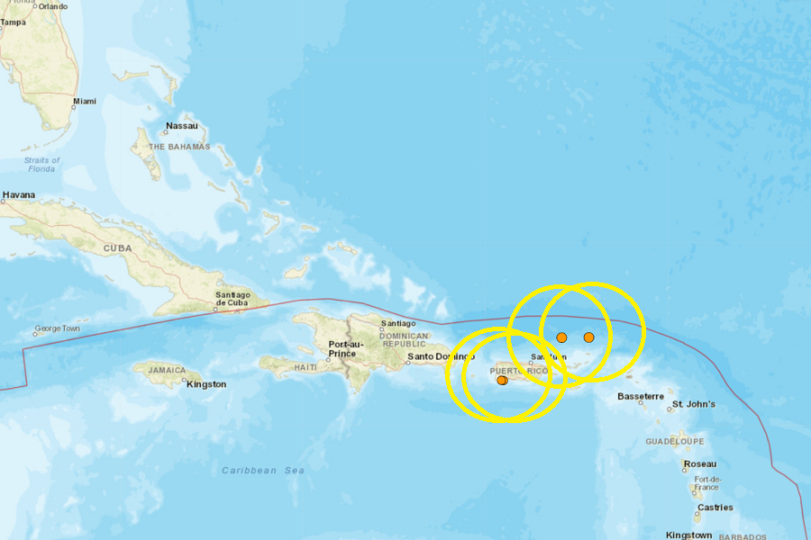
A series of earthquakes has rattled portions of Puerto Rico and the U.S. Virgin Islands in the last 24 hours, including a moderate 3.6 which struck 98 km north-northwest of Charlotte Amalie, USVI . Fortunately, none of the earthquakes that struck the Caribbean were strong enough to generate a tsunami; as such, there is no risk of tsunami to the U.S. East Coast, Puerto Rico, or the U.S. Virgin Islands.
The second strongest earthquake in today’s seismic activity happened 109 km north-northeast of Cruz Bay, USVI; that earthquake registered as a magnitude 3.4 event.
Two weaker earthquakes hit Puerto Rico: a 2.6 4 km east-southeast of La Parguera, and a 2.9 4 4km west-southwest of Guanica. Today’s earthquakes struck along the south coast of Puerto Rico where a strong earthquake hit in 2020. These earthquakes are likely continued aftershocks from that strong earthquake that struck the island in January 2020. That 6.4 created extensive damage in Puerto Rico, including widespread power failures across much of the island. An earthquake swarm started here in December 2019 and unrest has continued since.
These earthquakes are occurring near the northern edge of the Caribbean Plate, a mostly oceanic tectonic plate underlying Central America and the Caribbean Sea off of the north coast of South America. The Caribbean Plate borders the North American Plate, the South American Plate, the Nazca Plate, and the Cocos Plate. The borders of these plates are home to ongoing seismic activity, including frequent earthquakes, occasional tsunamis, and sometimes even volcanic eruptions.
