Elsa continues to evolve this morning in Florida, with forecasters keeping an eye on where the tropical cyclone will travel to next. With odds that Elsa’s impacts will be felt well beyond Florida, the National Hurricane Center (NHC) has issued Tropical Storm Watches as far north as the Chesapeake Bay today.
Yesterday, Elsa started the day as a tropical storm but strengthened to a hurricane. It weakened to a tropical storm again, but meteorologists at the NHC believe there is a chance it can intensify again back to hurricane status before it finally makes landfall today.
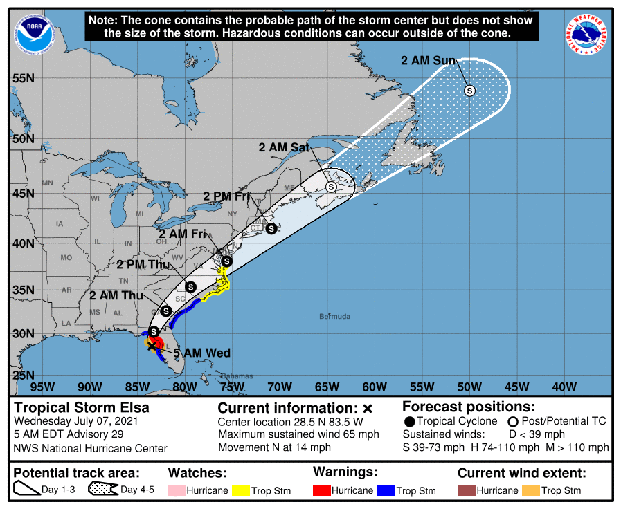
A variety of warnings and watches are up for Elsa as a result. A Hurricane Warning is in effect for the west coast of Florida from Chassahowitzka to the Steinhatchee River. However, the Hurricane Warning for the west coast of Florida has been replaced with a Tropical Storm Warning south of Chassahowitzka to Egmont Key; the Tropical Storm Warning has also been discontinued south of Englewood. A Tropical Storm Watch is now in effect for the coasts of North Carolina and Virginia from Duck, North Carolina to Chincoteague, Virginia, and for the Chesapeake Bay south of New Point Comfort. A Storm Surge Warning remains in effect for the west coast of Florida from Bonita Beach to the Aucilla River, including Tampa Bay. A Tropical Storm Warning is also in effect for the area from the mouth of St. Marys River, Georgia to Little River Inlet, South Carolina. A Storm Surge Watch is in effect for the area west of the Aucilla River to the Ochlockonee River in Florida. Finally, a Tropical Storm Watch is in effect for the area north of Little River Inlet, South Carolina to Chincoteague, Virginia; this includes North Carolina’s Pamlico and Albemarle Sounds.

A Storm Surge Warning means there is a danger of life-threatening inundation, from rising water moving inland from the coastline, in the indicated locations. A Hurricane Warning means that hurricane conditions are expected somewhere within the warning area. Preparations to protect life and property should be rushed to completion there. A Tropical Storm Warning means that tropical storm conditions are expected somewhere within the warning area. A Storm Surge Watch means there is a possibility of life-threatening inundation, from rising water moving inland from the coastline, in the indicated locations.
According to the NHC, after a slight jog to the left, the storm has resumed a motion to the north. This motion should continue for the next 12 hours or so until landfall occurs across the northwestern Florida peninsula. Thereafter, a gradual turn toward the north-northeast is expected by, followed by acceleration toward the northeast as Elsa moves into the mid-latitude westerlies.
While little change in strength is forecast before landfall, there is a chance that the new convection could cause a short lived re-intensification. Based on this possibility, the NHC says a hurricane warning remains in effect for portions of the west coast of Florida. After landfall, Elsa should weaken as it crosses the southeastern United States, followed by some re intensification as it accelerates back over the Atlantic. The system is expected to become extratropical by the time it reaches the Canadian Maritimes in 72 hours.

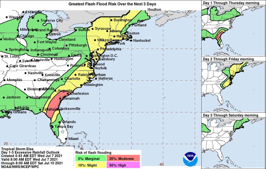
As Elsa moves across the western and northern Florida Peninsula today, heavy rainfall may result in considerable flash, urban, and isolated moderate river flooding. Heavy rainfall across southeast Georgia, South Carolina, North Carolina, and southeastern Virginia may result in isolated flash and urban flooding, with considerable flash and urban flooding possible across coastal Georgia and the Lowcountry of South Carolina. Heavy rainfall across the Northeast and New England Thursday and Friday could lead to isolated flash and urban flooding.
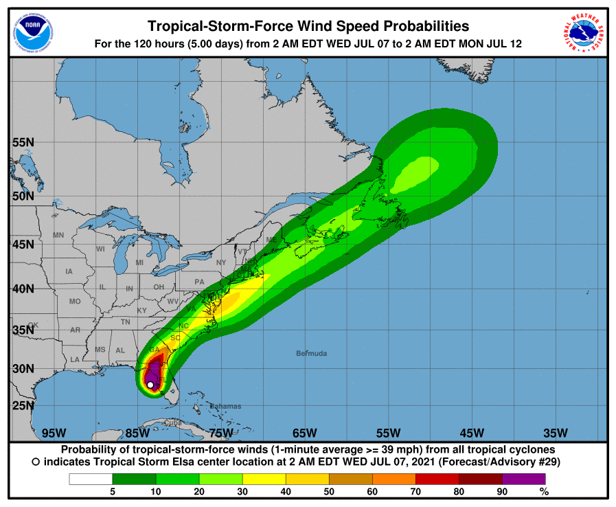
Although the center of Elsa is expected to remain inland of the coastline from Georgia through the Carolinas during the next day or two, tropical storm conditions are expected along much of the coasts of Georgia and South Carolina. Tropical storm conditions are also possible along the coast of the mid-Atlantic states by Thursday night or Friday.