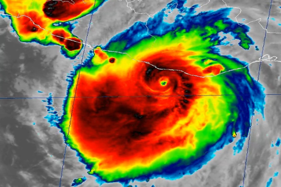
Last night Erick exploded into a Category 4 hurricane on the Saffir-Simpson hurricane wind scale before striking Mexico’s west coast during the early hours today. Now Erick is a significantly weaker category 1 hurricane but is bringing numerous life-threatening hazards to Mexico.
Right now, Erick is about 30 miles north-northwest of Punta Maldonado, Mexico. With a minimum central pressure of 980 mb or 28.94″, the storm has maximum sustained winds of 85 mph while it heads northwest at 12 mph. On the forecast track, the center of Erick is forecast to move over southern and southwestern Mexico until it dissipates tonight.
The government of Mexico has discontinued all warnings east of Puerto Escondido and discontinued the Hurricane Watch west of Acapulco to Tecpan de Galeana. However, a Hurricane Warning remains in effect for the area from Acapulco to Puerto Escondido and a Tropical Storm Warning is in effect for the area west of Acapulco to Tecpan de Galeana. A Hurricane Warning means that hurricane conditions are expected somewhere within the warning area while a Tropical Storm Warning means that tropical storm conditions are expected somewhere within the warning area.
Hurricane Erick will produce additional rainfall of 6-8″ in portions of the states of Oaxaca and Guerrero with storm totals of 16″ possible. Life-threatening flooding and mudslides are expected, especially in areas of steep terrain. Rainfall totals of 2-4″, with maximum totals of 6″, are expected across the states of, Michoacan, Colima and Jalisco.
Hurricane conditions, especially in gusts, are expected to continue for a couple of more hours in portions of the hurricane warning area. Tropical storm conditions will likely continue into the afternoon in the tropical storm warning area. Wind speeds atop and on the windward sides of hills and mountains are often up to 30% stronger than the near-surface winds indicated in this advisory, and in some elevated locations could be even greater.
A dangerous, life-threatening storm surge is expected to produce coastal flooding along portions of the coast of southern Mexico in areas of onshore winds. The surge will be accompanied by large and destructive waves.
Swells generated by Erick will continue affecting the coast of southern Mexico throughout the day. These swells are likely to cause life-threatening surf and rip current conditions.
