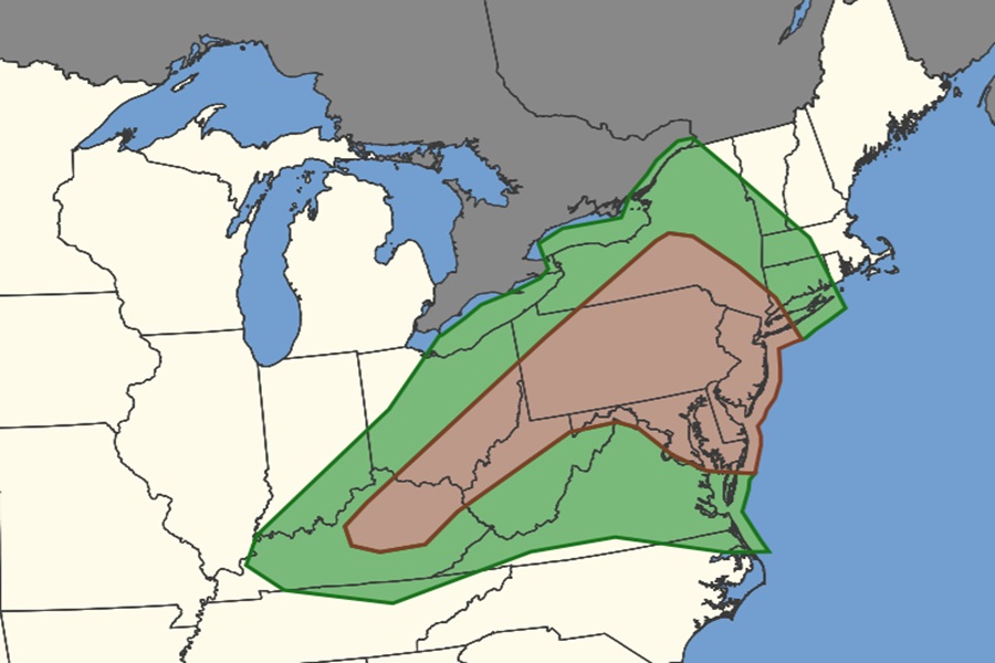
Severe weather is expected to impact parts of the east tomorrow; the National Weather Service’s Storm Prediction Center (SPC) is warning of an elevated threat of tornadic thunderstorms in Tuesday’s severe weather outbreak, especially for Pennsylvania, New Jersey, and Delaware.
According to the SPC, high amplitude ridging will build across the western US with continued progressive troughing across the east on Tuesday. Multiple short-wave impulses are forecast to rotate through the eastern US trough, with a belt of enhanced northwesterly flow traversing the Midwest into the Ohio Valley. At the surface, a cold front will shift south and east through the period, with a surface low across southern Ontario and Quebec in Canada . A pre-frontal surface trough will also be in place across western/central NY into the Mid-Atlantic vicinity, setting the stage for many thunderstorms to form.
Thunderstorm activity is expected to increase along the pre-frontal trough from western/central New York into the Northeast/Mid-Atlantic late Tuesday morning into the afternoon. Though there may be potential for early morning cloud cover, it does appear that sufficient heating/moistening will occur for at least moderate instability to develop across the region through the afternoon.
The SPC says that the mid-level flow will increase through the day along with forcing for ascent.
“It appears widely scattered thunderstorm activity with several clusters/embedded supercells will be ongoing by the afternoon,” warns the SPC. “Highest confidence in transient embedded supercell modes would be closer to the surface low and near the front across western New York into eastern Pennsylvania. Here, there may be potential for both damaging wind, large hail, and perhaps a couple of tornadoes.”
Generally, forecast guidance suggests the greatest threat from these storms will be damaging to destructive winds, with the best signal for damaging winds across the Mid-Atlantic, where several damaging clusters could occur.
However, there is also an elevated threat of tornadoes from these storms, with an especially elevated threat of tornadic thunderstorms across portions of northeastern Kentucky, southeastern Ohio, northern West Virginia, all of Maryland, Delaware, and New Jersey, much of Pennsylvania, and portions of New York and Connecticut. The Philadelphia, Baltimore, and Washington DC metro areas are all contained within this elevated tornado threat zone.
