Tropical Depression #2 continues to drift about erratically in the northern Gulf of America and the National Hurricane Center still expects the system to develop into Tropical Storm Bertha, the second named storm of the 2026 Atlantic Hurricane Season. With the system expected to develop more and approach the coast, more advisories have been issued by the National Hurricane Center there.
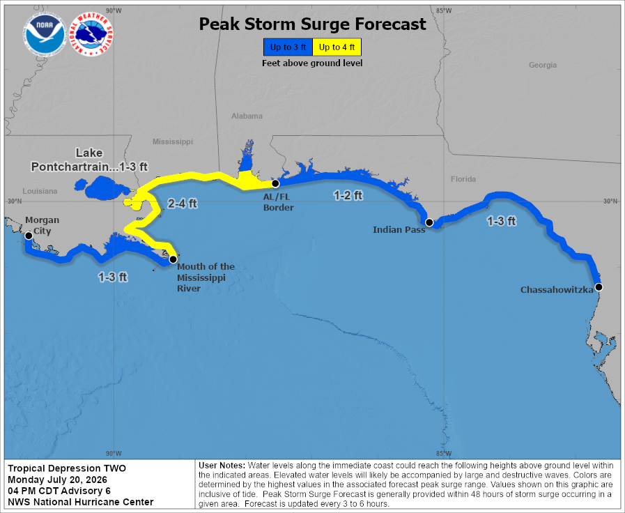
Now, a Tropical Storm Watch is in effect for the area stretching from the Ochlockonee River west to the Jefferson / Plaquemines Parish border in Louisiana. A Storm Surge Watch is also now in effect for the area between the Alabama/Florida border to the Mouth of the Mississippi River. A Storm Surge Watch means there is a possibility of life-threatening inundation, from rising water moving inland from the coastline, in the indicated locations during the next 48 hours while a Tropical Storm Watch means that tropical storm conditions are possible within the watch area, in this case in the next 24 to 48 hours.
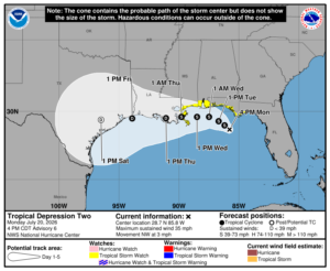
“Additional watches or warnings may be required tonight or on Tuesday,” cautions the National Hurricane Center (NHC) in their latest advisory.
The tropical depression is in light steering currents between two mid-level ridges, one to its northwest centered over the central U. S. and one to its southeast centered near the Bahamas. The U. S. ridge is expected to become a little more dominant of a steering feature as it builds eastward. The NHC expects that the cyclone will move slowly northwestward to west-northwestward for 36 hours or so, followed by a turn toward the west.
“It should be noted that strong northeasterly shear is forecast over the cyclone, which could keep the center south of the forecast track due to the effects of convective bursts. However, there are models such as the ECMWF and Canadian that bring the system inland on the northern Gulf coast,” says the NHC.
The depression is experiencing moderate northeasterly shear, and these conditions should continue for another 18-24 hours.
“It is likely that there will be convective bursts near and south of the center during this time, and these should help intensify the cyclone to a tropical storm. After that, the northeasterly shear should increase, and the global models suggest it will get strong enough to destroy the vertical integrity of the cyclone,” says the NHC. This should halt intensification and then cause weakening.
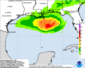
The NHC also suggests that much of the rain associated with this storm should fall over the open waters of the Gulf of America moreso than land. In their latest advisory, the NHC wrote, “It should be noted that the aforementioned shear is likely to give the cyclone a very asymmetric structure, with the bulk of the rainfall and much of the wind expected to occur to the south of the
center.”
The official storm track forecast from the National Hurricane Center brings the system through the Houston, Texas metro area by Friday afternoon as a tropical depression.
