Eta is becoming better organized once again and is expected to intensify back into a tropical storm this evening from its current tropical depression status. It now appears that Eta will strike Cuba and then follow an s-curve around Florida, impacting much of the state with heavy rain in the coming days. Because of the growing threat of Eta’s arrival, the National Hurricane Center says that Tropical Storm or Hurricane Watches could be required for Florida and even the Bahamas later tonight or on Saturday.
Right now, Eta is located about 115 miles east of Belize City and about 375 miles west-southwest of Grand Cayman. With maximum sustained winds of 35 mph and a minimum central pressure of 1002 mb or 29.59 inches, Eta is moving to the northeast right now at 7 mph.
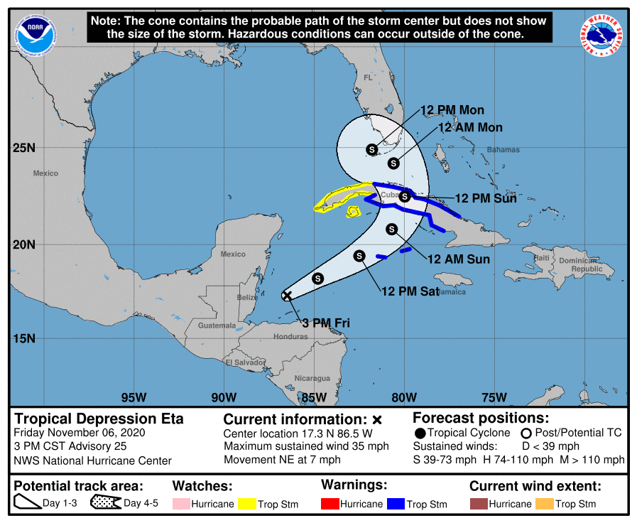
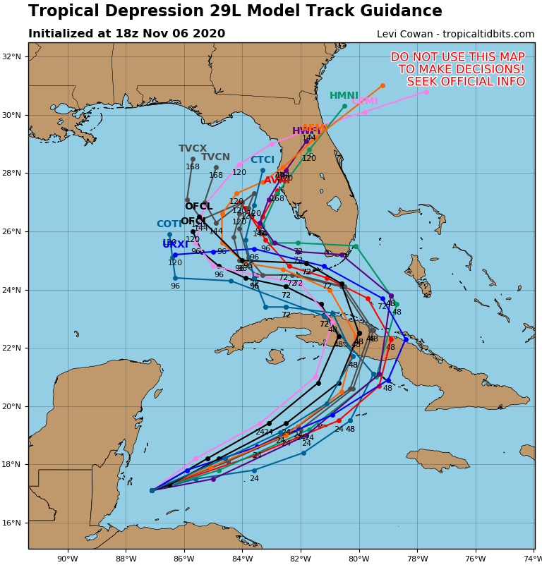
After moving to the northeast this afternoon at 7 mph, the National Hurricane Center (NHC) in Miami, Florida expects Eta to move faster through Sunday. On such a trajectory, Eta will move across the northwestern Caribbean Sea tonight and Friday, approach the Cayman Islands Saturday, and be near central or western Cuba Saturday night and Sunday.
From there, computer forecast guidance suggests Eta could take an s-curve of sorts, passing across the Florida Keys from the east and then striking Florida’s Gulf Coast again by the west.
Questions remain about how strong Eta will become with time. Right now, reports from an Air Force Reserve Hurricane Hunter aircraft indicate that maximum sustained winds are near 35 mph with higher gusts. The NHC is forecasting that Eta will become a tropical storm again tonight, with further strengthening likely through early Sunday. While Eta could lose strength as it crosses Cuba, it will have the possibility of gaining additional strength as it pulls away from Cuba. Some forecast guidance suggests Eta could become a hurricane before impacting Florida.
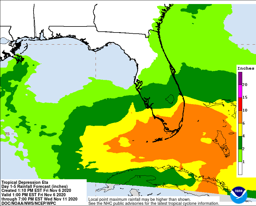
Even if Eta doesn’t become a hurricane, very heavy rains are expected in the Sunshine State in the coming days. 6-10″ of rain is possible across southern Florida including the Florida Keys and Miami. 4-6″ is possible from Naples to Fort Lauderdale. 2-4″ is possible over central Florida from Cape Coral to Sarasota east to Orlando and Melbourne.
If Eta does become a hurricane, damaging winds could lash the state south of I-4.
Beyond heavy rain and wind, rough surf, tornadoes, and storm surge flooding could be possible as Eta approaches Florida in the coming days.
