The northeastern U.S. is dealing with two major weather impacts today: ongoing excessive heat and the threat of severe to potentially violent thunderstorms.
A strong Bermuda high pressure system responsible for the significant heat and humidity in the northeast will slowly move to the south and east through the end of this week. A cold front arriving today is setting off an area of strong to severe thunderstorms; as these storms push east, some could create damage as they become violent. While the holiday weekend is arriving, the front will be slow to depart: it will stall along portions of the East Coast, keeping conditions wet and unsettled through to the Fourth of July. By early next week, the front will finally move away from the U.S..
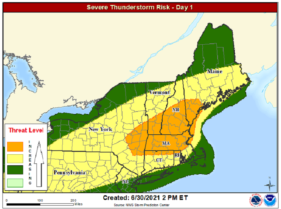
With abundant heat and humidity and atmospheric energy to work with, the front slowly sweeping east will develop potentially violent thunderstorms, with destructive wind gusts the most common element within these severe cells. While there’s a risk of large hail and isolated tornadoes, the threat of damaging wind will be far greater. The greatest threat of wind damage will be over southern Vermont, New Hampshire, and Maine, as well as east central Upstate New York and most of Massachusetts.
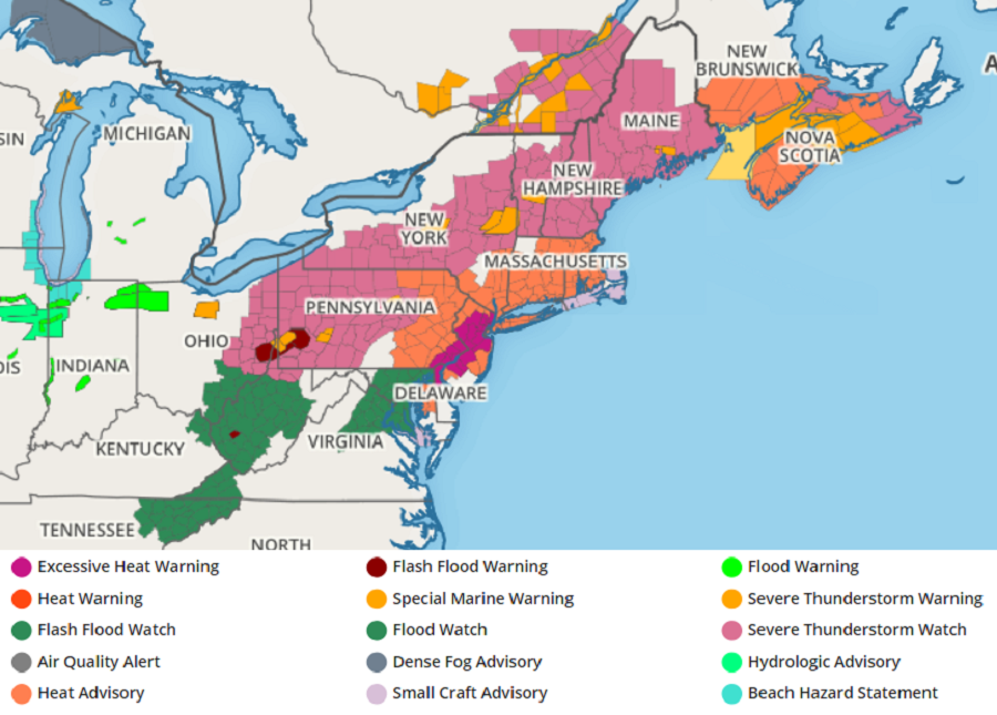
With severe weather arriving, the National Weather Service has been issuing Severe Thunderstorm Watches and Warnings. Watches right now are up from eastern Ohio into Pennsylvania, New York, and much of central and northern New England. Some strong thunderstorms are also dumping copious amounts of rain, leading to Flash Flood Warnings being issued in portions of Ohio and Pennsylvania.
Meanwhile, Excessive Heat Warnings remain up for much of New Jersey, southeastern Pennsylvania, and northern Delaware including the metropolitan Philadelphia area. Heat Advisories are up elsewhere across large portions of the northeast.
