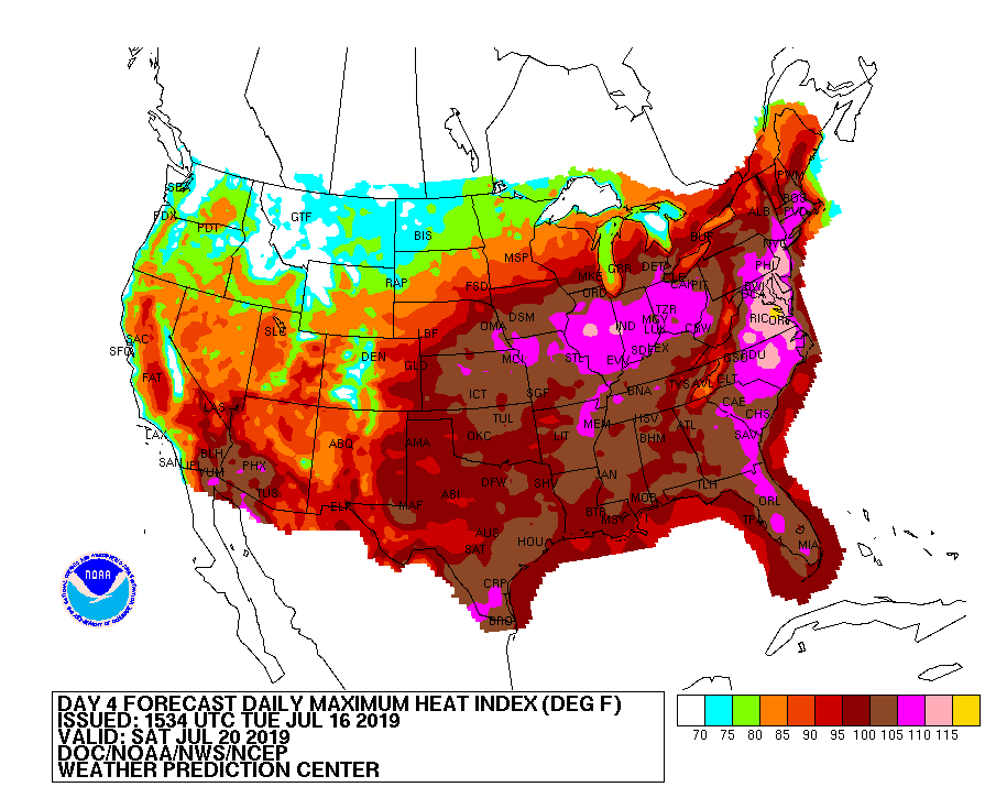
Extremely hot conditions are likely on Saturday for a large part of the country, with heat and humidity likely to be at dangerous levels for portions of the Mid Atlantic. The heat index, which combines impacts from temperature and humidity on the human body, will produce readings over 110 degrees on Saturday. Unfortunately for many, especially those in between Washington, DC and New York City, overnight temperatures won’t cool down too much during this next heat wave.
A variety of meteorological ingredients are coming together to produce the hazy, hot, and humid conditions. A tropical airmass will spreads into the Northeast and Mid-Atlantic ahead of the remnant low of Barry tomorrow. Meanwhile, Bermuda high pressure will be anchored offshore, and a hot and humid airmass will begin to spread into the Mid Atlantic. As Barry’s remnants move into the northeast Wednesday, heavy rain and the potential for flooding will exist Wednesday afternoon and evening. In the wake of Barry’s passage, humidity will remain with dewpoints in the Mid Atlantic and Northeast into the 70s. More heavy rain is possible as low pressure moves through on Thursday, with a saturated airmass capable of producing another round of flooding rains. After Thursday’s rain, a prolonged period of excessively hot and humid air will be in place from at least Friday through Sunday.
Due to high confidence in this high heat and humidity occurring, and the dangerous impacts of a prolonged heat wave, the National Weather Service took the rate step of issuing a prolonged Excessive Heat Watch that starts on Wednesday and continues through Sunday for the Philadelphia area. For areas outside of the urban corridor, confidence is no less in this occurring, but there is still some time for the National Weather Service , as values will probably not reach the necessary criteria until Friday. According to the National Weather Service, criteria for Excessive Heat Watches and Warnings are a bit more stringent for the urban corridor due to the cumulative effects of a heat wave on an urban center. In the watch area, overnight lows will likely fall no lower than into the 70s to around 80.
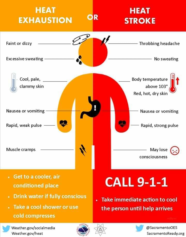
These high readings will have a serious negative impact on those who work outdoors, the elderly, and those with pre-existing health conditions that make them even more vulnerable to high heat and humidity.
In this hot weather, the National Weather Service may issue heat advisories such as an Excessive Heat Warning. An Excessive Heat Warning means that a prolonged period of very hot and humid conditions is expected. People in the watch area should drink plenty of non-alcoholic fluids, stay out of the sunlight, and be in an air-conditioned location if possible. People should also check-in on elderly relatives and neighbors in the Warning area.
