Meteorologists will soon have a new tool at their disposal; the JPSS-2 satellite is active and sending back sample images; the first image was shared this week. Following NOAA’s naming convention for polar orbiting weather satellites, the name JPSS-2 was replaced by NOAA-21. The Advanced Technology Microwave Sounder (ATMS) instrument onboard NOAA-21 captured its first global image on November 22, 2022, just 12 days after successfully launching into space from the Vandenberg Space Force Base in California.
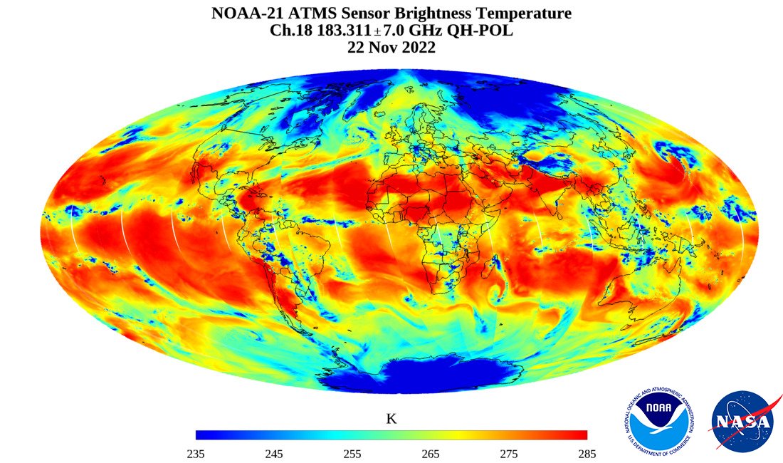
This image release marks the first in a series of first-light images from NOAA-21’s four instruments that will be released by NOAA before the satellite goes into full operational mode. ATMS is a key sensor used for numerical weather prediction models. The first image released uses NOAA-21 data to show the state of atmospheric water vapor. Red indicates little water vapor. Light blue shows more abundant water vapor, while dark blue in the polar region indicates surface snow and ice.
The ATMS instrument gives weather forecasters a global 3D picture of our atmosphere’s temperature and moisture—the most fundamental information needed by weather models that forecast daily weather and warn us of hurricanes, floods, droughts, heat waves, snowstorms, and other weather events. Because ATMS observes Earth in the microwave portion of the electromagnetic spectrum, it sees through clouds like an X-ray, allowing us to view the structure of the atmosphere underneath those clouds, and see inside of storms.
ATMS works closely with the satellite’s Cross-track Infrared Sounder (CrIS) instrument to take detailed measurements of the atmospheric conditions, such as temperature and water vapor soundings, needed to generate extreme weather forecasts days in advance. Data from ATMS also contribute to a global record of atmospheric measurements that dates back 40 years. These data are used in climate models to help us understand how our atmosphere has been changing over time.
“This information is used to determine initial conditions for numerical weather prediction models to provide accurate forecasts for the future,” said Joint Polar Satellite System Program Scientist Satya Kalluri. “ATMS data are also used for measuring precipitation, hurricane intensity and surface temperature.”
NOAA works together with NASA to oversee the development, launch, testing, and operation of all of the satellites in the Joint Polar Satellite System (JPSS) program. While NOAA funds and manages the program, operations, and data products, NASA develops and builds the instruments, spacecraft, and ground system, and launches the satellites,.
The first satellite of the series, JPSS-1, was launched in 2017. JPSS-3 is in development and is scheduled to launch sometime in/around 2027.
Meteorologists use data from both the JPSS series and the GOES series of Earth-observing satellites for forecasts, warnings, and monitoring of conditions.
