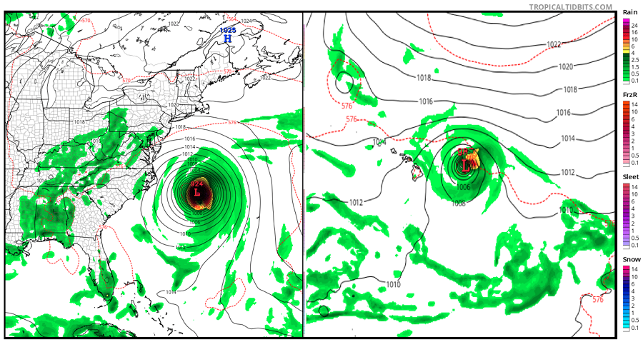
With the peak of both the Central Pacific and Atlantic Hurricane Basins almost here, it would make sense that we’re approaching a time of year where there would be more hurricane threats than none. However, computer forecast guidance that meteorologists use to aid in their forecast work are now suggesting the possibility of not one, but two hurricane strikes on the US coast at about the same time: one in Hawaii and one along the populated U.S. East Coast. The two global forecast models, the American GFS and the European ECMWF, are both calling for hurricane impacts on the U.S. coast in both basins at about the same time.

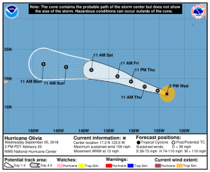
The concern is around Hurricane Florence in the Atlantic and Hurricane Olivia in the Pacific. Hurricane Florence is a Major Hurricane with Category 4 status on the Saffir-Simpson hurricane wind scale. Hurricane Olivia has top winds of 100mph but is forecast to strengthen further.
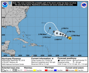
In the 5pm advisory from the National Hurricane Center, the well developed eye of Hurricane Florence was located near latitude 22.7 North, longitude 46.6 West. Florence is moving toward the northwest near 13 mph, and this general motion is expected to continue through Thursday. A turn toward the west-northwest with a decrease in forward speed is forecast to begin Thursday night, followed by a turn back toward the northwest early next week. Maximum sustained winds have increased to near 130 mph with higher gusts. According to the National Hurricane Center, some weakening is forecast during the next couple of days, but Florence is expected to remain a powerful hurricane through early next week. The estimated minimum central pressure is 953 mb.
The official National Hurricane Center forecast only goes out five days; however, forecast models which produce more than 10 days of solutions, suggest East Coast interactions. Many members of the ECMWF ensemble forecast suggest an east coast landfall between central Florida and Rhode Island, with many solutions clustering around the Mid Atlantic Coast. The latest batch of forecasts from the GEFS also include east coast impacts near the Mid Atlantic. Beyond U.S. East Coast strikes, both models do include storm paths that would curve the hurricane out to sea.
Meteorologists with the National Hurricane Center urge caution with the latest pessimistic model output. “It should be noted that there is considerable model ensemble spread and run-to-run variability for Florence’s track beyond day 5,” they write in the latest forecast discussion on Hurricane Florence. “Given the large uncertainty at these time ranges, it is far too soon to speculate what, if any, impacts Florence may have on the U.S. East Coast next week.” Central Pacific Hurricane Center meteorologist Robert Ballard also throws caution into the wind with these models on Twitter. Last night, Ballard Tweeted, “GFS trying to destroy Hawaii again in 8-10 days. If I had a nickel for every GFS model TC (tropical cyclone) strike that didn’t happen…” alluding to the fact that model performance is not terribly reliable in the extended range there.

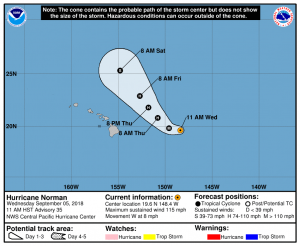
There are two hurricanes in the Pacific being monitored: Norman and Olivia. Norman is a Major Hurricane but is forecast to travel just north and east away from the Hawaiian Islands. Hurricane Norman is close enough to Hawaii today to kick up surf on eastern facing shores of the islands. It may also travel close enough to Hawaii to help trigger heavier than usual downpours on Hawaii and Maui islands as a robust moisture field surrounds the storm. The bigger concern is on Olivia, which could impact the islands head-on.

At this time, most model guidance does suggest direct impacts to Hawaii by Hurricane Olivia in about a week. Both the American and European forecast models suggest some kind of impact in the state, with Hawaii’s Big Island likely to feel the first impacts. Some forecast models suggest the storm may approach the state from the north, pushing through the major islands from east to west.
While it is concerning that forecast guidance in the central Pacific is aligned today around impacts from Olivia to Hawaii in the future, it is still too soon to say with certainty whether such a forecast solution will come to fruition. Unlike the U.S. East coast which has a dense network of ground and upper level weather observations, there’s a lack of such a dense network over the Pacific. As such, the global forecasts can’t pick up on smaller nuances over the ocean like they would on the U.S. East Coast.
While it’s too soon to forecast a specific strength and track forecast for both Florence and Olivia, it is never too soon to prepare for the possible impacts of these or future storms. People in Hawaii and along the U.S. East Coast should make sure they have a Hurricane Action Plan before any hurricane threat materializes. In Hawaii, it’s important for people to re-stock any hurricane supplies they may have consumed due to Hurricane Lane’s impacts last month. People in Hawaii should also learn from the Atlantic Basin: a season can bring multiple hurricane impacts and being impacted by Lane last month does not eliminate the possibility of additional impacts this season.
Beyond Florence and Olivia, meteorologists are concerned about other storms forming in each basin too. There’s a medium chance that a new tropical cyclone will form near where Olivia did in the coming days, according to the National Hurricane Center. And there’s a high chance that a new tropical cyclone will form where Florence did in the Atlantic. The National Hurricane Center believes there’s a 90% chance that a new cyclone will form where Florence did and they believe there’s even a chance of yet another system forming nearby over the next five days.