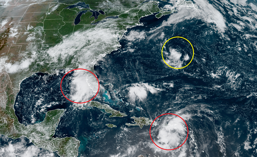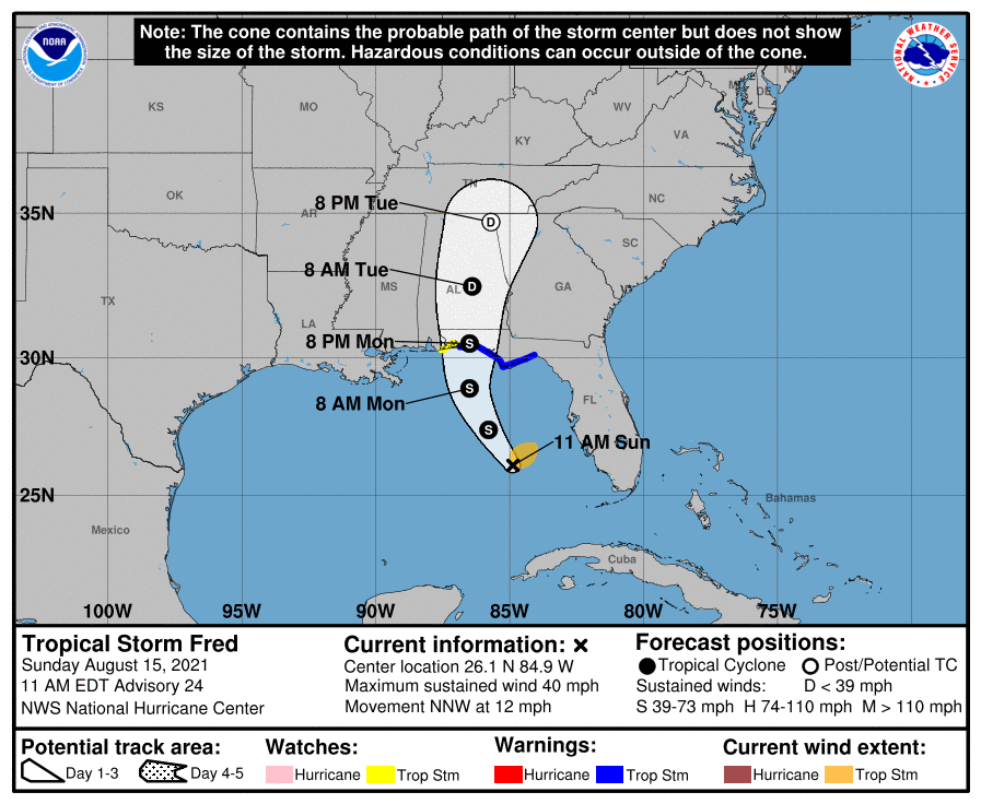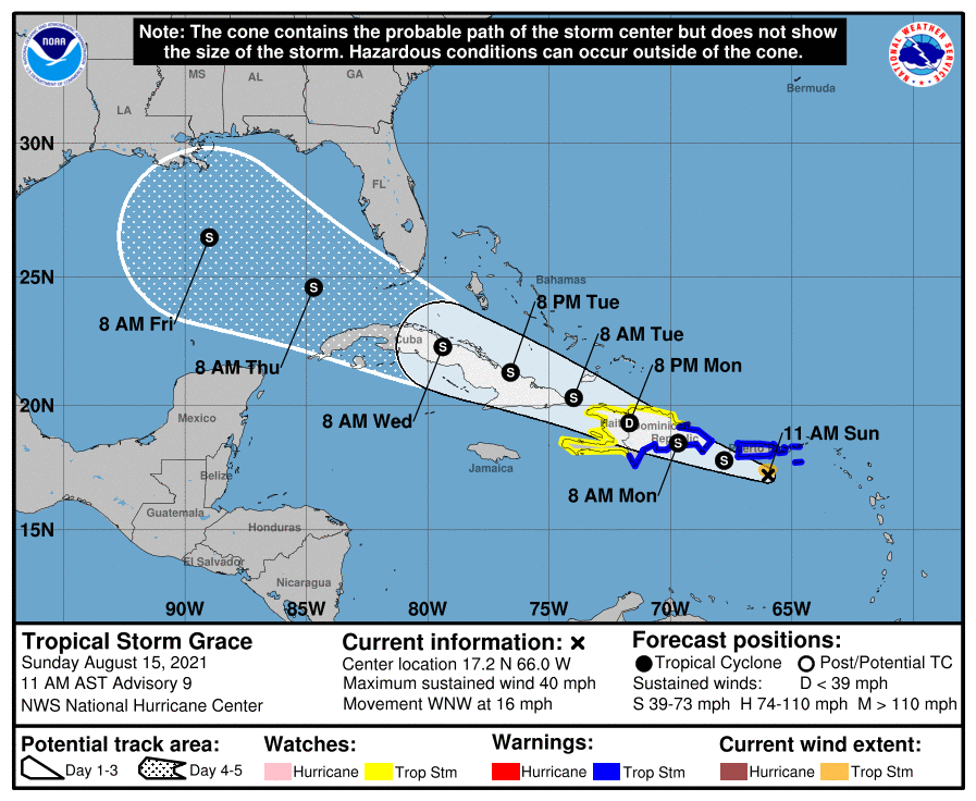
The National Hurricane Center is busy tracking Tropical Storm Fred and Tropical Storm Grace as they inch closer to the United States with time; they’re also tracking a third system near Bermuda that could develop into a new tropical cyclone too.
Tropical Storm Fred re-formed in the eastern Gulf of Mexico and is now due west of Florida’s Sanibel and Captiva Islands. According to the National Weather Service, today through Tuesday, heavy rain could lead to areal, urban, stream and river flooding impacts across southern Florida, the Florida Big Bend and Panhandle, southern Alabama, portions of Georgia, and western areas of the Carolinas. From Tuesday onward, heavy rain and flood impacts could impact other portions of the southeast, the southern and central Appalachians, and the Piedmont as Fred moves inland and interacts with a weather front there.

Fred could also bring a dangerous storm surge inundation to portions of the Florida Panhandle. Because of that threat, a Storm Surge Warning has been issued for the area expected to see impacts.
Tropical Storm conditions should begin along the Florida panhandle beginning tomorrow.
While Fred moves inland, Grace will be slamming into Caribbean Islands in a similar fashion to Fred. Like Fred did, Grace will create heavy rains which could lead to flash and urban flooding across the Virgin Islands, Puerto Rico, the Dominican Republic, and unfortunately even Haiti, which saw a catastrophic earthquake yesterday.

There is a risk of wind and rainfall impacts across the rest of the Dominican Republic, Haiti, the Turks and Caicos Islands, the Bahamas, Cuba, and Florida, but the National Hurricane Center says forecast uncertainty remains higher than usual. Tropical Storm Watches are only up as far west as Haiti for now, but that could change later today.
The National Hurricane Center forecast track brings Grace into the central Gulf of Mexico by the end of the week. However, they stress that path could change as conditions evolve in the coming days. Nevertheless, odds are increasing that Grace will strike the U.S. coast somewhere as a tropical storm or hurricane.
Lastly, a small but well-defined low pressure system located about 200 miles north-northeast of Bermuda is producing disorganized showers and thunderstorms mainly to the south of the center. The National Hurricane Center says some gradual development is possible over the next couple of days while the system moves slowly to the south or south-southwest at about 5 mph, near or to the east of Bermuda. By Tuesday, however, environmental conditions are forecast to become less conducive for tropical cyclone formation. For now, the National Hurricane Center believes there’s a 30% chance of tropical cyclone development over the next 48 hours here.