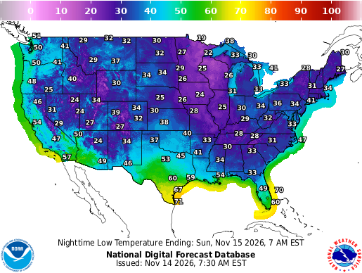
A blast of dry, cold air sent temperatures below freezing across much of the South early Saturday, bringing a first freeze of the season to some communities and prompting freeze warnings in nine states. Forecasters said a second, more widespread freeze is expected Sunday morning.
The National Weather Service had freeze warnings in effect Saturday for parts of Alabama, Arkansas, Georgia, Louisiana, Mississippi, North Carolina, Oklahoma, South Carolina and Virginia. Frost advisories covered additional counties in many of those states and in the Florida Panhandle.
The cold air is being driven by a deep upper-level trough over the eastern United States that is anchoring “a continental polar air airmass” over the region, the weather service office in Jackson, Mississippi, said in its forecast discussion Saturday.

Saturday Morning Readings
Preliminary hourly observations from airport weather stations showed temperatures at or below freezing in several Southern cities around sunrise Saturday.
Tupelo, Mississippi, fell to 28 degrees shortly before 6 a.m. CST. Birmingham and Huntsville, Alabama, and Jackson, Mississippi, each reached 30 degrees, and Montgomery, Alabama, dipped to 30 degrees around 5 a.m. CST. Little Rock, Arkansas, and Augusta, Georgia, were at 32 degrees. Macon, Georgia, hit 32 degrees before rising slightly.
Atlanta’s Hartsfield-Jackson International Airport was at 36 degrees early Saturday, while Raleigh, North Carolina, and Columbia, South Carolina, bottomed out near 34 degrees. These figures are preliminary, and official daily lows may differ.
In Arkansas, the weather service office in Little Rock said observations around midnight already showed “a large swath of temperatures overtaking the state in the 20s and 30s with many areas of the state already in frost and freeze territory.” A freeze warning covered the office’s entire forecast area through Saturday morning.
First Freeze for Parts of the Gulf Coast Region
For parts of southwest Alabama and southeast Mississippi, the cold brought the first freeze of the season, according to Mobile, Alabama, television station WALA. The station said the coldest temperatures were expected in inland communities along and north of U.S. Highway 84.
The weather service office in Mobile issued freeze warnings for Butler, Choctaw, Clarke, Conecuh, Crenshaw, Monroe, Washington and Wilcox counties in Alabama and Wayne County in Mississippi, with lows of 29 to 32 degrees expected both Saturday and Sunday mornings. Frost advisories extended closer to the coast, including inland parts of Mobile and Baldwin counties and inland areas of the western Florida Panhandle.
In central Alabama, the weather service office in Birmingham said a “widespread frost and freeze” was expected through the weekend. Freeze warnings covered dozens of counties, from Marion and Lamar in the northwest to Barbour and Russell in the southeast, with temperatures as low as 29 degrees forecast both mornings.
The office’s preliminary forecast called for lows of 28 degrees in Gadsden and Anniston and 32 degrees in Birmingham, Tuscaloosa and Montgomery early Sunday.
Georgia Braces for Coldest Morning So Far
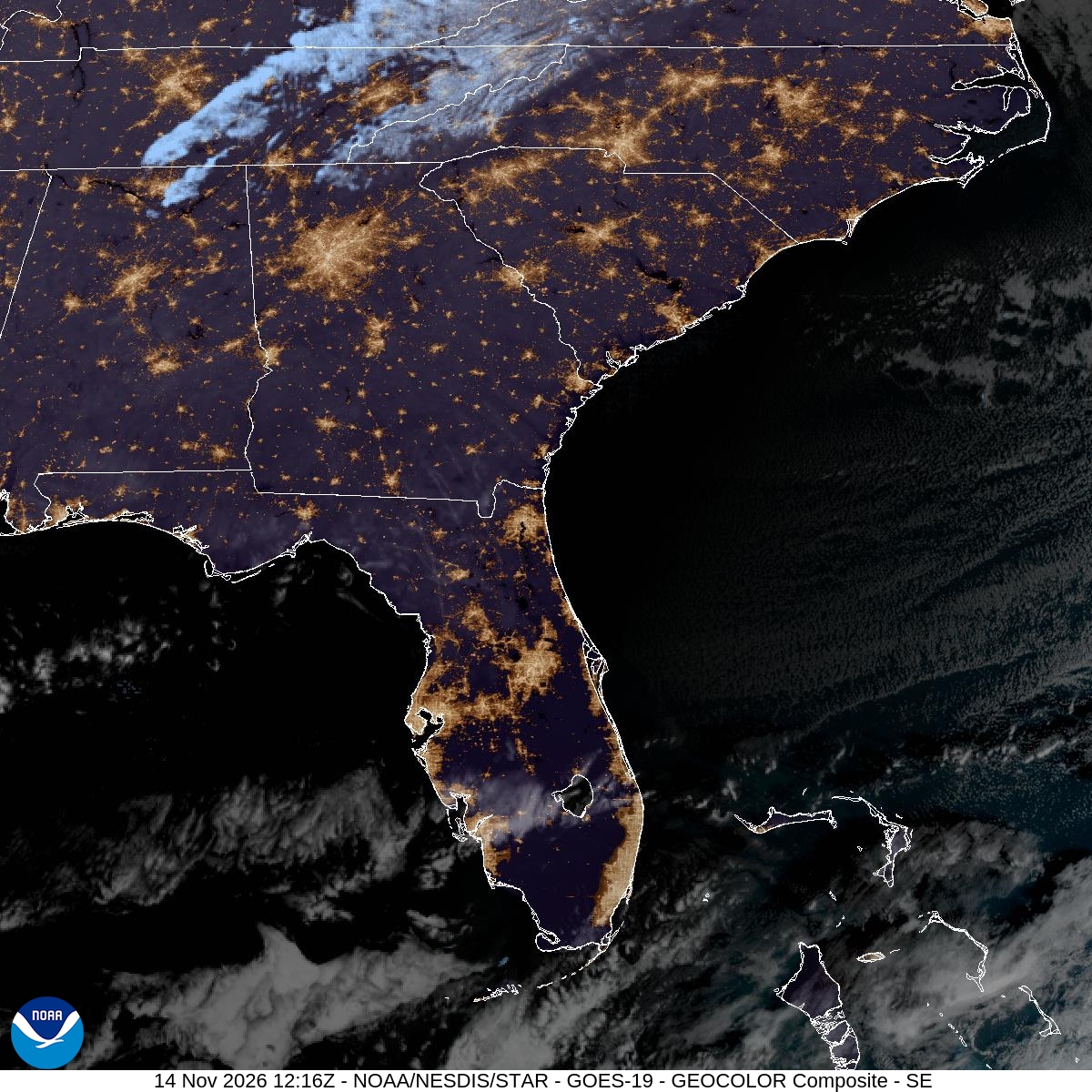
In Georgia, the weather service office in Peachtree City said a freeze warning was in effect for west and north Georgia Saturday morning, with a frost advisory for the rest of its forecast area. On Sunday morning, a freeze warning will cover all of north and central Georgia.
“Sunday morning will be the coldest of the season so far for many, with temperatures in the upper 20s to low 30s,” the office said. It said winds would be much lighter, allowing temperatures to fall quickly under clear skies.
“Widespread freeze is expected, with hard freeze likely in some areas of the state.”
The office said temperatures as low as 24 degrees were possible early Sunday in a warning area of north and west Georgia that includes Rome, Dalton, Marietta and Carrollton.
Forecasters also explained why frost advisories were issued for areas not expected to reach freezing. Official temperatures are measured about 2 meters, or about 6.5 feet, above the ground, and on calm, clear nights the ground can be about 4 degrees colder, the office said. “Meaning the ground can be at or below freezing despite a forecast temperature of 36,” forecasters wrote.
High temperatures will reach only the 50s and low 60s Saturday and Sunday, below average for mid-November, the office said.
Mississippi, the Carolinas and Virginia
In Mississippi, the weather service office in Jackson expected “another light freeze” late Saturday night into early Sunday. Freeze warnings covered a broad area of central, northern and eastern Mississippi, including Jackson, Meridian, Starkville, Columbus, Greenwood and Greenville, with lows as low as 28 degrees.
In North Carolina, the weather service office in Raleigh placed all of central North Carolina under a freeze warning for early Sunday, saying calm winds under a high-pressure system should “support a widespread freeze of mid/upper 20s to low 30s, coldest across the Northern Piedmont.”
The office in Columbia, South Carolina, upgraded a freeze watch to a freeze warning for 1 a.m. to 9 a.m. EST Sunday. Forecasters there said lows should fall into the low 30s, with some spots in the upper 20s, and reminded residents to protect people, pets, plants and pipes.
Freeze warnings were also in effect Saturday morning for parts of southeastern Virginia and northeastern North Carolina, and the weather service office in Newport/Morehead City, North Carolina, issued freeze warnings for parts of eastern North Carolina for early Sunday. Offices in Wilmington, North Carolina, and Charleston, South Carolina, issued freeze warnings for inland areas of the Carolinas and southeast Georgia for Sunday morning.
Farther west, freeze warnings were in effect Saturday morning for parts of eastern Oklahoma and western Arkansas from the weather service office in Tulsa, Oklahoma, and for parts of northern Louisiana and southern Arkansas from the Shreveport, Louisiana, office.
Protecting Plants, Pipes and Pets
Weather service offices urged residents to bring in or cover sensitive plants, which can be killed by temperatures at or below freezing. The Birmingham and Peachtree City offices said freeze conditions could also “possibly damage unprotected outdoor plumbing.”
“To prevent water pipes from freezing; wrap or drain or allow them to drip slowly,” the freeze warnings said. Forecasters also advised draining in-ground sprinkler systems and covering above-ground pipes.
Dry Pattern Ahead
Forecasters said the cold snap will be accompanied by very dry weather. The Jackson office said strong high pressure would become “a fixture over the southeast CONUS and eastern seaboard region” through next weekend, calling it “a classic dry fall weather pattern” that “offers little hope for any rainfall.” Daily temperature ranges could reach 35 to 40 degrees in the dry air, the office said.
The Birmingham office said “very little to no rainfall” was forecast for the next seven days, with minimum relative humidity values of 25% to 35% over the weekend. Wind gusts were expected to stay below 15 mph, the office said.
Temperatures should gradually moderate during the week. The Birmingham office said afternoon highs should climb into the upper 60s and mid-70s by Thursday, though nights will stay cool. The Little Rock office said temperatures should return to near seasonal averages by mid- to late week, and the Columbia office said below-normal temperatures would persist through early next week before moderating.
Clouds returning ahead of a weak system passing to the south should keep lows in Alabama slightly milder Sunday night, the Birmingham office said.
