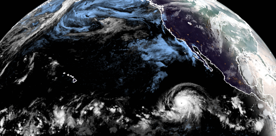
After being merely a tropical storm yesterday morning, Hurricane Barbara went through a period of explosive, rapid intensification early today, bringing the storm to Category 4 status with 130 mph sustained winds. With winds now over 120 mph, the storm is considered a “Major Hurricane”, the first of the 2019 hurricane season around the United States.
Conventional satellite imagery and microwave data reveal that the structure of Barbara has improved significantly. The hurricane has developed an eye surrounded by a ring of very deep convection and both features have been present during the past several hours. This improvement in structure has been accompanied by a substantial intensification. According to the National Hurricane Center (NHC), prevailing warm ocean and low shear could fuel additional intensification during the next 12 hours or so. However, the hurricane is forecast to encounter cooler waters and strong shear primarily beyond 3 days resulting in weakening. By the time Barbara reaches the Central Pacific on the weekend, it is likely to be a tropical storm or even a remnant low.
Barbara has been moving steadily toward the west and west-northwest. The hurricane is moving south of a deep-layer ridge of high pressure extending from the west coast of the United States westward across the Pacific. Barbara should move a little more to the northwest around the ridge in about 2 or 3 days, but as soon as the cyclone weakens and becomes shallow, it will likely move to the west steered by the low-level flow.
Once the Barbara passes 140W, the Central Pacific Hurricane Center co-located with the National Weather Service office in Honolulu will take over issuing advisories with this storm. Beginning this hurricane season, all National Hurricane
Center eastern Pacific advisory products that utilize local time, and the corresponding graphical products, will use Hawaiian Standard Time (HST) instead of Pacific Daylight Time (PDT) or Standard Time (PST) if the final forecast point is west of 140W. Since Barbara’s day 5 official forecast point is now west of 140W, advisory products are now being issued in Hawaiian Standard Time. Hawaii Standard time is 6 hours behind East Coast time.
