Hurricane Franklin continues to get stronger; now a Category 4 hurricane, it’s possible the major hurricane may briefly reach Category 5 status on the Saffir-Simpson hurricane wind scale. While Franklin isn’t expected to make direct impacts to land, it is expected to brush by Bermuda while creating dangerous surf up and down the entire U.S. East Coast.
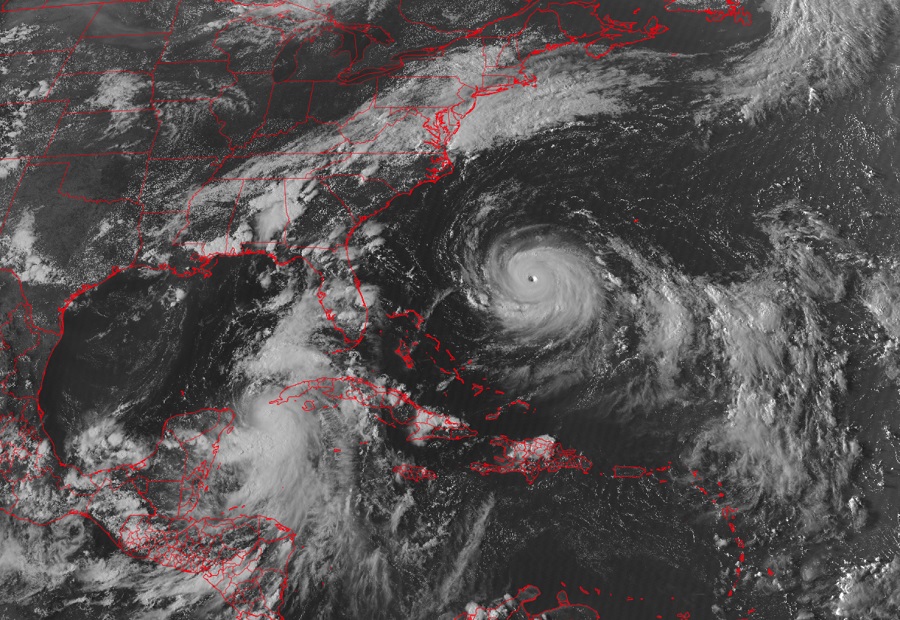
While Idalia is gaining strength near the western tip of Cuba, Franklin looks very impressive on the latest GOES-East weather satellite image, in which a clearly defined eye is visible in the center of the major hurricane.
According to the National Hurricane Center (NHC), tropical storm conditions are possible on Bermuda beginning on Wednesday morning when Franklin us forecast to make its closest approach to the island. Due to the threat of being brushed by the storm, authorities on Bermuda have issued a Tropical Storm W
Life-threatening surf and rip currents are occurring along the coast of the southeast United States today. The NHC says these conditions are expected to spread north along the remainder of the U.S. East Coast, Atlantic Canada, and Bermuda during the next couple of days.
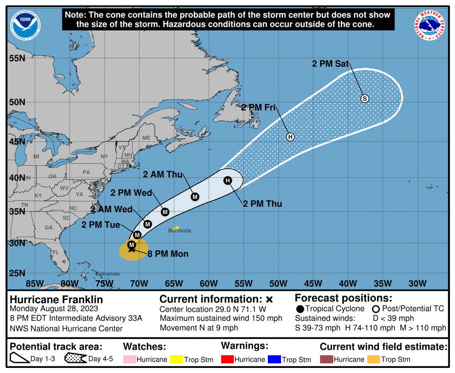
According to the latest update from the NHC, Major Hurricane Franklin was located about 330 miles west-southwest of Bermuda. Maximum sustained winds are at 150 mph, just 7 mph shy of reaching Category 5 status on the Saffir-Simpson wind scale. The storm is moving to the north at 9 mph while it has a minimum central pressure of 926 mb or 27.34″.
A northward to north-northeastward motion with a slightly faster forward speed is expected during the next few days. On the forecast track, the center of Franklin is expected to pass well to the west of Bermuda on Wednesday but still well east of the U.S. Mid Atlantic Coast. Maximum sustained winds have increased to near 150 mph and the NHC says some additional strengthening is possible tonight, but gradual weakening is expected to begin
late Tuesday.
