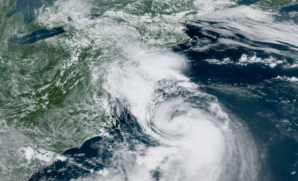
It appears Hurricane Henri is heading to Long Island, on a collision course with the famous New York island that’s about 120 miles across and 23 miles wide. With maximum sustained winds of 75 mph, it is forecast to strengthen further tonight. While some fluctuations with strength expected, Henri is expected to be around Category 1 hurricane strength when it strikes Long Island during the afternoon. While landfall is expected around lunchtime on Sunday, gusty rain showers tied to the circulation of Henri will begin to impact New Jersey, Long Island, and southern New England this afternoon.
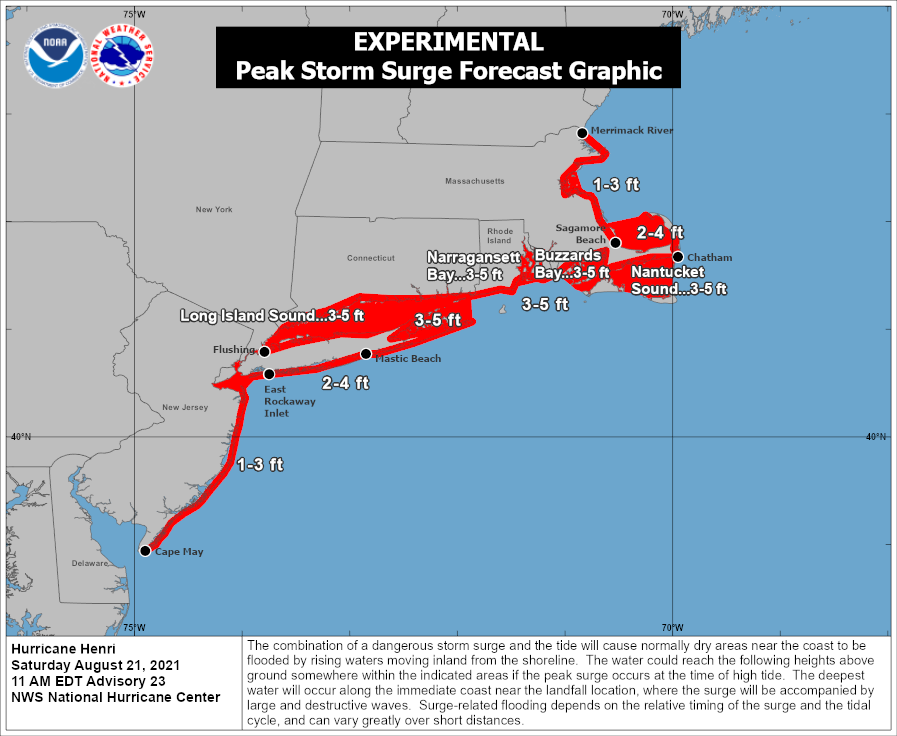
The National Hurricane Center (NHC) says that a dangerous storm surge inundation is expected to begin late tonight or Sunday in portions of Long Island, Connecticut, Rhode Island, and southeastern Massachusetts. Because of that threat, the National Hurricane Center has a Storm Surge Warning up; the first one ever issued for the region.
Hurricane conditions are expected to begin late tonight and early Sunday in portions of Long Island, Connecticut, and Rhode Island. Because of that, the NHC has a Hurricane Warning posted there. The strongest winds in a hurricane are closest to the center of the storm, with the east side likely to experience more damage than the west side. With New York City and New Jersey on the west side, hurricane conditions are not expected there at this time. However, some bands of heavy rain and tropical storm force wind gusts will move through the Big Apple and the Garden State.
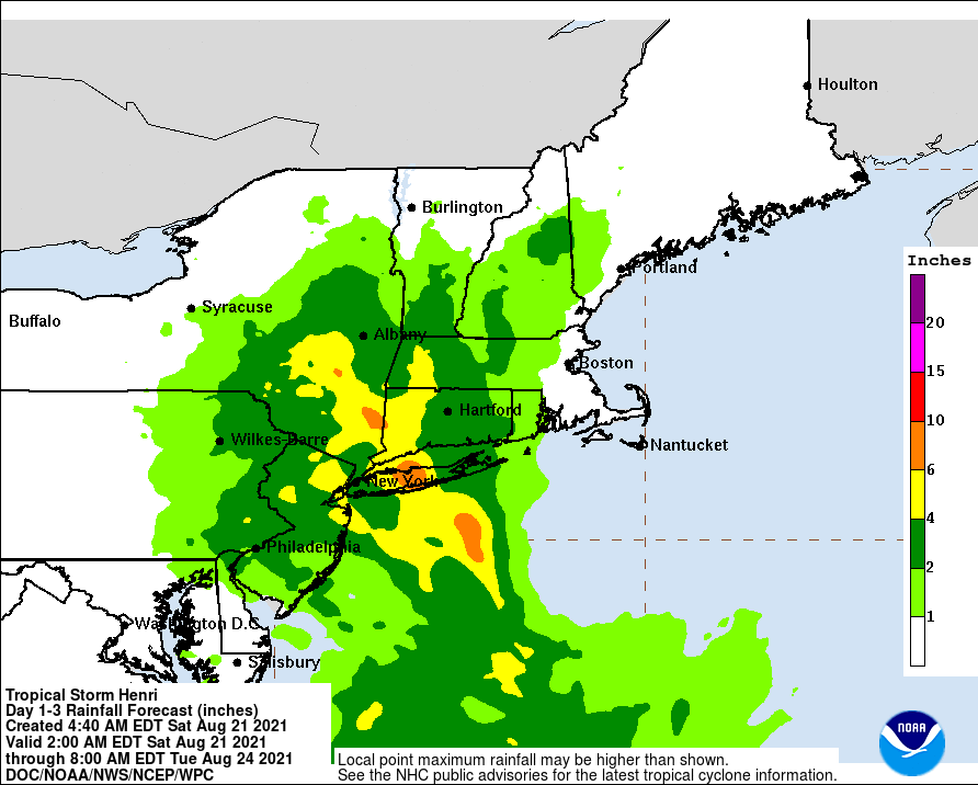
Heavy rainfall may lead to considerable flash, urban, and small stream flooding, along with the potential for widespread minor and isolated moderate river flooding over portions of Long Island, New England, southeast New York, and northern New Jersey.
Swells from Henri will continue to affect much of the U.S. East Coast over the next 2 days. These swells could cause life-threatening surf and rip currents, even far from the center of the storm or its landfall area.
While Henri will exit the northeast by Monday, its impacts will have long-lasting impacts. Electrical utilities are warning customers that power outages are possible for days or weeks. Wind and flood damage, especially storm surge damage, could take a significant amount of time to restore.
