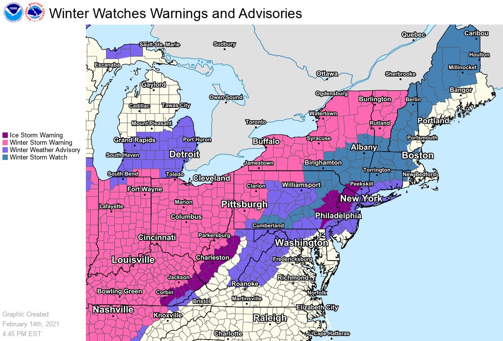
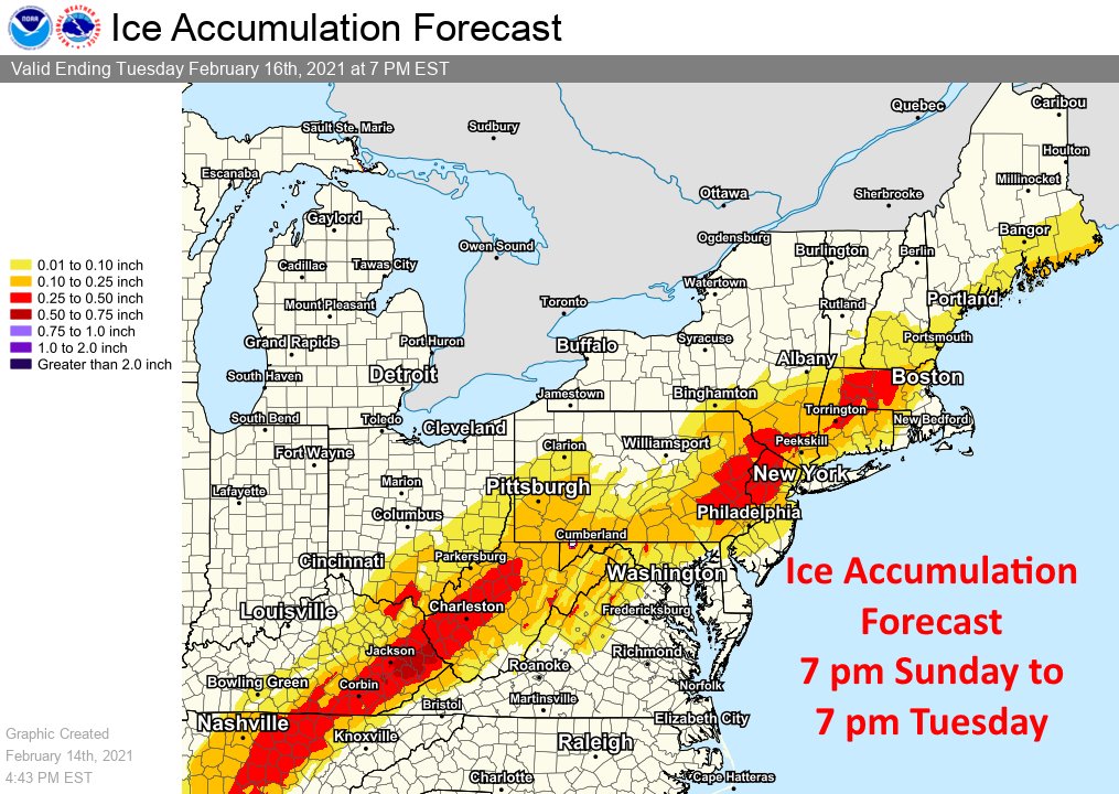
With a severe ice storm in the forecast, the National Weather Service has raised Ice Storm Warnings for portions of West Virginia, Kentucky, New Jersey, Pennsylvania, and New York, where accumulations of freezing rain could exceed 1/2″. Ice of this thickness will make travel nearly impossible and it’ll weigh down trees and wires, forcing many to the ground. Extensive, long-duration power outages are expected.
The storm responsible for the significant ice is also responsible for snow and ice all the way to the Gulf Coast. Currently, the entire states of Texas, Arkansas, Oklahoma, and Ohio and most of Indiana, Kentucky, Mississippi, and Louisiana are under a Winter Storm Warning for significant snow and ice.
Places that don’t usually see much cold or snow will see plenty of both this week. In Dallas, more than a half foot of snow is expected while temperatures shouldn’t climb out of the teens tomorrow and dive to near zero tomorrow night / Tuesday morning. This will be one of the coldest periods in Texas’s recorded history.
Because the storm is moving north and east from Texas to New Jersey, it is also bringing milder air with it along and to the south of the storm track. With this milder air riding over the colder air at the surface, an ice storm is being created. Significant ice accumulations are expected from the Gulf Coast north and east to New England. While rain will fall south and east of there, remaining snow cover and cold ground temperatures will create for icy spots near the New York City metro area, Long Island, coastal New England, and portions of central New Jersey. Due to the risk of patchy freezing rain and sleet with plain rain, the National Weather Service has issued Winter Weather Advisories there.
Good travel advice for this weekend: don’t.
Just stay put in areas expecting freezing rain! pic.twitter.com/12pM6hzqFI
— the Weatherboy (@theWeatherboy) February 13, 2021
