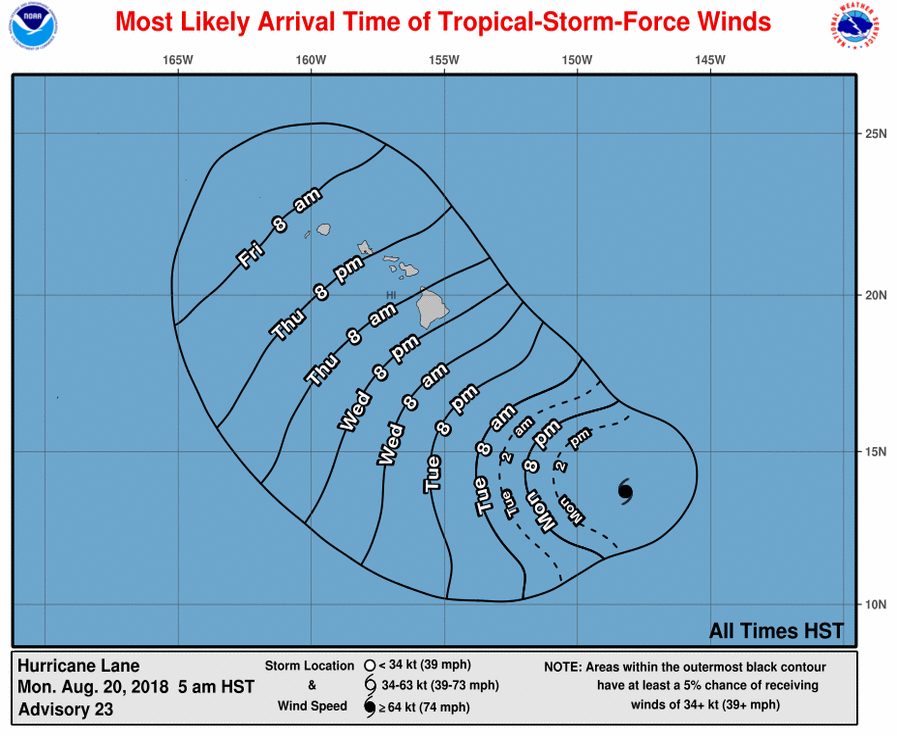
It appears Major Hurricane Lane could impact Hawaii this week and residents and visitors there should rush their storm preparations to completion. While no Tropical Storm or Hurricane Watch is up yet, they could be issued later today as the Central Pacific Hurricane Center in Honolulu, Hawaii reviews data coming in.
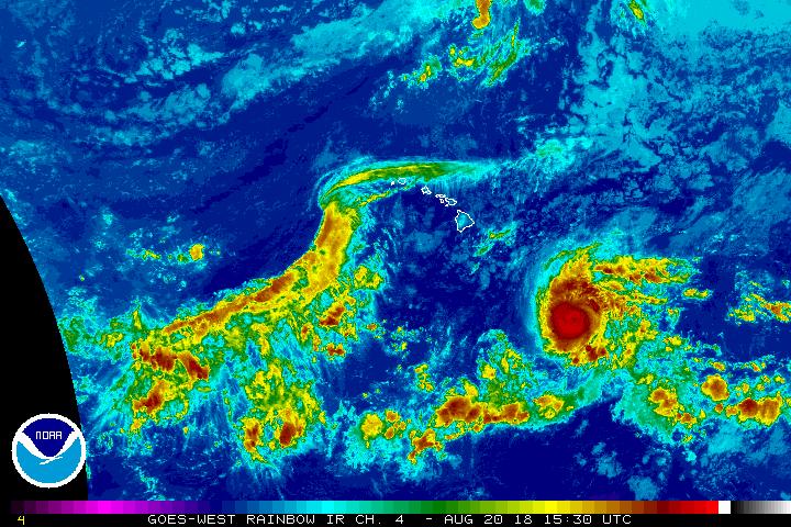
Major Hurricane Lane is a category 3 hurricane on the Saffir-Simpson Hurricane Wind scale. While the Central Pacific Hurricane Center expects little change in strength through Tuesday, it is possible the storm could become stronger as it continues to move over a warm water environment with less sheer. The Central Pacific Hurricane Center is forecasting the possibility of some weakening late Tuesday, but even so, Lane will be a dangerous hurricane. For now, maximum sustained winds are near 125 mph with higher gusts. Hurricane-force winds extend outward up to 30 miles from the center and tropical-storm-force winds extend outward up to 120 miles. The estimated minimum central pressure is 961 mb (28.38 inches).
Lane is forecast to move westward at a slightly slower forward speed from tonight through early Tuesday, followed by a turn toward the west-northwest starting late Tuesday. Computer forecast guidance has trended to bring the storm closer to Hawaii, with some models suggesting a landfall in Hawaii. It is still too early to say with certainty where Lane will go and how strong it’ll be when it gets there. Because of that uncertainty, it is imperative that everyone on every island in Hawaii make sure they have a Hurricane Action Plan in place and have appropriate supplies for at least two weeks.
Beyond tropical storm force and hurricane force winds, one of the larger threats from this storm could be torrential heavy rains. There is a chance of significant flooding, mud and rock slides, and coastal flooding, especially on Hawaii and Maui. If impacts are severe, its possible some roads and utilities may not be up and running for days or longer.
On Hawaii, due to destruction from the Lower East Rift Zone eruption of Kilauea, conditions may be that much more treacherous with a weakened infrastructure due to the volcano. With many in temporary shelters, tents, or evacuated to their vehicles, it’s especially important for volcano survivors to make sure they have a safe and sturdy place away from flood threats to go to in the coming days. Temporary tents or automobiles are not safe shelter.
