Another round of heavy rain and strong to severe storms are possible over a portion of the Mid Atlantic Wednesday into Thursday, with the best chances of heavy rain on Wednesday night and the best chance of severe thunderstorms during the afternoon hours on Thursday. While isolated tornadoes could form, there are better odds for damaging wind gusts from the storms moving through on Thursday.
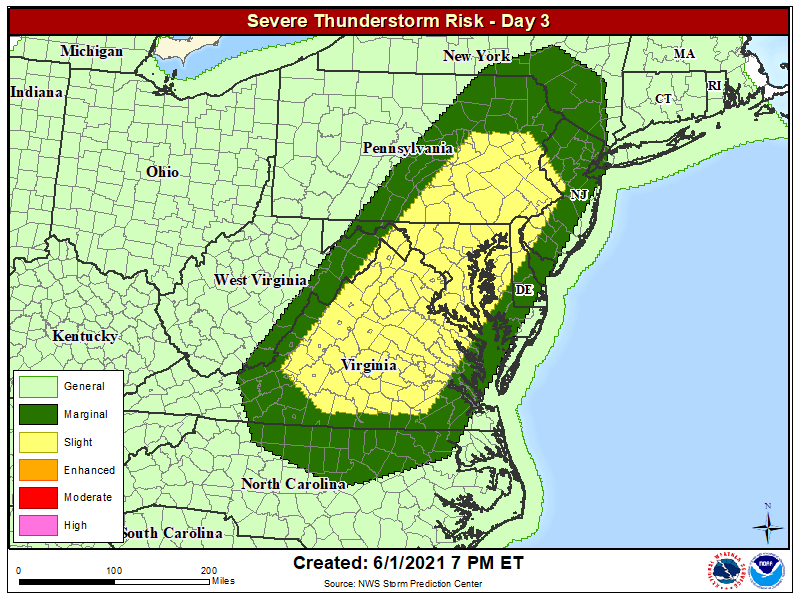
According to the National Weather Service’s Storm Prediction Center (SPC) and the latest Convective Outlook they issued, the best chance for severe weather on Thursday extends from central Virginia north and east through much of Maryland, northern Delaware, southeastern Pennsylvania, and western New Jersey. While thunderstorms are possible beyond this area, the area within it will have the greatest odds for reaching severe thunderstorm winds. The National Weather Service defines severe winds in thunderstorms as those 58 mph or greater.
The SPC says storms developing along and ahead of an approaching cold front on Thursday will “likely undergo a gradual intensification during the day.” Damaging wind appears to be the primary threat, but
low-level hodographs might become sufficient for a couple of tornadoes to form. Convective activity should weaken toward mid evening on Thursday as the atmospheric dynamics die-out.
Before severe weather arrives on Thursday, soaking rains will push into the region Wednesday evening as the initial warm front moves through. Rain could be heavy enough to create some flood conditions, with the best odds for flooding over central and northern New Jersey, eastern Pennsylvania, and southeastern New York including the New York City metro area. The National Weather Service reminds people within the flood threat zone: “turn around, don’t drown; never drive through flood waters.”
