Computer forecast models used by meteorologist to aid with weather forecasting are suggesting there could be a winter storm along the East Coast towards the end of next week, but it looks more wet than white with limited cold air to work with for snow.
The GFS and ECMWF are among many computer models meteorologists use to assist in weather forecasting. While meteorologists have many tools at their disposal to create weather forecasts, two primary global forecast models they do use are the ECMWF from Europe and the GFS from the United States. While the models share a lot of the same initial data, they differ with how they digest that data and compute possible outcomes. One is better than the other in some scenarios, while the opposite is true in others. No model is “right” all the time. Beyond the ECMWF and GFS models, there are numerous other models from other countries, other academic institutions, and private industry that are also considered when making a forecast.
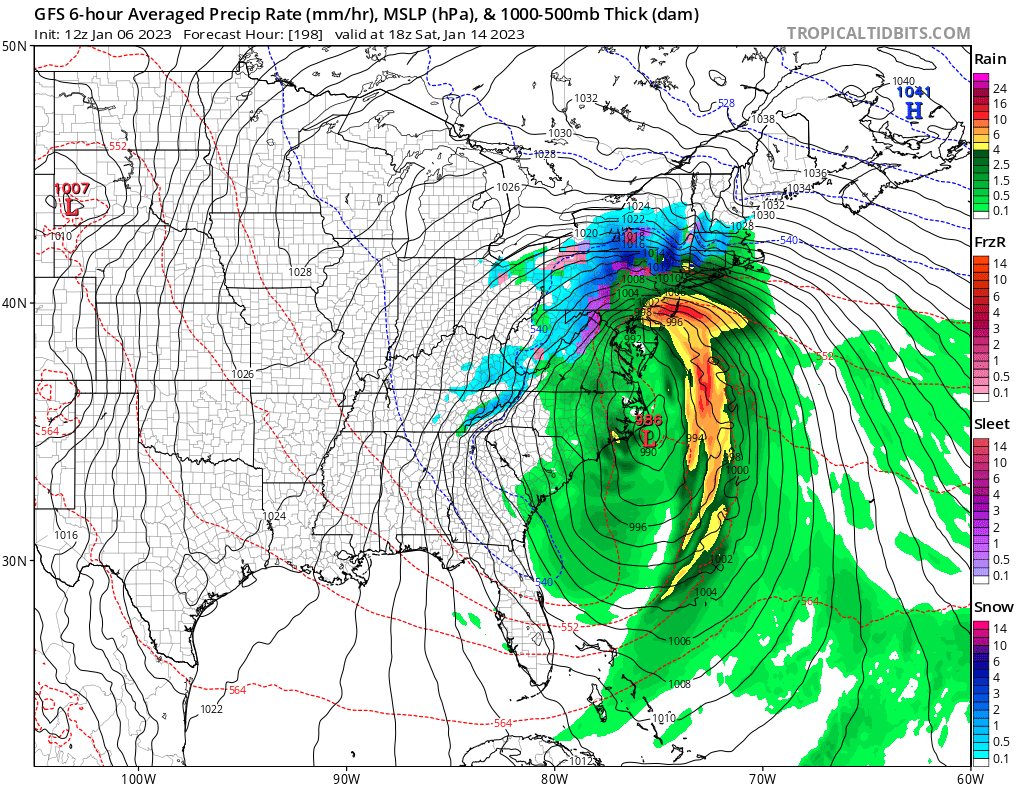
Right now, both the ECMWF and the GFS are aligned to the idea that an area of low pressure will develop along the U.S. East Coast towards the end of next week. The GFS is suggesting a more robust system than the ECMWF with more precipitation, but both share the same general idea of where a storm will form and will travel. Because such a system is more than 5 days away from forming, it is likely neither are exactly right with their forecast solution. But because they are in good agreement and run to run details with the models are closely aligned, it’s more likely than not that some storm system will take shape.
With a steady stream of Atmospheric River events hitting the U.S. West Coast though, the jet stream is following a zonal flow across the country, keeping cold air locked up north of it in Canada while allowing for mild air to lift up from the south into a large part of the country. Because of this set-up, there isn’t much cold air for any developing system to work with, especially on the east coast. While any system that does form will be able to pull down some cold air from Canada, at this time it seems most cold air won’t get much farther south than southern New England. Because of that, much of the precipitation from any storm that does form will be liquid with snow or sleet confined to higher terrain of the northeast.
Regardless of what forecast models suggest will happen now, meteorologists will continue to monitor and forecast for the evolving forecast in the coming days.
