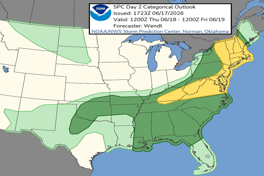
More severe weather is likely in the East on Thursday, with damaging wind and isolated tornado threats continuing for another day. According to the National Weather Service’s Storm Prediction Center (SPC), there’s a risk of severe storms from central Kentucky into the Mid Atlantic and portions of New England. While not everyone will encounter a thunderstorm due to their widely scattered nature on Thursday , those that do could see damaging winds in portions of the Mid Atlantic and isolated tornadoes in portions of New England.

According to the SPC, a potent upper trough and associated mid-level jet streak will move into the northern Mid-Atlantic/New England Thursday morning. A deep surface low moving through southern Ontario/Quebec in Canada will drive a surface cold front through the regions. This front will extend southwestward into the Ohio Valley/southern Appalachians and parts of the central/southern Plains.
During the morning, some thunderstorm activity is expected from eastern New York into New England. The SPC says that while this activity is likely to inhibit afternoon destabilization, strong wind fields will still promote some risk for damaging winds and perhaps a brief tornado.

The strongest activity will develop by early afternoon along the cold front and progress eastward. Bowing segments and marginal supercell structures will be possible. If sufficient heating occurs, this is where the tornado risk will be marginally greater.
In the area around Kentucky, West Virginia, and Virginia stronger instability is expected south of the surface front on account of richer low-level moisture. Scattered storms are expected to form along the front by mid afternoon. Though the low-level jet will weaken much quicker in these areas, deep-layer shear near the front will remain sufficient for organized cells and linear thunderstorm segments. These storms will move eastward through the afternoon and pose a risk of damaging wind gusts too.
