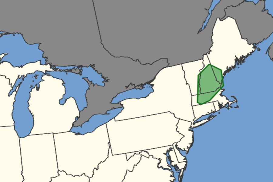
The National Weather Service’s Storm Prediction Center (SPC) has highlighted an area where they believe potential tornadic activity will exist on Thursday over parts of central New England. Isolated to scattered severe thunderstorms will be possible from Kentucky to the Mid-Atlantic, and across parts of the Northeast. Damaging wind gusts will be the main hazard with this activity according to the SPC, but there will also be an elevated tornado threat in these storms across central Massachussetts, the southern two-thirds of New Hampshire, portions of southwest Vermont, and southeastern Maine.
A tornado is a violently rotating column of air touching the ground, usually attached to the base of a thunderstorm.
Tornadoes are nature’s most violent storms. Spawned from powerful thunderstorms, tornadoes can cause fatalities and devastate a neighborhood in seconds. Winds of a tornado may reach 300 miles per hour. Damage paths can be in excess of one mile wide and 50 miles long. Strong downburst or straight-line winds may also occur due to the same thunderstorm. Hail is very commonly found very close to the tornadoes, as the strongest thunderstorms that spawn tornadoes are formed under the atmospheric conditions that are also highly likely to make hail.
According to the National Weather Service, some tornadoes are clearly visible, while rain or nearby low-hanging clouds obscure others. Tornadoes develop extremely rapidly, and may dissipate just a quickly. Most tornadoes are on the ground for less than 15 minutes.
Before a tornado hits, the wind may die down and the air may become very still. A cloud of debris can mark the location of a tornado even if a funnel is not visible. Tornadoes generally occur near the trailing edge of a thunderstorm. It is not uncommon to see clear, sunlit skies behind a tornado.
