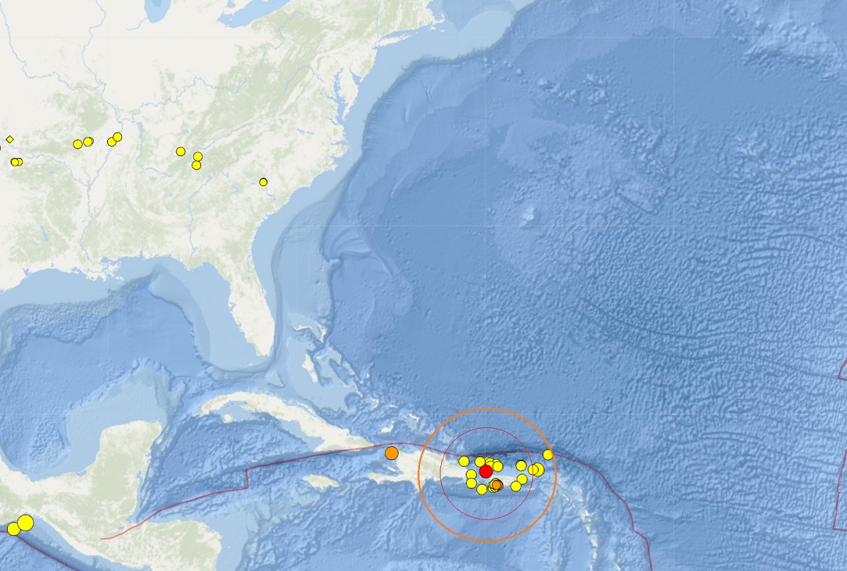
According to the National Weather Service Pacific Tsunami Warning Center (NWS-PTWC) in Honolulu, Hawaii, there is no tsunami threat from a moderate earthquake that struck near Puerto Rico and the U.S. Virgin Islands (USVI) a short time ago. At 7:53 pm ET, a 4.0 earthquake struck roughly 28 miles northwest of San Antonio, Puerto Rico at a depth of 10 km.
The earthquake prompted a tsunami bulletin from the NWS-PTWC to say there was no tsunami threat at this time. “Based on all available data, there is no tsunami threat to Puerto Rico, the U.S. Virgin Islands, or the British Virgin Islands from this earthquake,” the NWS-PTWC said in their bulletin. They add that people may have experienced shaking from the quake.
“This will be the only statement issued for this event unless additional data are received or the situation changes,” the NWS-PTWC wrote. “Information regarding any tsunami threat to U.S. Gulf of Atlantic Coasts will be issued by the U.S. National Tsunami Warning Center.”
The area has been seismically active lately, with more than 55 earthquakes reported by USGS around Puerto Rico in the last 7 days with a magnitude of 2.5 or greater. While today’s earthquake was the strongest this week in Puerto Rico, a 4.3 struck the northwest corner of Haiti earlier today too.
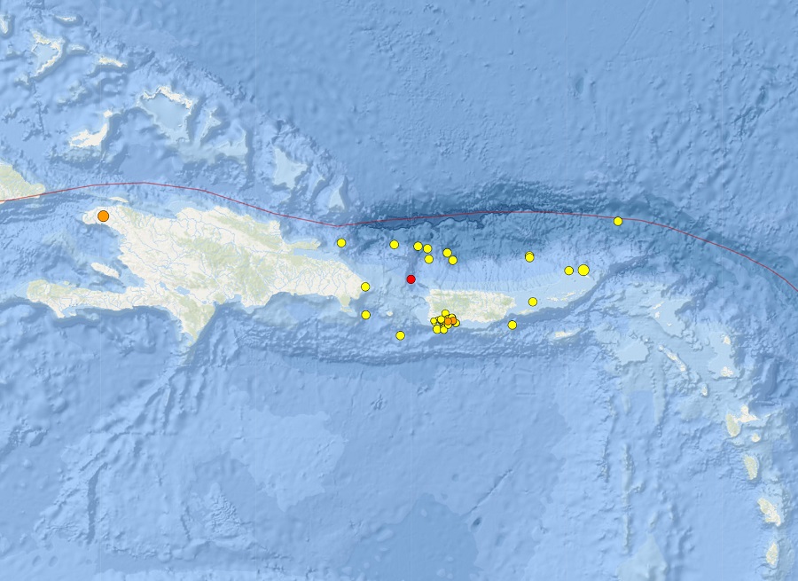
These earthquakes aren’t far from the epicenter of a strong earthquake that hit in January 2020. That 6.4 created extensive damage in Puerto Rico, including widespread power failures across much of the island. An earthquake swarm started here in December 2019 and unrest has continued since.
These earthquakes are occurring near the northern edge of the Caribbean Plate, a mostly oceanic tectonic plate underlying Central America and the Caribbean Sea off of the north coast of South America. The Caribbean Plate borders the North American Plate, the South American Plate, the Nazca Plate, and the Cocos Plate. The borders of these plates are home to ongoing seismic activity, including frequent earthquakes, occasional tsunamis, and sometimes even volcanic eruptions.
