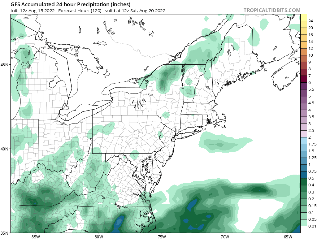
Over the weekend, computer forecast guidance and meteorologists at the National Weather Service were calling for the possibility of a mid-week nor’easter in portions of the northeast. Unfortunately for areas still facing severe drought, those forecast possibilities have fizzled-out, leaving simply dry conditions in the forecast for many days.
A closed low is still forecast to be parked over the Northeast into the northern Mid-Atlantic through Wednesday, then it should lift northeastward into Thursday. It no longer appears a coastal low will develop at the surface, bringing wind-whipped rains to the region. Instead, due to the position of the closed low, much of the northeast will be beneath an area nearly void of large scale ascent.
The National Weather Service’s Mount Holly, New Jersey office says in their latest forecast discussion, “While a few showers or low-topped thunderstorms cannot be ruled out primarily during the peak heating hours, it looks rather spotty. Pinpointing where any showers will develop is more challenging in setups like these, however any development may be more tied to terrain areas or differential heating boundaries.”

With isolated pop-up showers or storms possible but no widespread soaking rain event likely to unfold, much of the northeast will remain dry through to Saturday morning.
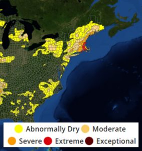
The lack of rain now in the forecast is bad news for those dealing with drought conditions. While it’s abnormally dry in much of New Jersey, Delaware, southern New York, Vermont, New Hampshire, and Maine, moderate to extreme drought exists across coastal New England.