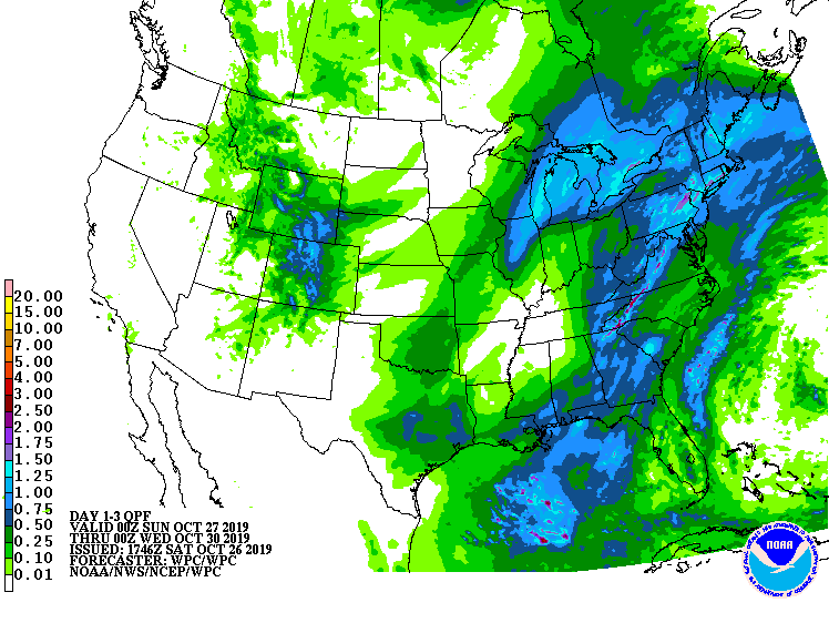
Short-lived Tropical Storm Olga has merged with a frontal system marching east through the United States; it’ll bring soaking albeit much needed rains to portions of the Mid Atlantic and Northeast later today into tomorrow. Widespread 1-2″ rainfall amounts will fall, with some areas of northeastern Pennsylvania, southern Connecticut and Rhode Island, and the higher peaks of the Appalachian Mountains seeing 2-3″.
Tonight, post tropical storm Olga will be deepening as it pushes north and it will bring and push a cold front through the mid-Atlantic. The surface convergence out ahead of the front increases sharply as the system tracks through Pennsylvania with a deep moisture feed from the Gulf of Mexico. As the cold front pushes through, a low level jet will develop out from the south to southeast which will bring strongwinds over the coastal waters; this has prompted the National Weather Service to issue Gale Warnings there. Rain right before and during the cold frontal passage could be especially heavy, leading to flash flooding concerns in isolated areas. The National Weather Service cautions people: “Turn around, don’t drown; never drive through flood waters.”
The frontal system is forecast to clear the coast Sunday evening, helping temperatures fall just behind it. While high temperatures will be warm on Sunday ahead of the frontal passage, they should drop by 20 degrees after the cold front passes through. Once the front exits the coast, fair, dry high pressure will slide up through the Ohio Valley and into the Mid Atlantic on Monday.
