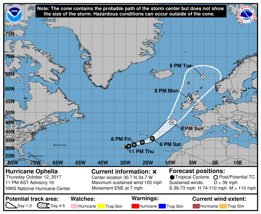
Hurricane Ophelia, now a Category 2 hurricane, is due to impact Europe at the start of the new week. In the last advisory from the National Hurricane Center (NHC), the eye of Hurricane Ophelia was located near latitude 30.7 North, longitude 34.7 West. Ophelia is moving toward the east-northeast near 7 mph and this general motion is expected to continue for the next couple of days with a large increase in forward speed. On this trajectory, Ophelia should strike the west coast of Ireland and then race to northern England late Monday.
Maximum sustained winds have increased to near 105 mph with higher gusts, making Ophelia a dangerous Category 2 storm. Some slow weakening is forecast to begin Friday night but Ophelia should remain a hurricane for the next couple of days. Hurricane-force winds extend outward up to 25 miles from the center and tropical-storm-force winds extend outward up to 90 miles. The estimated minimum central pressure is 970 mb (28.65 inches).
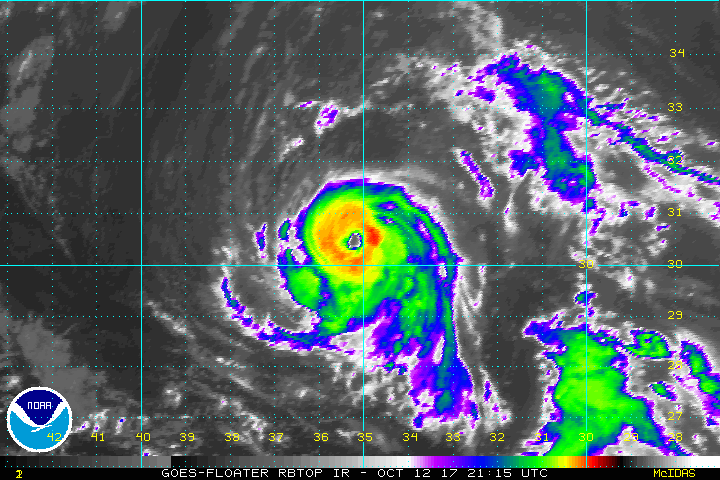
According to well-known hurricane forecaster Dr. Phil Klotzbach, who releases an annual hurricane forecast from Colorado State University, Hurricane Ophelia is the strongest hurricane this far east in the Atlantic outside of the tropics since 2012’s Gordon. This is also the strongest hurricane ever recorded this far east this late in the hurricane season, which runs from June through to the end of November.
Ophelia is expected to produce total rain accumulations of 2 to 4 inches over the southeastern Azores Saturday and Saturday night. During the same time, a cold front and moisture associated with Ophelia is expected to produce total rain accumulations of 1 to 3 inches over the other islands of the Azores. This rainfall could produce flooding, especially over the southeastern Azores.
Beyond the Azores, damaging winds and heavy rain could impact Ireland and the United Kingdom on Monday; people there should closely monitor this system for potential impacts in the coming days.
