A potent storm is forecast to impact a large part of the nation with significant weather this week; some will experience blizzard conditions, others will see major or worsening floods, while others will see severe thunderstorms with large hail and isolated tornadoes.
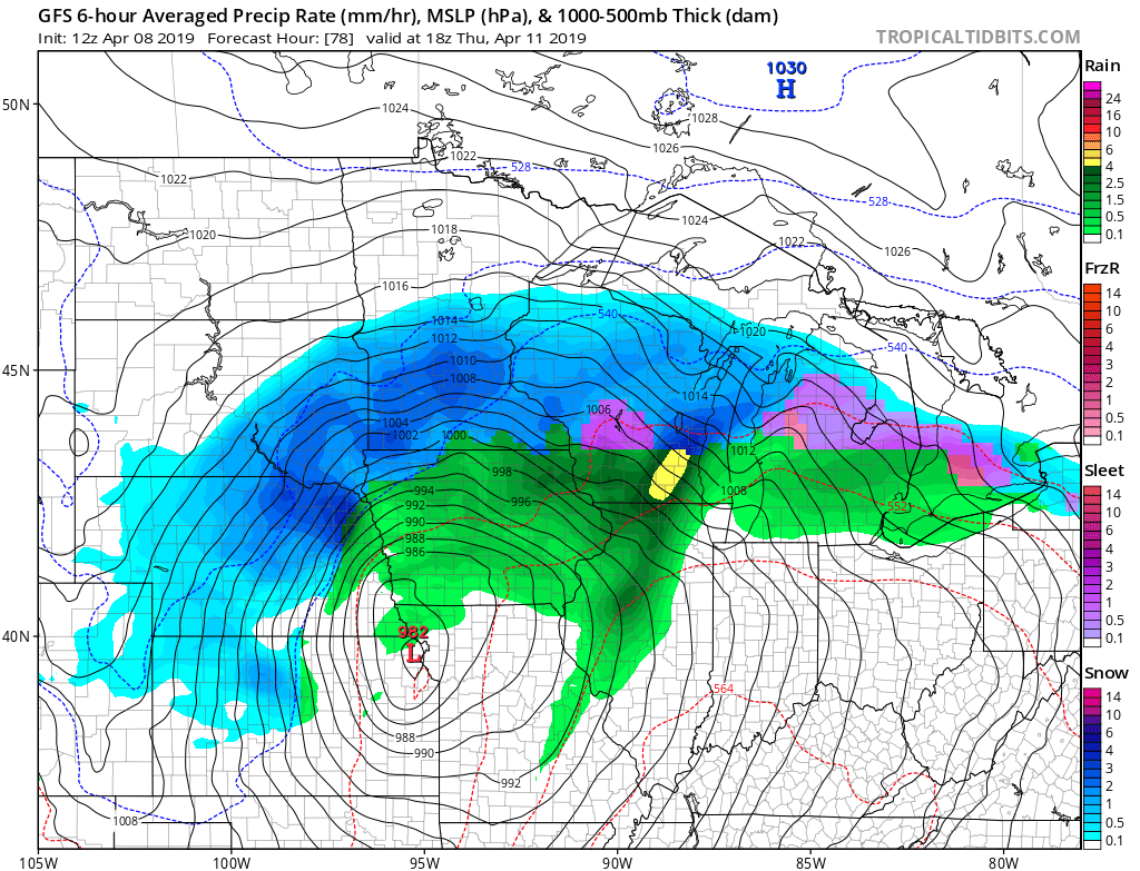
First, an intense winter storm will develop in the Plains by Wednesday. Heavy snow is likely in parts of the Plains and upper Midwest. As the storm intensifies, powerful winds will whip around it, leading to likely blizzard conditions by Thursday into early Friday. More than a foot of snow is forecast to fall over portions of northeastern Nebraska, southern South Dakota, southern Minnesota, central Wisconsin, and northern Michigan. It’s possible even locations as far south as Chicago could see some late-season, albeit light, snowfall accumulations as the system moves through.
On the south side of the system, heavy rain will fall, aggravating areas already dealing with record flooding including parts of the Missouri Valley. As the system moves north and east through the Great Lakes, an area of heavy rain will increase in intensity and coverage across the Ohio Valley.
In addition to heavy rain, an area of severe thunderstorms is possible too. It appears this could form on Friday morning across portions of Indiana and Ohio and push east into Pennsylvania by Friday afternoon. Heavy showers and potentially severe thunderstorms would then move into Delaware, Maryland, New Jersey, and New York Friday evening and the rest of New England by early Saturday morning.
High pressure will build briefly behind this system, only to yield to another area of low pressure that’ll bring another round of rain to the Mid Atlantic by Sunday.
