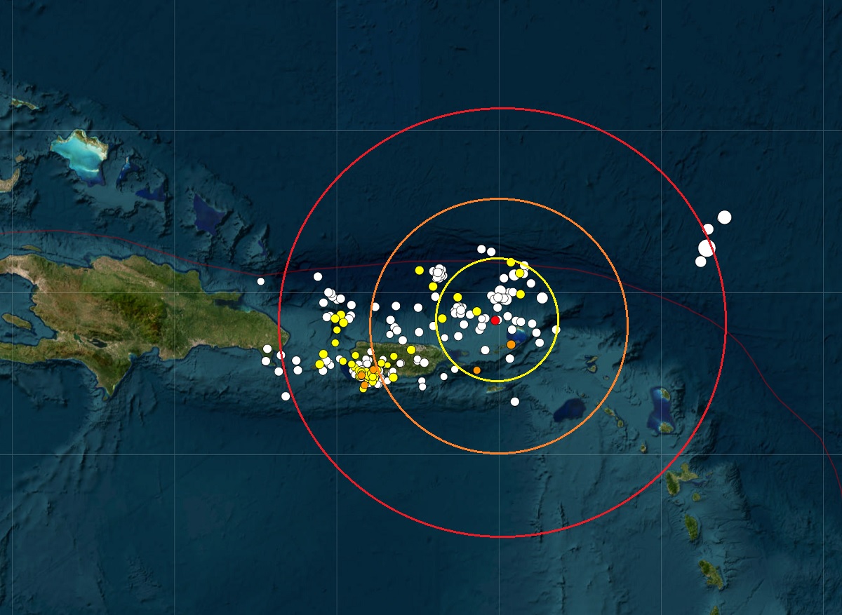
A moderate quake rocked the U.S. Virgin Islands this morning; fortunately, it wasn’t strong enough to trigger a tsunami there and there’s no tsunami threat to nearby Puerto Rico or the U.S. East Coast at this time. According to USGS, at 4:27 am ET this morning, a magnitude 3.9 earthquake struck from a depth of 49 km just north of the U.S. and British Virgin Islands. There have been no reports of any injuries or damage at this time.
Today’s earthquake was the strongest to strike the Virgin Islands in the last 30 days according to USGS. This morning’s earthquake is one of hundreds that have struck the area near Puerto Rico and the Virgin Islands over the last 30 days. According to USGS, there have been 332 earthquakes in this region over the last 30 days, with 216 at a magnitude 2.5 or greater and 8 a magnitude 4.0 or greater event. Generally, earthquakes with a magnitude of 2.0 or greater can be felt by most people. Earthquakes generally need a much greater intensity than that to do any harm; those at 4.0 or higher are likely to create some damage; earthquakes over 7.0 could create catastrophic damage.
Tsunamis are giant waves caused by earthquakes or volcanic eruptions under the sea. Out in the depths of the ocean, tsunami waves do not dramatically increase in height. But as the waves travel inland, they build up to higher and higher heights as the depth of the ocean decreases. According to the National Ocean Service, the speed of tsunami waves depends on ocean depth rather than the distance from the source of the wave. Tsunami waves may travel as fast as jet planes over deep waters, only slowing down when reaching shallow waters. While tsunamis are often referred to as tidal waves, this name is discouraged by oceanographers because tides have little to do with these giant waves. This morning’s seismic activity was not substantial enough to generate a tsunami.
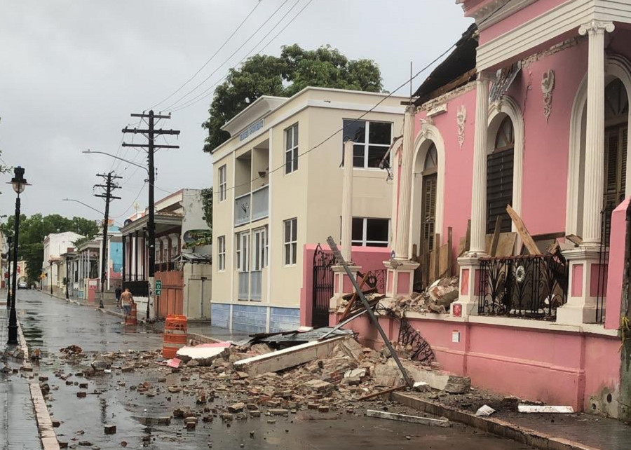
Most of the recent earthquakes in Puerto Rico and the Virgin Islands aren’t far from the epicenter of a strong earthquake that hit in January 2020. That 6.4 created extensive damage in Puerto Rico, including widespread power failures across much of the island. An earthquake swarm started here in December 2019 and unrest has continued since.
These earthquakes are occurring near the northern edge of the Caribbean Plate, a mostly oceanic tectonic plate underlying Central America and the Caribbean Sea off of the north coast of South America. The Caribbean Plate borders the North American Plate, the South American Plate, the Nazca Plate, and the Cocos Plate. The borders of these plates are home to ongoing seismic activity, including frequent earthquakes, occasional tsunamis, and sometimes even volcanic eruptions.
The U.S. Government holds annual tsunami drills for the U.S. East and Gulf Coasts each spring with a variety of international agencies and partners. While Hawaii, Alaska, and the U.S. West Coast are more prone to earthquakes and tsunami, catastrophic tsunami could occur on the east coast too from seismic activity here.
