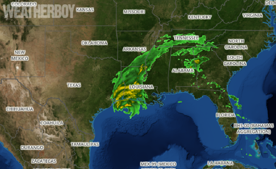
Hurricane Delta is hours away from striking the Louisiana coast, not far from where Hurricane Laura struck just weeks ago. With damaging winds of 110 mph, flooding rains, and a life-threatening storm surge building, it is important to track and monitor what Delta is doing in the moments before and after impact. Unfortunately, Hurricane Laura destroyed a NEXRAD weather RADAR site at the Lake Charles office of the National Weather Service. The Lake Charles RADAR unit was only the third RADAR system damaged by a tropical cyclone during the NEXRAD program history.
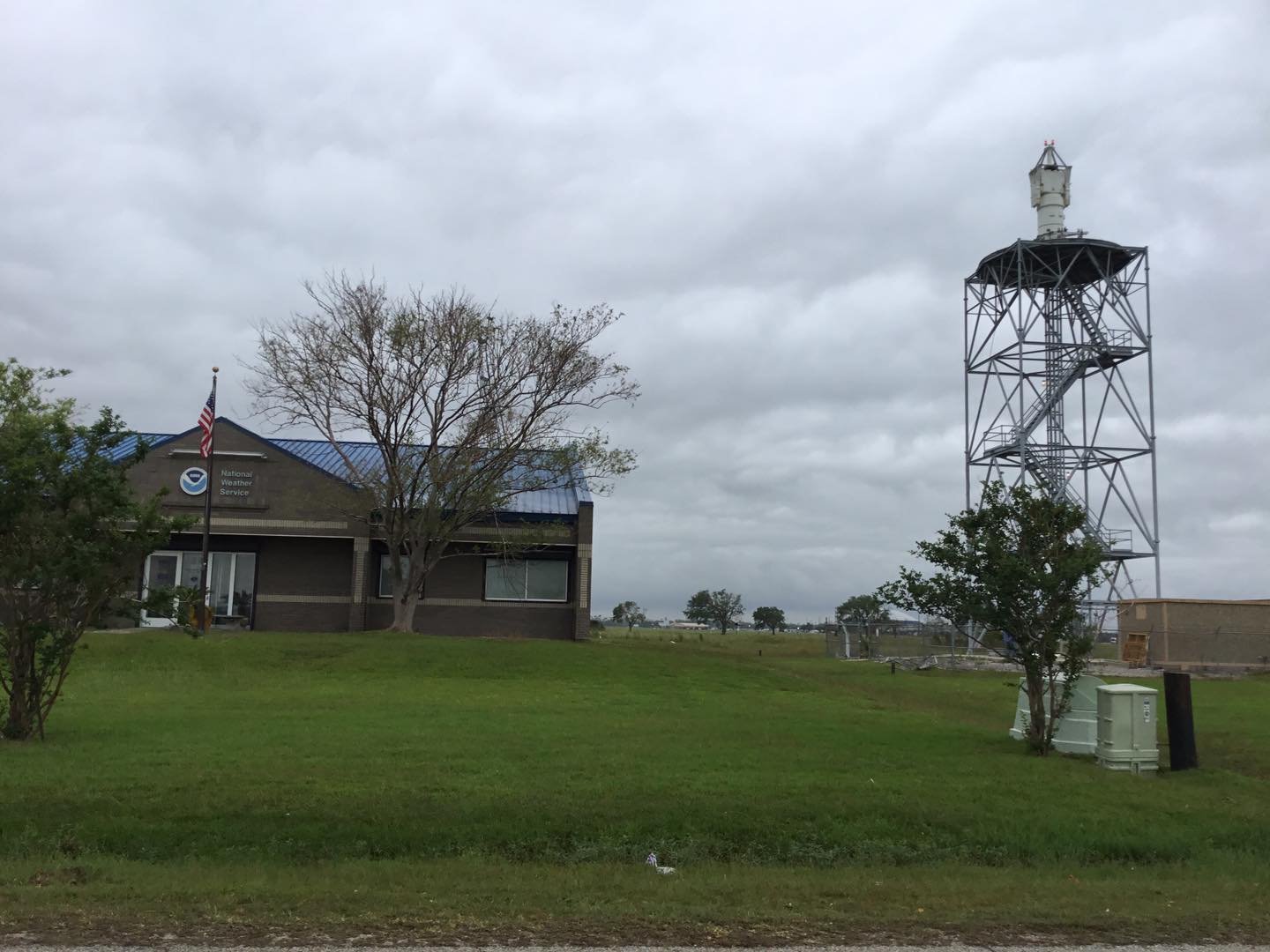
Jessica Schultz, deputy director of the National Weather Service’s Radar Operations Center in Norman, Oklahoma, said Hurricane Laura’s winds pierced the Lake Charles radar system’s radome, the dome-shaped structure that sits atop a pedestal and protects the radar antennae. When Hurricane Laura’s fierce winds blew through Lake Charles at the end of August, the wind or an object tossed in the wind destroyed the radome. Schultz said the radome is rated for a top wind speed of 124 mph; a higher wind rating would mean a thicker covering which would in turn interfere with the antenna’s signal. Lake Charles was only the third radar system damaged by a typhoon or hurricane during the NEXRAD program’s history, Schultz said.
According to the National Weather Service, replacement of the destroyed RADAR system at Lake Charles won’t occur until next spring. In the meantime, a gap exists in coverage in an area seeing numerous tropical cyclone threats this season.
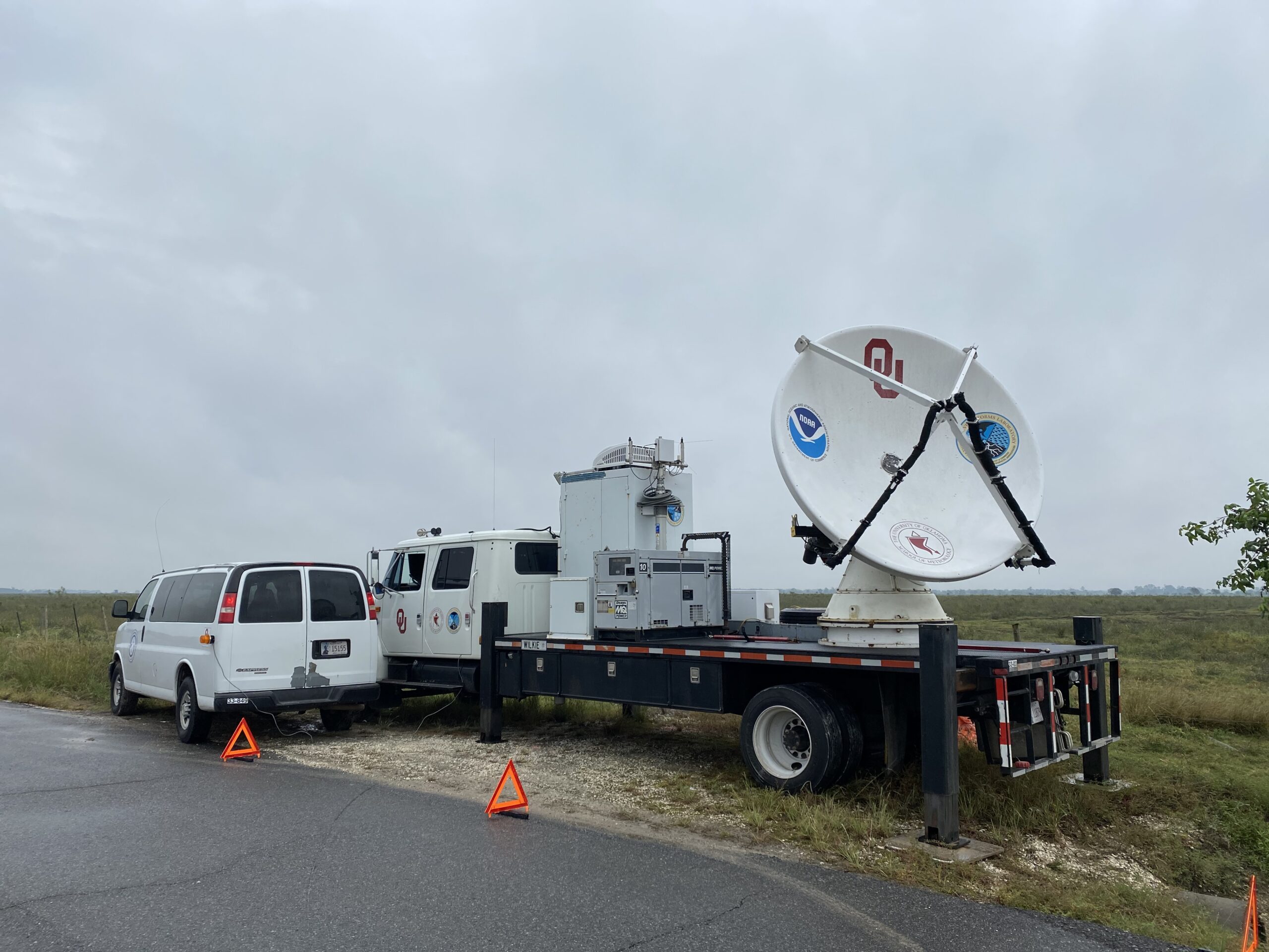
With Delta approaching the Louisiana coast, a novel solution was crafted to fill the gap. The University of Oklahoma’s Shared Mobile Atmospheric Research and Teaching (SMART) RADAR Team, in collaboration with NOAA, has deployed a mobile weather RADAR to the area around Lake Charles.
The SMART RADAR will provide additional coverage for NOAA’s National Weather Service meteorologists, many of which are issuing life-saving forecasts and warnings ahead of Hurricane Delta’s landfall.
“Our nationwide network of NEXRAD radars provides overlapping coverage. To have this opportunity to provide additional radar data is a bonus for forecasters and others monitoring Hurricane Delta,” said Steven Cooper, director of the National Weather Service Southern Region. “We’re fortunate to have the relationship between all parties involved that allows this type of cooperation.”
According to a statement released by the University of Oklahoma, the SMART radars are operated by the NOAA-OU Cooperative Institute for Mesoscale Meteorological Studies. Through a partnership with AT&T and The Weather Channel, the SMART radar data will be distributed in real-time and made available to local Weather Service Offices, the National Hurricane Center, emergency management, and to the general public via an open-access website. Michael Biggerstaff, OU School of Meteorology professor, leads the SMART radar team.
“The SMART radars have helped build a strong collaborative research program between university scientists and our NOAA partners, including the National Severe Storms Laboratory and the Hurricane Research Division,” Biggerstaff said. “We will do our best to augment the existing radar coverage in the vicinity of the landfall of Hurricane Delta.”
“With the outage of the Lake Charles NEXRAD, it is great to collaborate with our colleagues at the University of Oklahoma to provide valuable supplemental weather data to NWS forecasters and decision-makers during this unprecedented hurricane season,” said Terrance Clark, Radar Operations Center director.
