
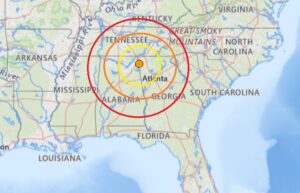
According to USGS, at 6:01 pm yesterday, an another earthquake struck Georgia; this time, it struck in the middle of the state near Warner Robins and Cochran. This earthquake struck from a depth of 4.3 km. This was the second earthquake to strike Georgia within 24 hours. The first earthquake struck at 8 am in northwestern Georgia near the state line with Alabama. Striking from a depth of 9,8 km, the magnitude 2.6 earthquake struck just outside of Menlo, Georgia. While people reported to USGS through their “Did you feel it?” website reporting tool that they felt the first earthquake, neither were strong enough to create any reported damages nor injuries.
According to Georgia’s Emergency Management and Home Security Agency (GEMA), approximately 15 percent of the world’s earthquakes are scattered over areas like Georgia that lack clearly defined active faults. Although earthquakes in Georgia are comparatively rare, scattered earthquakes caused significant damage and are an important consideration for homeowners. Georgia’s northwest counties, South Carolina border counties, and central and west central Georgia counties are most at risk.

GEMA recommends that people in Georgia plan for the risk of damaging earthquakes, especially if they’re in the northern Georgia counties of Bartow, Catoosa, Chattooga, Dade, Fannin, Floyd, Gilmer, Gordon, Murray, Pickens, Rabun, Towns, Union, Walker, and Whitfield, the South Carolina border counties of Burke, Chatham, Columbia, Effingham, Elbert, Lincoln, Richmond, and Screven, and central and west-central counties of Twiggs, Bibb, Jones, Baldwin, Hancock, Greene, Putnam, Butts, Jasper, Newton, Morgan, Walton, Harris, and Muscogee.
GEMA writes, “It’s important to be aware of your earthquake risk and to know how to protect yourself.” They encourage people to take a moment now to learn basic steps they should take before, during, and after an earthquake.
