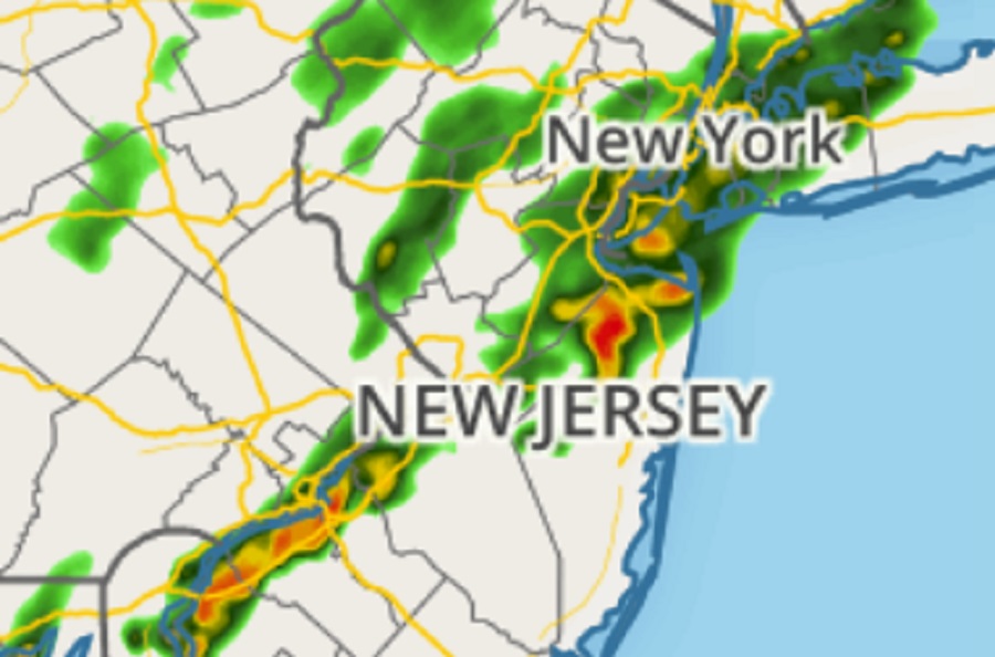
An area of slow-moving to nearly stationary heavy rain showers and thunderstorms is bringing about flood conditions to portions of central and southern New Jersey tonight. Due to the flood event underway, the National Weather Service office in Mount Holly, New Jersey has issued a Flash Flood Warning for West Central Burlington County, Northwestern Camden County, Northwestern Gloucester County, and Northwestern Salem County in southern New Jersey until 2:30 am tonight. A Flash Flood Warning was already in effect ’till midnight for Southern Mercer County and Northwestern Burlington County in southern New Jersey and for southeastern Bucks County in southeastern Pennsylvania.
At 10:31 pm, doppler RADAR indicated thunderstorms producing heavy rain across the warned area. Additional rainfall amounts of 1-2″ are possible in the warned area.
“Flash flooding is ongoing or expected to begin shortly,” the National Weather Service warns.
Flooding of small creeks and streams, urban areas, highways, streets, and underpasses as well as other drainage and low lying areas is all possible. Some locations that may experience flash flooding include Camden, Gloucester City, Deptford, West Deptford, Pennsville, Bellmawr, Woodbury, Carneys Point, Palmyra, Paulsboro, Philadelphia, Trenton, Ewing, Willingboro, Florence, Burlington, Bristol, Mount Holly, Columbus, Springfield, Mansfield Township, Riverside, Bordentown, Beverly, and Yardley.
Watch out for flooding downpours in portions of New York, Pennsylvania, Maryland, Delaware, & New Jersey! #NJwx #DEwx #MDwx #PAwx #NYwx https://t.co/pN0AehE0dm
— the Weatherboy (@theWeatherboy) September 10, 2023
Major highways in the area are also being impacted. This includes the New Jersey Turnpike between exits 1 and 3, Interstate 76 in New Jersey between mile markers 0 and 3, Interstate 295 in New Jersey between mile markers 0 and 30, and Interstate 676 in New Jersey between mile markers 0 and 4.
“Motorists should not attempt to drive around barricades or drive cars through flooded areas,” the National Weather Service warns, adding: “Turn around, don’t drown; never drive through flood waters.”
