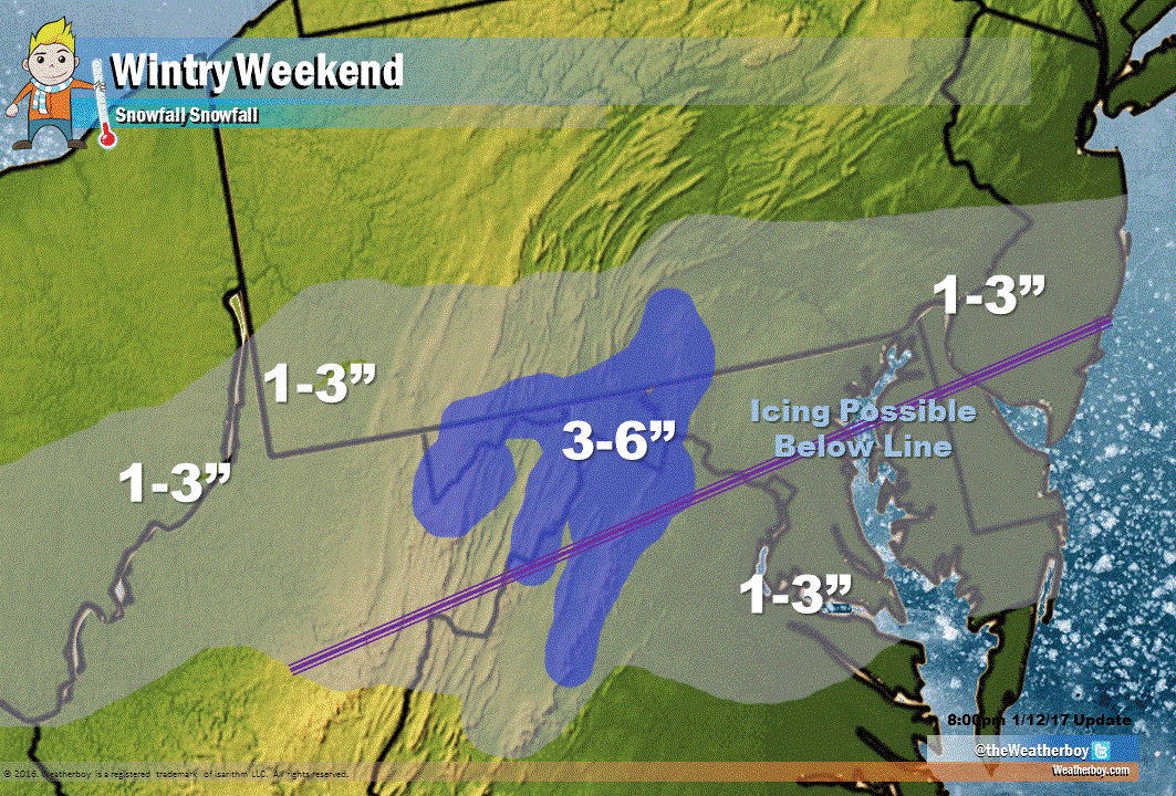
A crippling ice storm will coat a large part of the country with ice over the next 72 hours; where cold air is thick enough, plain snow will fall for a brief period of time on Saturday.
As warm moist air surges north over a dome of cold air in the Mid Atlantic, the precipitation that falls through the cold air mass will do so as snow. But with marginal temperatures for snowfall and accumulation and limited moisture to work with, snowfall amounts will be very light.
An inch or two of snow may fall south of I-76/I-276 in Pennsylvania and I-195 in New Jersey south through the northern third of Virginia, all of Maryland, and Delaware. No accumulating snow is expected further north in central or northern New Jersey, the New York City metro area, or the northeastern part of Pennsylvania. An inch or two of slushy snow may also fall over the Washington, DC and Baltimore, MD metro areas. However, as the purple line indicates, the light snow may mix with or change to freezing rain or drizzle before ending.
The event may be comparable to the icing situation that happened on Saturday, December 17 which brought deadly road conditions between Washington, DC and Baltimore, MD. If you plan to travel through this area, exercise extreme caution: roads that appear to be wet may actually be icy.
In the highest elevations of western and central Maryland, northeastern West Virginia, western Virginia, and south-central Pennsylvania, 2-3″ of snow may fall.
For the latest information on the bigger ice storm story, click here.