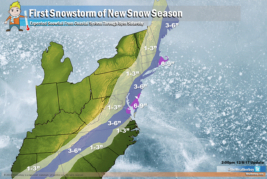
Several inches of snow are expected from the deep South to the Northeast today into tomorrow evening. This storm is producing snow down to the US/Mexico Gulf Coast border; Brownsville, TX reported a measurable snowfall today, only the third in its 122 year weather record history. Snowflakes may even fly in northwestern Florida, although accumulations are not expected on roads there. Snow is sticking to roads though now in and around Atlanta where 3-6″ is expected. 3-6″ is also expected south and east of the I-95 corridor between Washington, DC and Boston, MA. Some heavier snow, of around 6-8″, with isolated amounts to 9″, are possible over the DelMarVa and southeastern New England.
There could be mixing with non-snow precipitation along immediate coastal areas of Maryland, Delaware, New Jersey, and Cape Cod. At the beach, snow accunulations may be 10-20% lighter than areas just inland away from the shoreline and away from barrier islands.
The threat of additional snow in this area will return as a new storm system approaches Tuesday into Wednesday.
More detailed local forecasts for locations throughout the United States can be found here.