An area that has seen a tremendous amount of rain in recent weeks is about to get more: a frontal boundary will be nearly stationary across the Mid Atlantic region this weekend, with several waves of low pressure sliding east along it. This stationary front and companion low pressure waves will produce unsettled weather in the region, with more flash flooding and severe weather threats popping up here.
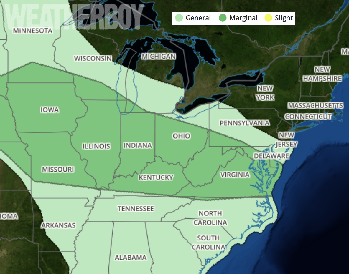
The National Weather Service Storm Prediction Center has declared a “marginal risk” for severe storms across the DelMarVa peninsula. Analysis of data shows that portions of eastern Maryland and Delaware may be at most risk of severe weather on Saturday. According to the Mount Holly, NJ office of the National Weather Service, the “biggest threat is damaging winds and potentially some hail” from these storms. They add, “Any storms that develop will be efficient rain makers and heavy rain will likely occur.”
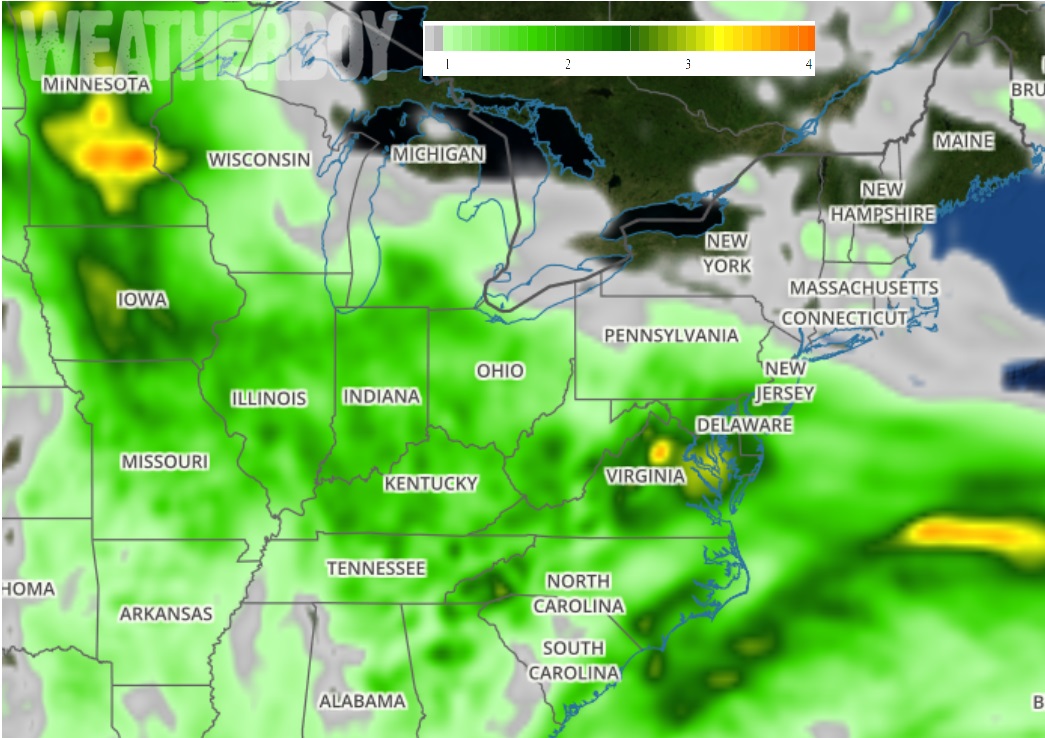
Rain may create flooding woes for an area that has seen frequent flooding events in recent weeks. Upwards of 2-4″ of rain is likely in the Mid Atlantic, with the heaviest amounts expected over eastern Virginia, eastern Maryland, Delaware, southeastern Pennsylvania, and southern New Jersey.
Beyond a showery Saturday, more showers and thunderstorms are expected to continue into the overnight hours Saturday and Sunday. Showers and thunderstorms should be ongoing across the Mid Atlantic on
Saturday evening, mainly near and south of the Mason-Dixon line. Convection has a good potential to last through most of the evening since the forcing will result from an upper level wave interacting with the stalled front over the area. Early in the evening there will still be the risk of an isolated severe storm but otherwise the main threat looks to be very heavy rainfall with an associated urban, poor drainage, and small stream flood issue. The heaviest and steadiest showers and storms should taper off overnight Saturday with the passage of the shortwave which will also push the frontal boundary farther south setting up a cooler day for Sunday. On Sunday, high pressure will nose in southeast from Quebec into New England, setting up a cooler, more stable northeast flow in the northeast. While this should also tend to keep the front and most of its precipitation suppressed to Virginia and Maryland, some scattered showers and storms could work their way as far north as Pennsylvania and New Jersey on Sunday. With an abundance of clouds and the threat of more showers, temperatures will stay cool. As an example, in the Philadelphia area on Sunday, highs will only be in the 70s.
It appears Mother Nature won’t be done with the wet weather on Sunday. It appears that the main shortwave associated with the upper trough will drive-through, helping to develop a surface low along the front which will pass through the Mid Atlantic later Sunday night into Monday. This will likely bring another period of rainfall through, which could be heavy at times again. The National Weather Service says, “it appears that once again, the threat for very heavy rain will be highest across the Delmarva. Additional hydro (flooding) issues will be possible at this time.” The rainfall with this low may continue at least into the first part of Monday before the system moves out by late day and high pressure finally returns.
