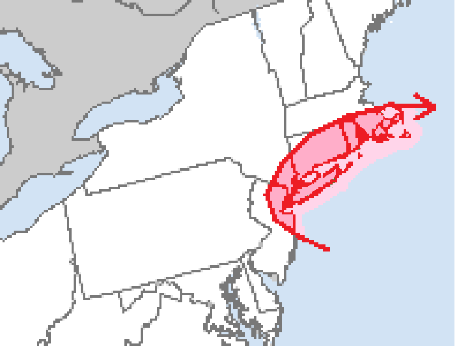
A potent frontal system will create strong thunderstorms across portions of the Mid Atlantic and Northeast tomorrow while also producing a tornado risk across portions of New Jersey, New York, Connecticut, Massachusetts and Rhode Island. According to the National Weather Service’s Storm Prediction Center (SPC), isolated damaging wind gusts and a tornado or two are possible Friday morning through Friday afternoon in this area.
Responsible for this latest round of severe weather is a a strong and mature mid-latitude cyclone. It is forecast to be centered over the upper Mississippi Valley early Friday morning; from there, it will gradually move east throughout the day while a series of shortwave troughs rotate around it. This cyclone will be accompanied by a strong cyclonic flow high in the atmosphere, with even stronger flows tied to the shortwave troughs that are rotating through.
The SPC says one such shortwave is forecast to move from the mid Ohio Valley northeast through the Great Lakes region, accompanied by a strong jet streak. The additional forcing associated with this shortwave will likely result in a strongly forced line of thunderstorms along the front. According to the SPC, “the strongest flow aloft will likely lag behind this convective line, but strong deep-layer flow will still be in place across much of the northern Mid-Atlantic and Northeast.” The low-level flow is forecast to strengthen in the warm sector ahead of the shortwave trough, adding more wind energy to the system that could translate down to the surface in damaging wind gusts. With just enough low-level veering winds, some isolated tornadoes are possible too.
While the greatest risk of isolated tornadoes is over portions of New Jersey, New York, Connecticut, Massachusetts and Rhode Island, the threat of severe storms is over a broader area that stretches from southern New England down into eastern Pennsylvania, including Philadelphia, all of New Jersey, all of Delaware, and much of eastern Maryland. There’s a risk of thunderstorms in eastern Virginia and North Carolina too, but storms there aren’t expected to become too strong nor severe.
Once the front clears the coast, the severe weather threat will end. But much colder and drier air will eventually arrive behind the front, with temperatures by Sunday 10-15 degrees colder than they’ll be on Friday across the region.
