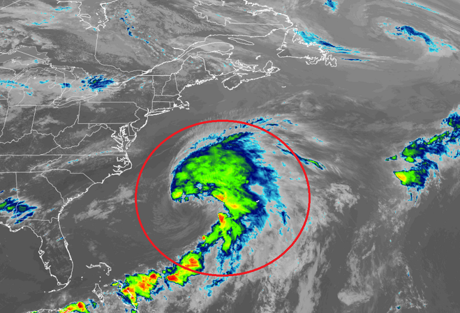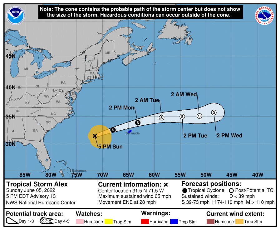
A stronger, larger Tropical Storm Alex is headed to Bermuda tonight where Tropical Storm Warnings remain in effect. The tropical cyclone, which was upgraded from Potential Tropical Cyclone #1 to Tropical Storm Alex last night, has increased in size and strength today, with maximum sustained winds now up to 65 mph.
According to the National Hurricane Center (NHC), Alex is forecast to pass near or just north of Bermuda on Monday, and tropical storm conditions are expected on the island late tonight and Monday.
As of the latest advisory from the NHC, Alex was located about 395 miles west of Bermuda. With maximum sustained winds of 65 mph, the storm is moving east-northeast at 28 mph. The minimum central pressure is at 991 mb or 29.27″.

Based on the latest NHC track, Alex will continue a fast motion to the east-northeast through Monday followed by a more eastward motion and a slower forward speed on Tuesday. Based on this track, the center of the storm will pass near or just north of Bermuda tomorrow. Because most of the rain and wind with the storm is on the northern and eastern side, Bermuda should experience the worst impacts tonight and early tomorrow in advance of the storm center’s arrival.
The NHC also believes Alex has reached it’s maximum intensity, just 9 mph shy of becoming a Category 1 hurricane. While little change in strength is expected through tonight, Alex is forecast to weaken tomorrow as it moves over colder water. By Tuesday, the NHC expects the system to become an extratropical low pressure system, losing all of its tropical cyclone characteristics.
The storm is much larger than it was when it crossed Florida; tropical-storm-force winds extend outward up to 205 miles mainly to the east of the center.
Bermuda will see heavy rain and gusty winds from this system as it moves through. 1-2″ or 25-50 mm of rain is expected tonight into early tomorrow, with tropical storm force winds expected to arrive late tonight.