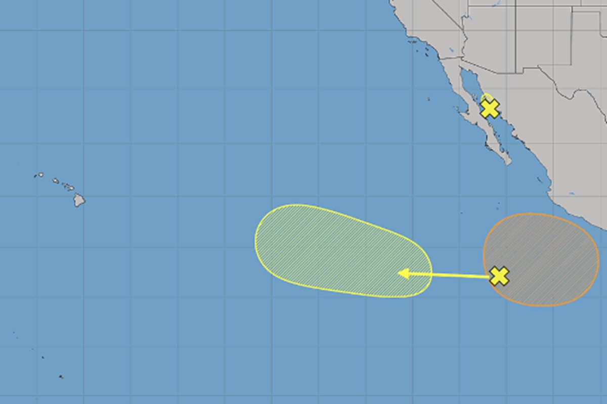
Meteorologists with the National Weather Service and Central Pacific Hurricane Center are closely monitoring areas of disturbed weather in the Eastern Pacific Hurricane Basin that could develop into tropical cyclones over time. The Pacific hurricane season has been hyperactive in recent weeks due to the El Nino phenomena and it doesn’t appear to be letting up anytime soon.
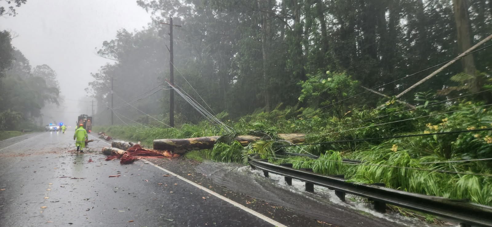
The state of Hawaii has had catastrophic impacts from two hurricanes in recent weeks: Lala and Lowell. Hurricane Lala formed in the Central Pacific Hurricane Basin in early August and brought destructive winds and rain to the Big Island of Hawaii on August 16. Later in the month, Hurricane Lowell developed in the Eastern Pacific Hurricane Basin and moved west, nearly dodging Hawaii completely before turning north to bring direct impacts to Kauai on September 8. There, a very significant storm surge tore across communities on the south side of the island and rough surf hit the north shore while strong winds and heavy rains battered much of the rest of the island.

Now, the National Hurricane Center (NHC)’s latest Tropical Outlook is pointing out three areas of concern; the first is in the Gulf of California and the other two are in the Eastern Pacific far from the Mexican coastline.
An area of low pressure over the central Gulf of California is bringing heavy rains to portions of the Mexican state of Sonora. The NHC says that although the development chances appear to be decreasing since the system is expected to move inland later this morning, heavy rains will likely continue across portions of the state of Sonora during the next day or so, and could cause isolated flooding. For now, the NHC says there’s only a 20% chance of tropical cyclone formation here and if it did form, it would only impact the Mexican coastline that’s already being lashed by heavy rains and gusty winds by the disturbance.
The next two systems are over the Pacific.
The first is an area of low pressure that the NHC says could form well offshore of southwestern Mexico within the next few days. Environmental conditions appear conducive for some gradual development, and this system could become a tropical depression early next week while it moves slowly northwestward or northward. Of the systems being tracked, this has the highest odds of developing into a tropical cyclone. The NHC says there’a a 50% chance of formation sometime over the next 7 days, although it’s unlikely anything would form in less than 2 days.
The second area of concern is a tropical wave that is producing disorganized showers and thunderstorms well to the south of the southern tip of the Baja California Peninsula. According to the NHC, upper-level winds are forecast to be unfavorable for significant development through the weekend as the system moves westward at 10 to 15 mph. However, the NHC cautions that some gradual development of this system is possible early next week when it reaches the western portion of the east Pacific basin. For the next 7 days, the NHC says there’s a 30% chance of tropical cyclone formation over the next 7 days.
A “tropical cyclone” is the general, broad scientific term for any large, rotating storm system that forms over warm ocean waters with a low-pressure center and thunderstorms. This family includes tropical depressions, tropical storms, and hurricanes. Once a tropical cyclone becomes a tropical storm, the National Hurricane Center will name it, choosing from a list of approved names assigned to each hurricane basin.
These two systems may over time bring direct to indirect impacts to Hawaii in time. It is too soon to say what these impacts would be, but if they were to occur, it would be more than a week out.
For now, the National Weather Service (NWS) office in Honolulu on the island of Oahu is also monitoring the remnants of prior tropical cyclones for potential impacts to Hawaii. Moisture from the remnants of Tropical Depression 15-E may bring another round of enhanced trade showers early next week. Surf is initially small today, but the NWS says it will trend upward toward the High Surf Advisory threshold by this weekend. Surf along east-facing shores increases today into Thursday as trade winds strengthen and a small, medium-period east swell from the remnants of Tropical Storm Norbert arrives.
