The USGS and their Alaska Volcano Observatory (AVO) have raised the aviation color code and volcano alert level at the Mount Gareloi stratovolcano, the westernmost volcano in the United States. Because the level of seismic activity is now above background levels at the volcano, AVO raised the aviation color code to YELLOW and the Volcano Alert Level to ADVISORY yesterday.
According to the AVO, a slight increase in seismic activity was observed at Mount Gareloi on May 18, and beginning May 27 there has been a sustained increase in the rate and size of small volcanic earthquakes. While seismic activity has increased, the AVO says there has been no other notable changes at the volcano in satellite data or web camera views. “Sulfur dioxide gas was detected in satellite imagery from Gareloi over the past week and is consistent with measurements from the last several years. No activity was observed by an AVO field crew flying over the summit on May 23,” the AVO said in a statement.
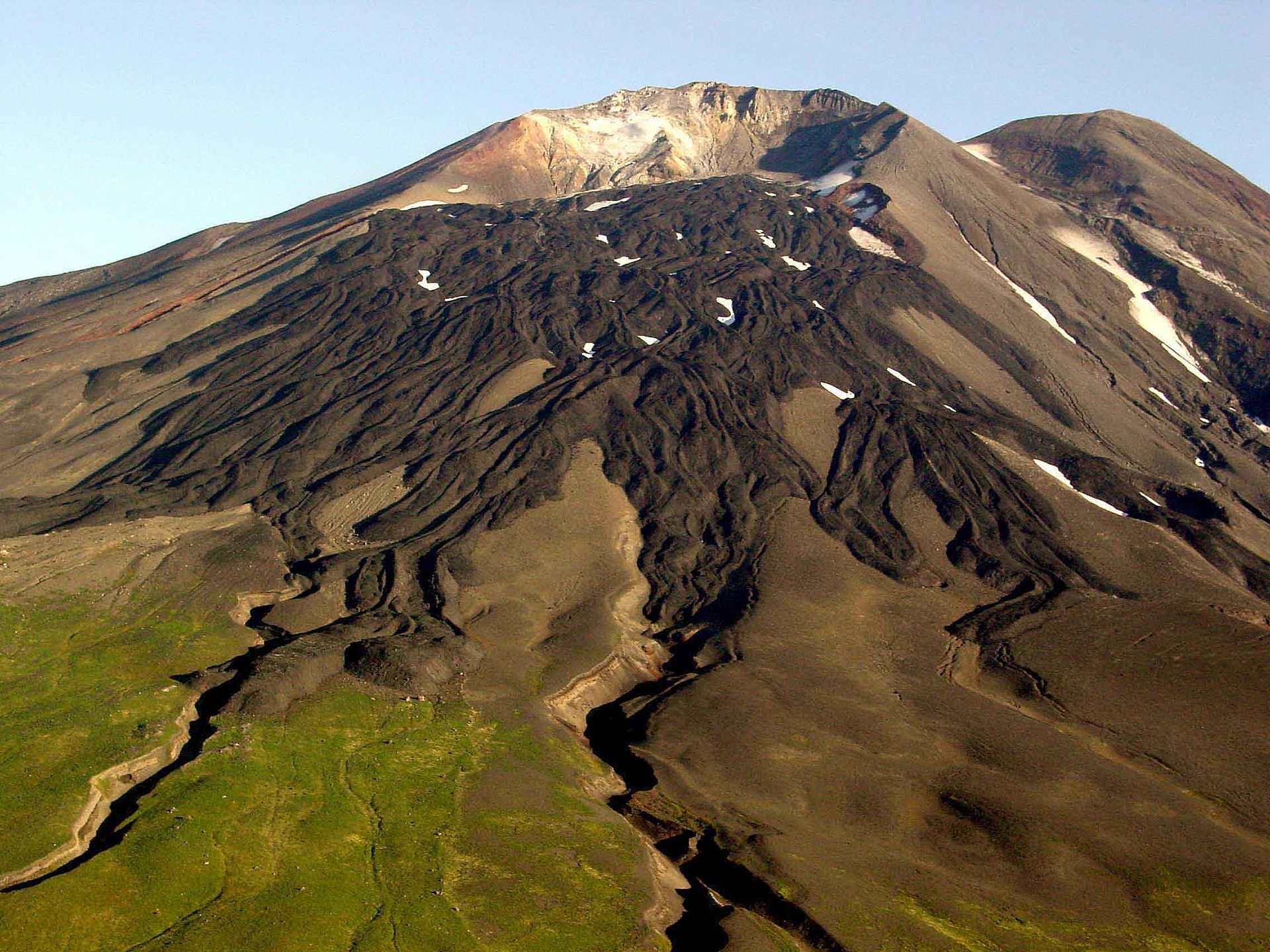
Gareloi volcano persistently emits magmatic gases from a fumarole field on the south crater and commonly exhibits low-level seismic activity. “These observations suggest the presence of shallow magma and potential interaction with a hydrothermal system,” AVO says. “The current increase in seismicity likely reflects a change to the magmatic-hydrothermal system, but it is not clear that the likelihood of a volcanic eruption has increased.”
Volcanoes in this portion of the Ring of Fire are monitored by the Alaska Volcano Observatory, which is a joint program of the U.S. Geological Survey (USGS), the Geophysical Institute of the University of Alaska Fairbanks (UAFGI), and the State of Alaska Division of Geological and Geophysical Surveys (ADGGS). The AVO is similar to the Hawaii Volcano Observatory (HVO) which monitors Hawaii’s three active volcanoes: Kilauea, Mauna Loa, and Hualalai. In the case of AVO, they monitor Cleveland, Semisopochnoi, and Veniaminof too.
Alaska is home to many volcanoes, though; there are more than 130 volcanoes and volcanic fields which have been active within the geologically young last 2 million years. 50 have been active since the mid 1700s and AVO studies those too.
AVO is responsible for issuing Aviation Codes and Volcanic Activity Alert Levels. Aviation Codes are green, yellow, orange, or red. When ground-based instrumentation is insufficient to establish that a volcano is at a typical background level of activity, it is simply “unassigned.” While green means typical activity associated with a non-eruptive state, yellow means a volcano is exhibiting signs of elevated unrest above known background levels. When a volcano exhibits heightened or escalating unrest with the increased potential of eruption, it jumps to orange. Finally, when an eruption is imminent with significant emission of volcanic ash expected in the atmosphere or an eruption is underway with significant emission of volcanic ash into the atmosphere, the code becomes red. Volcanic Activity Alert levels are normal, advisory, watch, or warning. As with aviation codes, if data is insufficient, it is simply labeled as “unassigned.” When the volcano is at typical background activity in a non-eruptive state, it is considered normal. If the volcano exhibits signs of elevated unrest above background level, an advisory is issued. If a volcano exhibits heightened or escalating unrest, a watch is issued while a warning is issued when a hazardous eruption is imminent.
Gareloi is monitored by a local seismic and infrasound network, satellite data, and regional infrasound and lightning-detection networks. AVO says they will continue to monitor activity to determine if the recent changes are related to influx of new magma or other changes to the magma system. If an eruption appears imminent, they will raise the aviation and alert codes accordingly.
