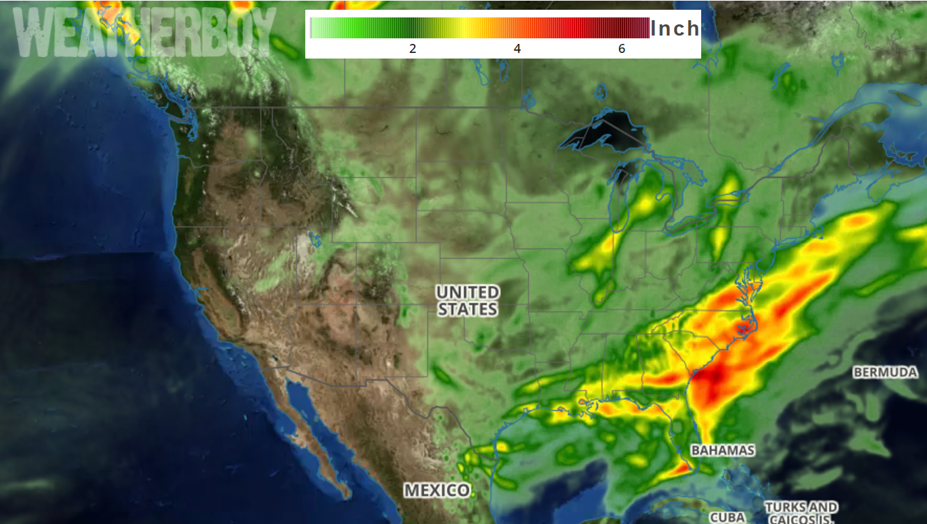
A very wet pattern will exist on the east coast this week, bringing soaking rains to areas that have seen significant rain in recent weeks, while also bringing significant rain to places that really need it in Georgia and Florida.
Weak low pressure is developing on a warm front from the DelMarVa Peninsula into southern New Jersey today. A cold front approaching from the west will merge with the warm front just off the mid Atlantic coast tonight. Low pressure in North Carolina on Tuesday will pass east of the Mid-Atlantic coast on Tuesday night. While weak high pressure is in that system’s wake on Wednesday, stronger low pressure will organize over the Ohio Valley by Wednesday evening, sending its associated fronts through the Mid Atlantic region late Thursday and early Friday as this newer system advances towards New England.
With these back-to-back lows, rain will fall throughout the period, some of it heavy at times.
With the arrival of Memorial Day Weekend, some lingering shower activity will remain, but a wash-out is not expected over the three-day weekend. In fact, many places will be able to enjoy 36-48 hours of dry conditions over the weekend in the eastern US.