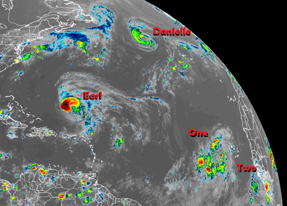
The National Hurricane Center is issuing advisories on Hurricane Danielle, located several hundred miles west-northwest of the Azores, and on Hurricane Earl, located several hundred miles south of Bermuda; they are also monitoring two areas in the eastern Atlantic that could develop into tropical cyclones over time too.
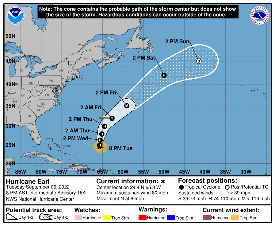
Hurricane Earl is 550 miles south of Bermuda, where a Tropical Storm Watch is now in effect. A Tropical Storm Watch means that tropical storm conditions are possible within the watch area, generally within 48 hours. Earl is moving toward the north near 6 mph and this motion is expected to continue into tomorrow with a gradual turn to the north-northeast on Thursday. On the forecast track, the center of Earl is expected to pass to the southeast of Bermuda by Friday morning. Data from Hurricane Hunter reconnaissance aircraft indicate that the maximum sustained winds in Earl have increased to near 80 mph with higher gusts. Strengthening is expected over the next couple of days and Earl is forecast to become a major hurricane by Friday.
While Earl is forecast to inch closer to Bermuda and gain strength, it should pass far enough to its east to only give the island a glancing blow of rain and wind. No direct impacts from Earl are expected to the Bahamas, the U.S. East Coast nor to the Canadian East Coast.
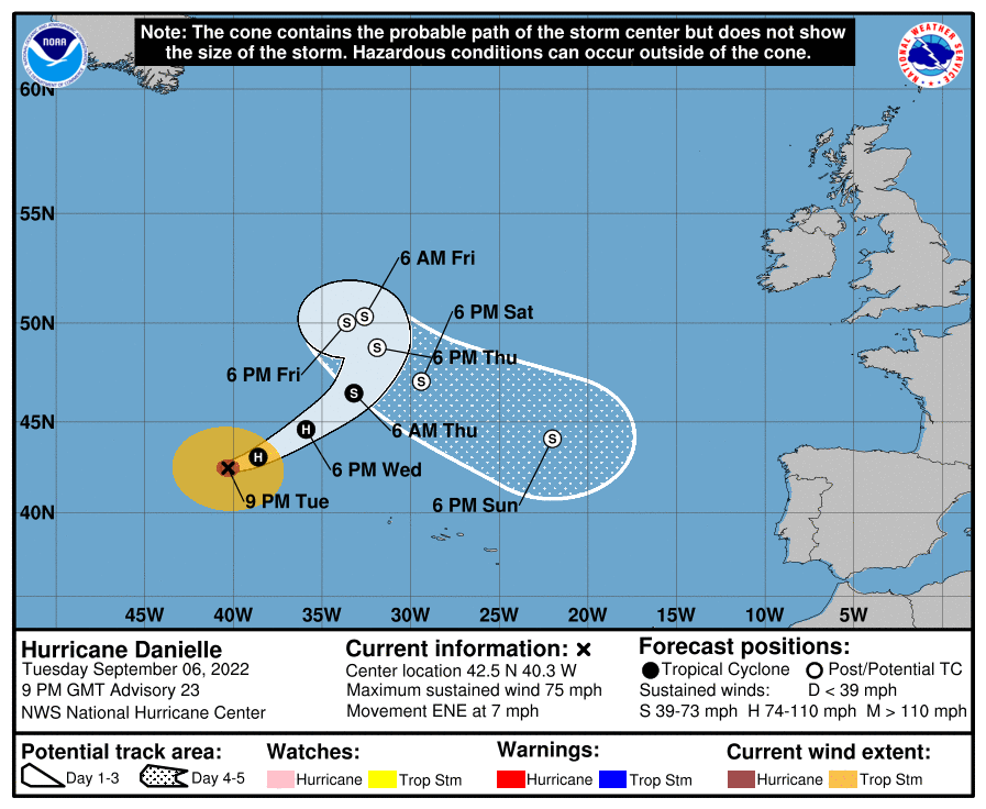
Hurricane Danielle, located in the open waters of the North Atlantic, is forecast to remain there for the next several days. The official forecast track from the National Hurricane Center has it doing a big loop over the North Atlantic where no direct impacts to any land mass are expected.
Over time, moisture from Danielle could reach Europe where rainfall is needed from a prolonged seasonal drought. Other than lingering beneficial moisture, Danielle isn’t expected to bring any impacts to any land in the immediate future.
Beyond Danielle and Earl, the National Hurricane Center are monitoring two areas of meteorological activity that could become tropical cyclones over the next five days.
The first in the eastern Tropical Atlantic is an area of disorganized showers and thunderstorms near the Cabo Verde Islands which extend southwestward several hundred miles in association
with a broad area of low pressure. According to the National Hurricane Center, environmental conditions are conducive for some development of this system, and a tropical depression could form in a few days while it moves westward to west-northwestward at 15 to 20 mph over the eastern and central tropical Atlantic. For now, the National Hurricane Center believes this system has a 50-50 medium chance of becoming a tropical cyclone over the next 48 hours; those odds rise somewhat to 60% for formation over the next five days.
The second in the eastern Tropical Atlantic is a tropical wave moving off the west coast of Africa. According to the National Hurricane Center, environmental conditions appear generally conducive for some slow development as the system moves west-northwestward over
the eastern tropical Atlantic. While there’s no chance of formation over the next 48 hours, the National Hurricane Center believes those odds increase somewhat over the next 5 days to 20%. Odds for development could improve beyond 5 days.
