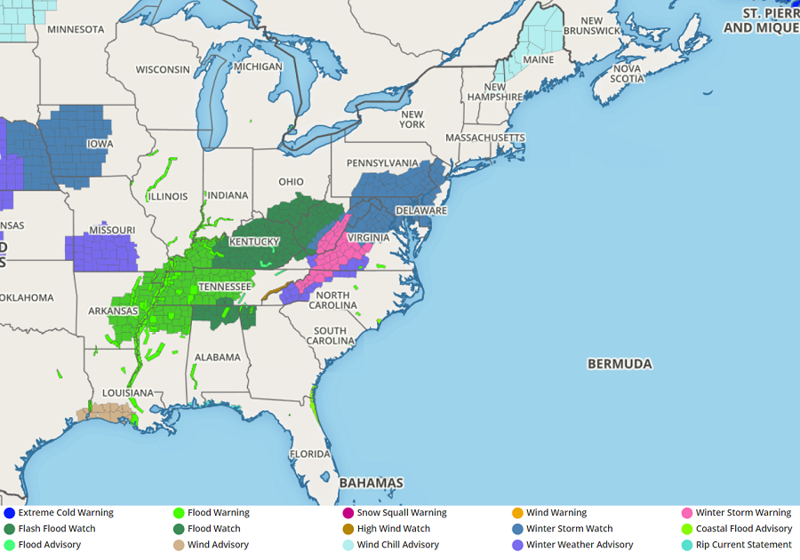
The National Weather Service has begun to issue Winter Storm Watches for portions of the Mid Atlantic ahead of another sloppy winter storm expected to impact the region Wednesday into Thursday. Winter Storm Watches are now up for portions of New Jersey, Pennsylvania, Delaware, Maryland, and Virginia. With winter weather arriving earlier, the National Weather Service has issued Winter Storm Warnings and Winter Weather Advisories for portions of North Carolina, western Virginia, and eastern West Virginia.
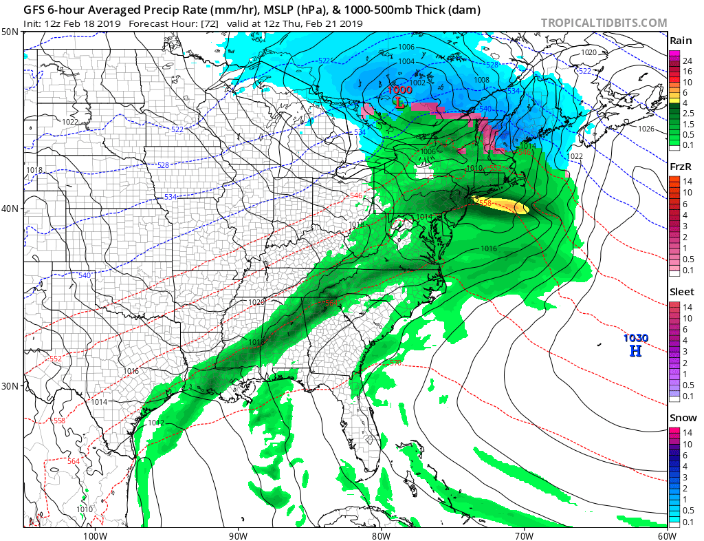
Accumulating snow is expected from an approaching storm system prior to a change-over to plain rain in many areas. Low pressure south of the Canadian Maritimes now will continue to move out to sea tonight. High pressure over the Northern Plains will build to the south and east, will be over the Great Lakes on Tuesday. This high, helping establish cold air into the Mid Atlantic for this storm, will be over the Northeast on Wednesday before exiting the coast. A complex low pressure system will organize over the Ohio Valley on Wednesday and shift east, passing into the Mid Atlantic by Wednesday night. On Thursday, the system will exit the Northeast, allowing high pressure to build in before another low pressure arrives for the weekend.
Before a surge of milder air moves up the coast, snow will break out across the Mid Atlantic, bringing accumulating, plowable snow to many before it turns to rain.
The snow and change-over to rain will spread from southwest to northeast Wednesday into Thursday. In Washington, DC, snow should arrive around 6am Wednesday; it should change to plain rain by 6pm Wednesday evening. In Philadelphia, PA, snow should arrive by lunchtime and change to plain rain by 7pm. In New York City, snow should arrive by 2pm and turn to plain rain by midnight. In Providence, RI, a light wintry mix should arrive by 1am Thursday, changing to plain rain by 4am Thursday. In Boston, MA, some light snow is possible by 2am Thursday but should quickly change to rain by 5am Thursday.
Due to the timing of the snow, travel will become tricky around the Washington, DC area throughout the day Wednesday; travel will become very tricky around the Philadelphia metro area Wednesday afternoon. Travel could also be tricky in the New York City metro area for the ride home from work or school Wednesday.
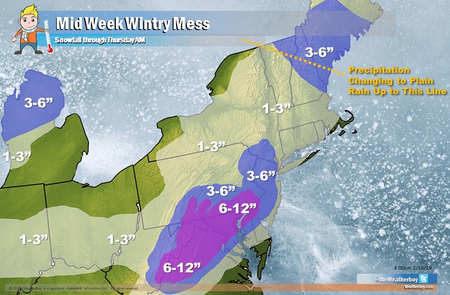
Before the rain arrives in portions of the Mid Atlantic, snow will accumulate, especially over southern Pennsylvania, southwestern New Jersey, northern Delaware, central Maryland, western Virginia, and eastern West Virginia. We expect 3-5″ for the Philadelphia metro area and 6-8″ for Washington, DC. In New York City, Boston, and Providence, we only expect 1-2″.
Rain could become heavy at times Wednesday night into Thursday morning for the Washington, DC to Providence, RI area. Rain and/or a mix of rain/snow will reach northern Upstate New York, northern Vermont and New Hampshire, and central Maine with this storm.
