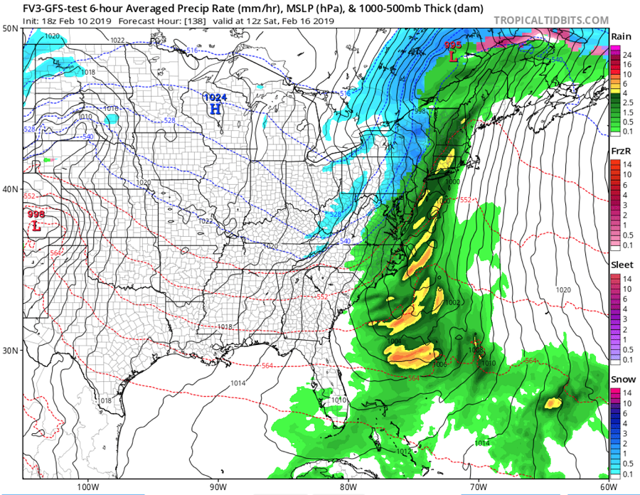
While the northeast is dealing with another round of wintry precipitation today into tomorrow, it appears yet another soaking rain storm will impact much of the East Coast at the end of the week, bringing yet another round of heavy rain to an area that doesn’t need it. And unlike the winter storm that we’re kicking the start of the week off, this next system will likely surge mild air far north, bringing soaking rains to areas expecting heavy snow today in interior New England.
After the messy system bringing wintry weather to portions of the Mid Atlantic and New England today and tomorrow exits, high pressure will builds across the southeast US and ridge up into the Mid-Atlantic coast by Wednesday night. Relatively clear conditions expected Wednesday night which will set up a decent radiational cooling scenario for the Mid Atlantic. However, with winds remaining up as opposed to calming down, it won’t cool as much as it potentially could and lows will only drop into the 20s. Warmer air will stream northward on Thursday in a more west to southwest flow; this will allow temperatures to return to normal levels. The high will shift offshore and head east on Thursday, setting the stage for the next weather maker.
On Friday, a new surface low will push eastward through to the coast, crossing to the north of the Mid Atlantic late Friday into Saturday. As the low tracks into New York, the trailing cold front will approach the Mid Atlantic and southeast. Another low may form along the front as the front crosses the Mid Atlantic on Saturday, amplifying precipitation amounts. Warm air will surge across the coastal plain ahead of the cold front bringing heavy rain all the way north to the Canadian border. The heaviest precipitation should hit the northeast early Saturday. The surface low will then settle in New England on Sunday, moving very slowly north as high pressure tries to build in from the west. This will put a rather tight pressure gradient across the Mid Atlantic and Sunday looks to be an exceptionally windy day as a result.
As the low exits on Sunday, colder air will return to the Mid Atlantic and Northeast. But like so many storms before it this winter season, the precipitation will shut off before much of the cold air arrives, leading to very little new snowfall.