An area of low pressure will bring a snow and a frozen and freezing mix of snow, sleet, and freezing rain to a large part of the northeastern US tonight and tomorrow.
Light snow and flurries have broken out through portions of northern New Jersey, Pennsyvlania, and southern upstate New York while heavier snow is falling over Michigan. The snow will taper off a bit in the northern Mid Atlantic and southern New England before picking up again later tonight.
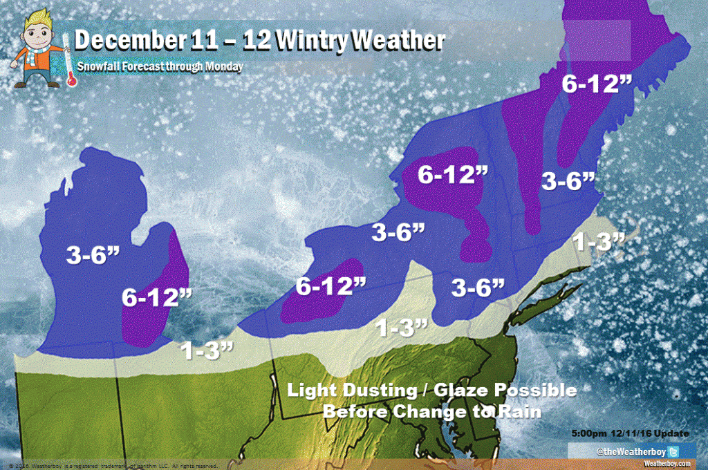
Across much of eastern Pennsylvania (except for higher terrain of northeastern Pennsylvania), New Jersey, and the New York City metro area, the snow activity tonight will eventually turn over to plain rain by tomorrow morning. This transition will occur from south to north during the overnight hours. With cold air slow to scour out of some locations well away from the coast, there could be a prolonged period of sleet and/or freezing rain prior to the changeover.
A light dusting of snow and a light glaze of ice is also possible in the northern and western suburbs of Washington DC, northern and western suburbs of Philadelphia, and central New Jersey and points north. However, in these areas, liquid rain should arrive before daybreak Monday.
Further north, the cold air will stay strong, keeping the precipitation as snow or mainly snow. Without a changeover to plain rain, that snow will accumulate substantially. Upwards of 10″ is possible over portions of New York, Vermont, New Hampshire, Massachusetts, and Maine, although the heaviest amounts will fall at the highest terrain.
Once this storm system clears out Monday, our attention will turn to another system which could bring another round of wintry weather to this same region towards the end of the week.
