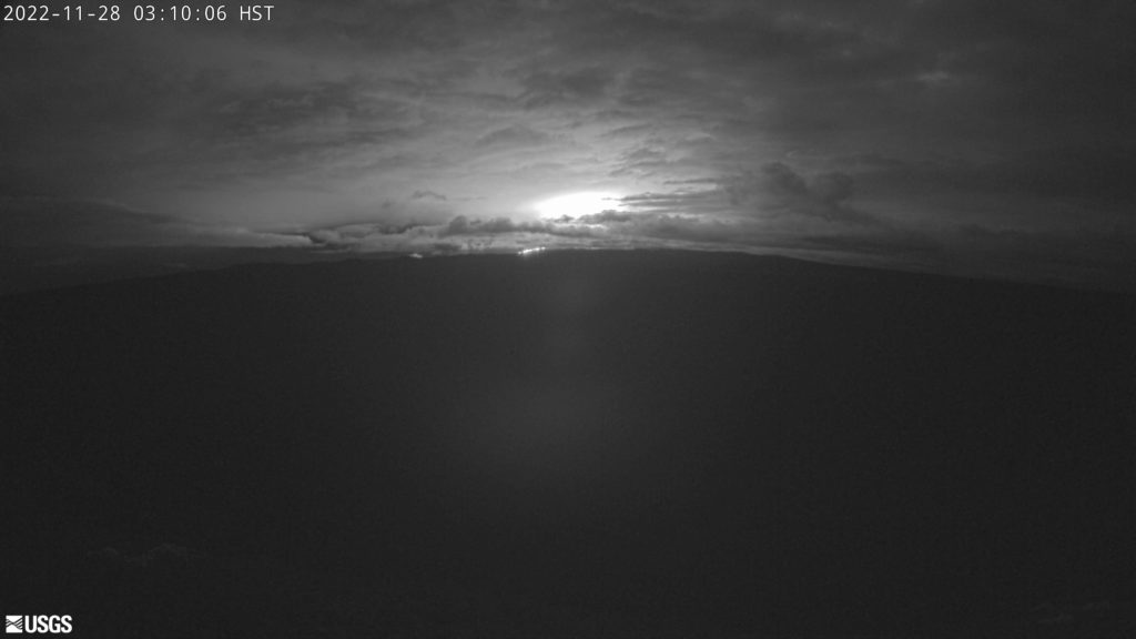
The world’s largest active volcano is erupting: Mauna Loa Volcano, on the Big Island of Hawaii, began a new eruption at its summit caldera at 11:34 pm local time (4:34 am ET) The volcano alert level has been raised to the highest possible alert level: RED / WARNING and people are being urged in Hawaii to closely monitor the situation and be prepared to take swift action to protect life and property should lava begin to flow down the slopes of the giant volcano.
According to USGS, an eruption began in Moku‘āweoweo, the summit caldera of Mauna Loa, inside Hawai‘i Volcanoes National Park. At this time, lava flows are contained within the summit area and are not threatening downslope communities. Winds may carry volcanic gas and possibly fine ash and Pele’s hair downwind.
USGS warns, “Residents at risk from Mauna Loa lava flows should review preparedness and refer to Hawai‘i County Civil Defense information for further guidance. Based on past events, the early stages of a Mauna Loa eruption can be very dynamic and the location and advance of lava flows can change rapidly.”
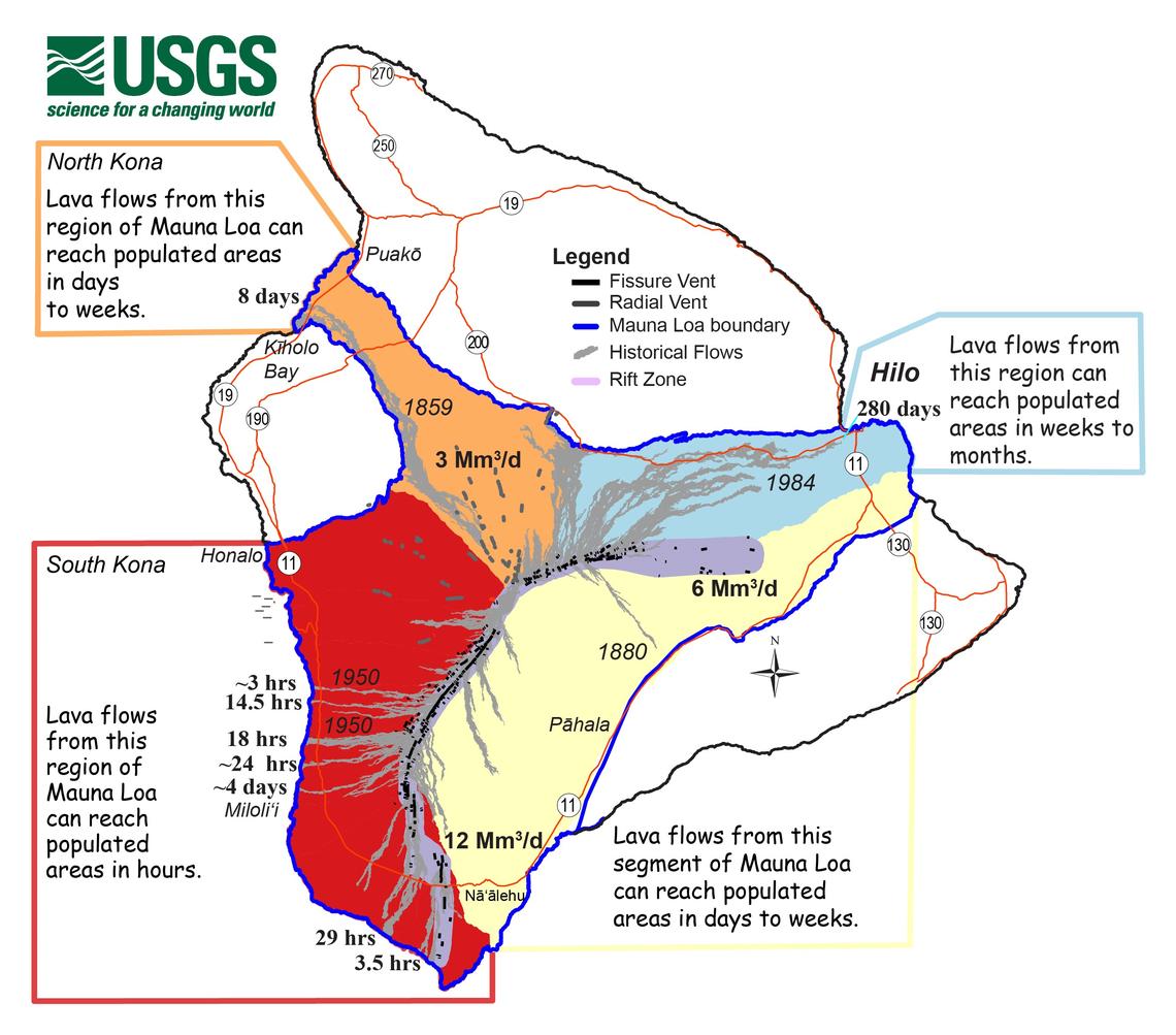
If the eruption remains in Moku‘āweoweo, lava flows will most likely be confined within the caldera walls. However, if the eruptive vents migrate outside its walls, lava flows may move rapidly downslope. In past eruption events, some eruptions have been contained to the caldera, while others have had voluminous flows out through down-slope fissures and radial vents. Since the 1850s, Hilo in eastern Hawaii has been threatened by 7 Mauna Loa lava flows. On the south and west sides of the island, Mauna Loa lava flows have reached the coast there 8 times: in 1859, 1868, 1887, 1926, 1919, and three times in 1950.
Mauna Loa is considered the largest active volcano on Earth, rising to 13,681 feet above sea level. Mauna Loa rises up from the ocean floor of the Central Pacific at a depth of about 3 miles. Because of the volcano’s significant mass, the ocean floor directly beneath Mauna Loa is depressed by another 5 miles. According to USGS, this places Mauna Loa’s summit about 56,000 feet above its base; the enormous volcano covers half of the island of Hawaii, also known simply as the “Big Island of Hawaii.”
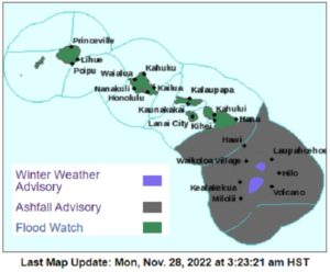
While lava isn’t threatening any communities as of print time of this report, the National Weather Service in Honolulu, Hawaii has issued an Ashfall Advisory for the area stretching from the east coast of Maui across the entire Big Island of Hawaii, including all surrounding ocean waters. The National Weather Service warns, “A volcanic eruption is causing volcanic ash and debris to fall over the waters near and downwind of the volcano, depositing ash and debris. A light accumulation of ashfall is expected on vessels. Falling volcanic ash and debris can cause respiratory distress in people, and render engines or electronics inoperative.” The National Weather Service also warns that there could be possible harm to crops and animals, minor equipment and infrastructure damage, and reduced visibility. “Widespread clean- up may be necessary,” the National Weather Service cautions. However, volcanic ash is extremely abrasive and great care should be used to remove it from surfaces to avoid scratching even glass and other hard substances. Mariners are advised to remain in-port or avoid the advisory area.
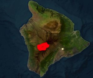
The National Weather Service warns that up to 1/4″ of volcanic ash could fall.
The National Weather Service is also continuing Winter Weather Advisories for Hawaii too, where snow is falling on currently-eruption Mauna Loa and also on nearby Mauna Kea volcanoes. With snow and freezing fog, authorities have closed roads up/around Mauna Kea volcano. Access to the summit of Mauna Loa was closed several weeks ago due to heightened unrest at the volcano. The National Weather Service says, “A Winter Weather Advisory means that periods of snow, sleet, or freezing rain will cause travel difficulties. Be prepared for slippery roads and limited visibilities and use caution while driving.”
Falling snow and falling volcanic ash could make travel treacherous if not impossible.
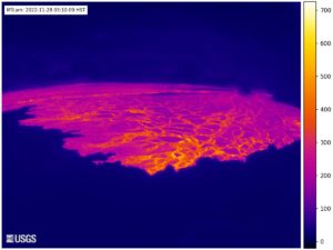
This fresh eruption began after a series of earthquakes rattled the summit region. With lava visible on webcams positioned onto the summit of the volcano, USGS’s Hawaiian Volcano Observatory (HVO) scientists upgraded the alert level there. HVO is responsible for issuing Aviation Codes and Volcanic Activity Alert Levels. Aviation Codes are green, yellow, orange, or red. When ground-based instrumentation is insufficient to establish that a volcano is at a typical background level of activity, it is simply “unassigned.” While green means typical activity associated with a non-eruptive state, yellow means a volcano is exhibiting signs of elevated unrest above known background levels. When a volcano exhibits heightened or escalating unrest with the increased potential of eruption, it jumps to orange. Finally, when an eruption is imminent with significant emission of volcanic ash expected in the atmosphere or an eruption is underway with significant emission of volcanic ash into the atmosphere, the code becomes red. Volcanic Activity Alert levels are normal, advisory, watch, or warning. As with aviation codes, if data is insufficient, it is simply labeled as “unassigned.” When the volcano is at typical background activity in a non-eruptive state, it is considered normal. If the volcano exhibits signs of elevated unrest above background level, an advisory is issued. If a volcano exhibits heightened or escalating unrest, a watch is issued while a warning is issued when a hazardous eruption is imminent or occuring.
Hawaii County Civil Defense says they are now “activated” for this eruption emergency. While there is no lava making its way down the slopes of the huge volcano at this time, they have opened up shelters for people that could be impacted by future flows. As a precaution, shelters have been opened at Old Kona Airport in Kailua-Kona and Ka`u Gymnasium in Pahala. USGS has said all along they won’t know where and if lava will come down from a Mauna Loa eruption, but warned that once it starts, lava could race down slopes at high speeds and reach the ocean within hours. Once lava is flowing down-slope, USGS experts will be able to predict where those flows will go and work with Hawaii County Civil Defense to get those people out of harm’s way. Even so, people may only have an hour or so to get out of harm’s way when that occurs, especially in south Kona and in areas along the southwest rift zone in Hawaii like Ocean View Estates.
Hawaii County Civil Defense Administrator Talmadge Magno has been telling residents to be prepared for this moment in recent weeks. “This volcano is not dead. Now’s the time to prepare in case an eruption occurs…It could be only hours before lava inundated this area. So now is the time to get ready.”
Talmadge Magno, Civil Defense Administrator on the Big Island of Hawaii, has been warning island residents to be prepared for an eruption for many weeks now. He has said that similar to preparing for hurricane season, having an eruption plan in advance helps during an emergency.”
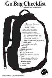
One thing Hawaii County Civil Defense and the Hawaii Emergency Management Agency have been urging people in the possible paths of Mauna Loa’s lava flows is to develop a plan and pack a “go bag.”
“We work with partners like the HVO for volcano and earthquakes and NOAA for tsunamis and hurricanes,” Magno said at a recent community townhall meeting . “During the blue skies period when there isn’t an active disaster, we work with partners preparing for emergencies.”
“We need the community to receive our messages,” Magno said, encouraging that locals sign-up for Everbridge TXT, email, and phone alerts should things change. Users can customize the types of alerts they get, ranging from flood advisories to earthquake, tsunami, and volcano updates, when they’re issued.
Magno wants people prepared if they need to evacuate their homes in case lava heads their way. “Do you have friends or family you can stay with? Do you have the ability to stay in a hotel? Or leave the island? Shelters will be open for people who have no other places to go, and they will be pet friendly.”
Magno also warned that when an eruption occurs, cell phone networks will likely be overwhelmed with activity, leaving many people with dropped calls or simply no service. “If you aren’t in harm’s way, stay off cell phones. Texting is best.”
This period of heightened unrest began in mid-September 2022 when earthquake rates below Mauna Loa’s summit grew from 10-20 per day to 40-50 per day. In addition to the dramatic increase of earthquakes, there’s also been an increased rate of inflation recorded by GPS stations and by a device near the volcano summit.
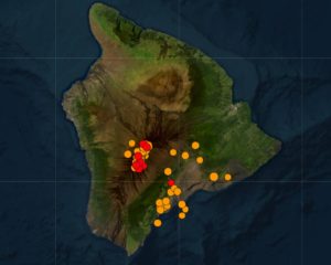
“The unrest is likely caused by renewed input of magma into Mauna Loa’s summit reservoir system. As the reservoir expands it is triggering small earthquakes directly beneath Mokuʻāweoweo caldera and in a region just to the northwest of the caldera,” HVO said in a recent update. “Deeper magma input is detected by the continued increase in upward movement and extension measured between GPS stations located on the ground surface. Shallower magma input was likely responsible for inflation recorded on the summit tiltmeter during the last two weeks of September.”
Before the eruption began, there was a surge of more than 10 earthquakes within an hour period at the volcano. USGS is reporting ongoing earthquake activity at and around the volcano at this time. People in Hawaii should be alert for earthquake-specific hazards and the risk tsunami could pose should a stronger earthquake strike.
Now USGS is waiting for Mauna Loa’s next move. According to USGS scientist Research Geologist Frank Trusdell, an eruption at Mauna Loa always starts at the summit; from there, it could continue on its slopes through fissures that open up on rift zones, or through radial vents that extend out on the western slopes of the volcano. But not every summit eruption leads to lava flows below the summit.
“Since 1832, there have been 33 eruptions. About half stayed in the caldera (at the summit), while 25% erupted into northeast rift zones towards Hilo and 20% erupted into southwest rift zones towards Ocean View,” said Trusdell. “And we’ve had radial vents on the north and west flanks too.”
Where the lava heads on the island and the speed it takes to get there is a function of the dramatically different terrain on the volcanic Hawaiian island.
“In Hilo, you have weeks to months to prepare,” Trusdell said, describing how a flow heading into the heavily populated northeastern corner of the island would take a considerable amount of time to get to due to the slope of the terrain. “It will take days to weeks for a flow to threaten South Kohala,” added Trusdell, pointing out that Hawaii’s famous gold coast dotted by luxury resorts like Auberge’s Mauna Lani, Hilton’s Waikoloa Village, and the Fairmont Orchid could be in the path of a future lava flow. The resorts are built on flows that erupted from Mauna Loa in the 1850’s.
This is a developing situation that will be updated as new information is received.