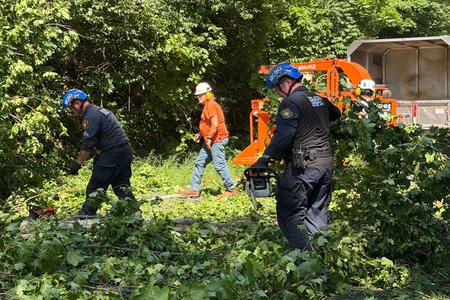
The National Weather Service has completed their storm surveys examining damage caused by Tuesday’s tornado outbreak in the Garden State and confirmed 4 tornadoes touched down in New Jersey . In a typical year, New Jersey will see 2-3 tornadoes. According to the NOAA, in the period from 1950 to June of 2022, there have been a total of 184 reported tornado touch-downs in New Jersey, responsible for 80 injuries, 1 death, and more than $84 million in property damage.
Tuesday’s tornadoes touched down during a well predicted severe weather outbreak which struck portions of the Ohio Valley and Mid Atlantic. Tornadoes were confirmed in Sussex, Morris, and Cape May Counties. Three were rated an EF-1 while one, in Cape May County, was rated an EF-0. There were no fatalities nor injuries in New Jersey as a direct result of the confirmed tornadoes.
The Enhanced Fujita Scale or EF Scale, which became operational on February 1, 2007, is used to assign a tornado a ‘rating’ based on estimated wind speeds and related damage. When tornado-related damage is surveyed, it is compared to a list of Damage Indicators (DIs) and Degrees of Damage (DoD) which help estimate better the range of wind speeds the tornado likely produced. From that, a rating from EF0 to EF5 is assigned. In general, EF-0 tornadoes have 65-85 mph winds, EF-1 have 86-110 mph winds, EF-2 have 111-135 mph winds, EF-3 have 136-165 mph winds, EF-4 have 166-200 mph winds, and EF-5 tornadoes have winds in excess of 200 mph. The EF Scale was revised from the original Fujita Scale to reflect better examinations of tornado damage surveys so as to align wind speeds more closely with associated storm damage., with the new scale related to how most structures are designed.
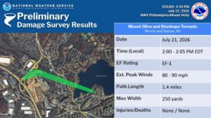
The first confirmed tornado struck Mount Olive and Stanhope in Morris and Sussex County. This EF-1 tornado traveled 1.4 miles, was 250 yards wide, and had an estimated peak wind of 80-90 mph. The National Weather Service said it touched down at 2 pm and lifted up 5 minutes later. The National Weather Service said extensive tree damage was noted near the interchange of Interstate 80 and Highway 206. The path of tree damage continued towards Continental Drive while there was a discontinuous tree damage path through Stanhope. The next area of damage was noted on the southern shore of Lake Musconetcong. At residences along Koclas Drive, tree damage was observed; some shingles were blown off the roof of one residence and gutter damage was noted at another. The distinctive path of damage appeared to end at Koclas Drive.
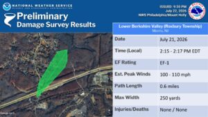
The second confirmed tornado struck the Lower Berkshire Valley near Roxbury, Township in Morris County at 2:15 pm. This tornado had estimated peak winds of 100-110 mph, traveled 0.6 miles, and was 250 yards wide. It only lasted in the ground for 2 minutes. According to the National Weather Service, the tornado began on the west side of Berkshire Valley Road, between the Morristown & Montclair-Boonton NJ Transit line and Interstate 80, uprooting several trees. The tornado continued to the northeast, causing additional damage along Berkshire Valley Road, north of I-80. In this area, a softwood pine tree was snapped about halfway up along its trunk. Continuing northeast, the tornado crossed through a neighborhood along Little Lane. Numerous trees and wires were damaged in this area, including a large, healthy, hardwood tree being uprooted. The tornado proceeded northeast, damaging numerous additional trees and wires as it crossed Mill Road, before dissipating.
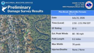
The third confirmed tornado struck in Pine Brook in Morris County at 2:50 pm; by 2:51 pm the tornado lifted up. This tornado had estimated peak winds of 80-90 mph, had a short path of 0.2 miles, and was only 70 yards wide. The EF-1 tornado touched down behind the ridgeline on Windsor Drive in the Pine Brook section on Montville and the tornado generally tracked northeast where a path of mainly tree damage was found. A large uprooted tree and several large branches were found to be snapped in a couple of backyards along Hook Mountain Road. Photos were passed on by local residents of a broken power pole which was snapped at its base which was also lying across Hook Mountain Road. The tornado continued onward, removing some shingles from a house, before crossing over Hook Mountain Road and dissipating around 2:51 PM EDT before reaching the Passaic River.
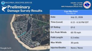
The final tornado struck Cape May Point in Cape May County. This EF-0 rated tornado had estimated peak winds of only 60-70 mph; it traveled 0.255 miles and had a width of only 30 yards. This tornado also only lasted a minute, touching down at 6:15 pm before lifting up at 6:16 pm. The National Weather Service says a waterspout was witnessed going on shore the beach at Cape May point; from that area, a narrow path of tree damage was noted along Lincoln Avenue, Yale Avenue, and near the intersection of Oxford Ave and West Lake Drive. At least one witness saw the funnel cloud proceed into Lake Lily, but no other damage was noted.
