Today marks the one year anniversary that lava began flowing through the once-quiet Leilani Estates subdivision in the Puna district in eastern Hawaii. Hawaii Island, known as the Big Island to most, is home to the Kilauea Volcano which has erupted non-stop for decades. For most of that time, lava stayed away from populated areas, but that wasn’t the case in May 2018.
On May 2, cracks started appearing in large number as a swarm of low-level earthquakes rocked the community. In some cases, the cracks opened wider and wider, with lava and volcanic gases escaping from them with jet-engine-like noises on May 3.
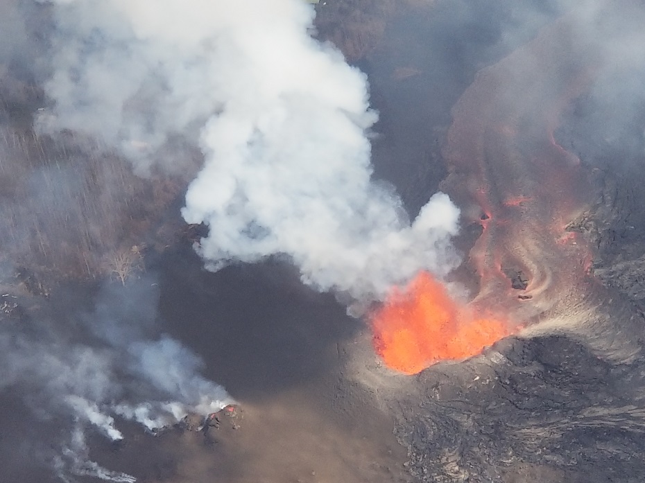
However, the most impactful Earth science story this year was undoubtedly the 2018 Kilauea Eruption of the Lower East Rift Zone on Hawaii’s Big Island. While hurricanes, wildfires, and floods erased scores of homes around the country, no event was more unpredictable and more permanent than the volcanic eruption in Hawaii. While neighborhoods destroyed by storms, like Mexico Beach, Florida will recover over time, a large part of an area rich with residential neighborhoods and agricultural lots will be forever buried in thick lava rock. The eruption was so significant that the Honolulu office of the National Weather Service had to create new volcanic ash advisories to warn residents and visitors of the dangers there.
The volcanic event in Hawaii was a multi-month ordeal that started in May. On May 4, a 6.9 magnitude earthquake hit the Puna of eastern Hawaii. Just a few weeks later, by May 27, 2018, 24 fissures had erupted lava in or near the Leilani Estates and Lanipuna Gardens subdivisions of Hawaii. The Puna Geothermal Venture, which provided one-quarter of the island’s electricity, was forced to shut down and was later damaged by lava. Work began in December to bring the plant back to life, although the company said any such effort would take more than a year to complete.
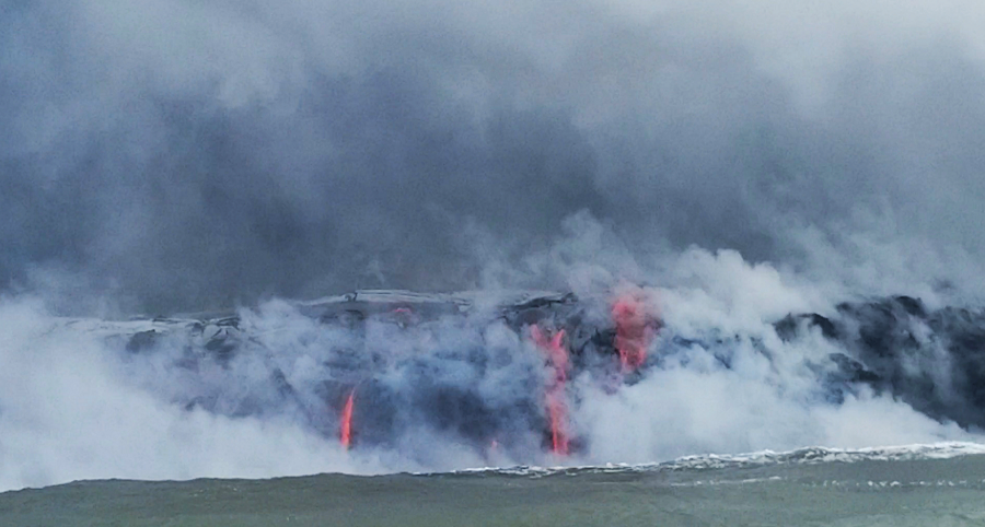
On May 29, lava from a new northeastern flow overran Hawaii Route 132, cutting the access between Kapoho and Pāhoa. On June 4, the immense lava flow reached the Pacific Ocean at Kapoho Bay. The northeastern flow of lava quickly moved forward and destroyed the subdivision of Vacationland. By the next day, Kapoho Bay was completely filled in with lava. The destruction in early June made Kilauea the most destructive volcano in the United States since the 1980 eruption of Mount St. Helens.
On December 5, after three months of inactivity, scientists considered the eruption over. However, USGS continues to warn that volcanoes remain somewhat unpredictable and that an eruption can resume in the Lower East Rift Zone or elsewhere around Kilauea with little notice.
Beyond losses from canceled vacations and a damaged tourism industry, the eruption claimed no lives. However, 1 person remains missing while 24 were injured in the eruption event. Damage estimates continue to be added, but the toll currently stands at about $800million and growing.
The eruption event was covered by social media, with Ikaika Marzo and Phil Ong become internet stars with their in-depth video and analysis of the ongoing disaster in Hawaii.
While a lot was happening on Earth, plenty was happening above it too. The high-tech GOES-S weather satellite was launched from NASA’s Kennedy Space Center in March. However, a failure of a cooling system has somewhat crippled the satellite, not providing scientists with the full suite of data they were initially hoping for. In November, ESA launched the METOP-C weather satellite. Combining data captured by GOES-S and other polar orbiting satellites, computer forecast models are now armed with huge amounts of data which should lead to more accurate forecasts. ESA’s Sentinel satellites were used to monitor the volcanic situation in Hawaii while the GOES satellites provided fire data for wildfires in the US.
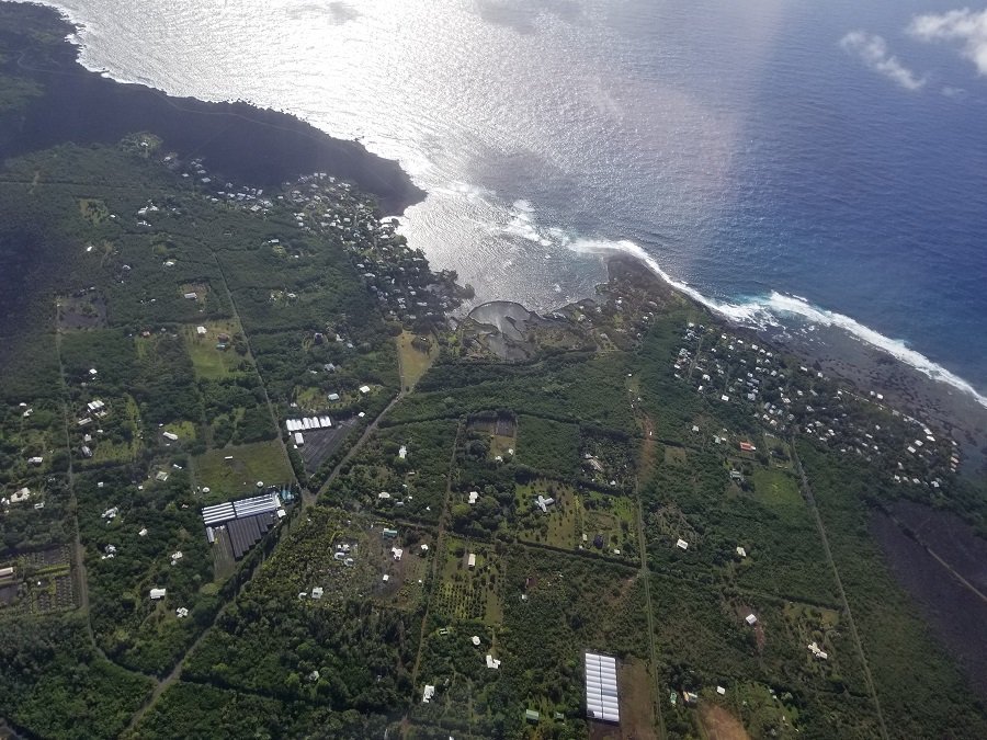
Today, one day later, a large piece of what was once Leilani Estates, and the land beneath it to the former Kapoho Coast, is now a black landscape, void of the lush tropical vegetation and happy Hawaiians that once called it home.
