
An atmospheric river event dumped rain measured in feet and snow measured in yards in the western U.S. earlier this week; with powerful winds over 100 mph, blizzard conditions were observed there. But will blizzard conditions unfold as that system heads to the east coast? It looks quite possible.
While many people think a blizzard is simply a big snowstorm, they’re wrong. A blizzard is all about wind and visibility. According to the National Weather Service, three criteria must be reached before a storm is considered a blizzard. First, there needs to be sustained winds of 35 mph or frequent gusts over 35 mph. Second, due to the weather, the visibility must be reduced to 1/4 mile or less. This reduction can happen from falling heavy snow …or it could simply be previously fallen snow blowing about in the wind. You do not need fresh snow to be falling to reach blizzard criteria. Third, to count as a blizzard, the reduction in visibility and the strong winds must last for at least three hours. When all three of these conditions are met, you have more than a snowstorm: you have a full-fledged blizzard!
The blizzard criteria was easily met this week in the Sierra Nevada where more than 4 feet of snow fell as winds gusted beyond hurricane strength for a prolonged period of time.
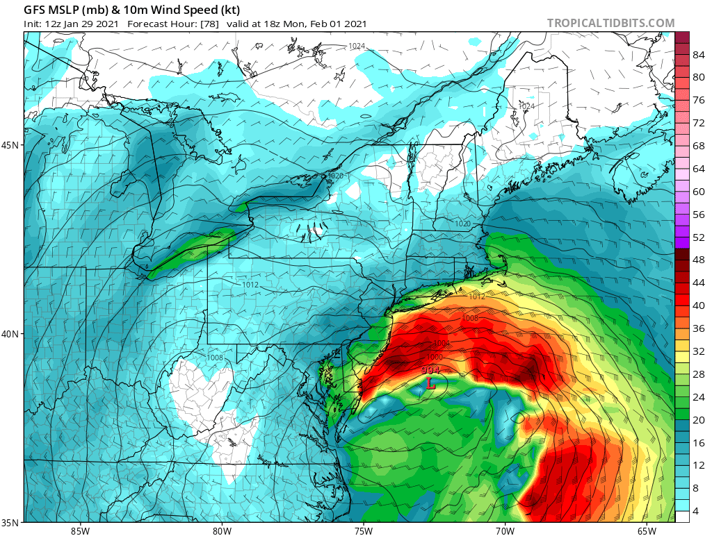
Now that system is moving across the United States and is forecast to bring snow to the Chicago metro area and Great Lakes region by tomorrow night. On Sunday, the storm will head to the east coast, where it is expected to redevelop into a potent coastal storm by Monday afternoon east of Delaware and Maryland.
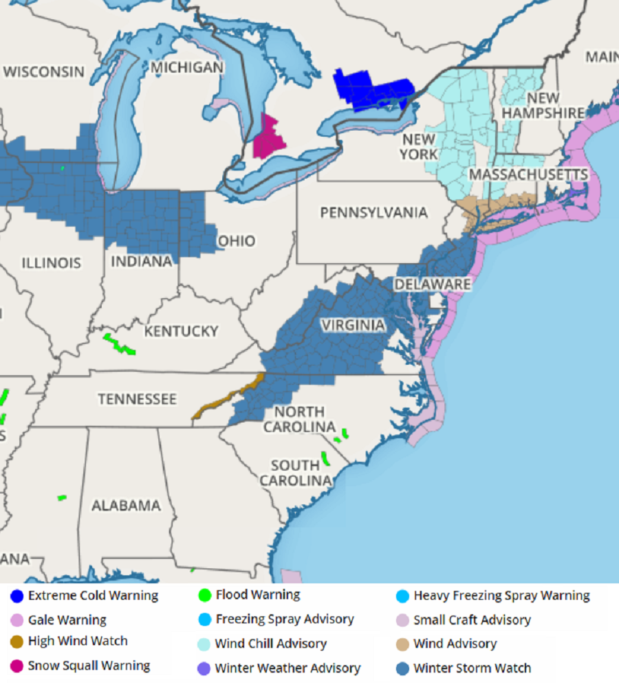
According to the National Weather Service, in addition to creating significant precipitation including heavy snow, the storm could also produce very strong winds. In Delaware and Maryland, the National Weather Service says, “Total snow accumulations over 6 inches possible. Winds could gust as high as 45 mph creating significant blowing and drifting of snow.” To the north, across the Philadelphia area and much of central and southern New Jersey, the conditions could be more severe. The National Weather Service says for there, “Heavy snow possible. Total snow accumulations over 7 inches possible. Winds could gust as high as 50 mph creating significant blowing and drifting of snow.”
With winds gusting 45-50 mph in this area and lasting for several hours, combined with falling snow, the blizzard criteria could be reached, especially Monday night. If the National Weather Service is confident blizzard criteria could be met there, blizzard watches or warnings may be issued.
Even if the blizzard conditions don’t materialize, travel could still be very difficult in the area currently under the Winter Storm Watch.
As more data comes in this evening and Saturday morning, meteorologists will have a better grasp on how this storm should evolve and be in a better situation to understand where a rain/snow line will set-up and calculate how much snow could fall in the snowy areas. At that point, additional advisories, watches, or warnings could be issued for this developing east coast winter storm for the northeast and Mid Atlantic.
