• Skip to primary navigation
  • Skip to main content
  • Skip to primary sidebar

Weatherboy

Weatherboy Weather News, Maps, RADAR, Satellite, and Forecasts.

  • Local
  • Earth Science News
  • RADAR
  • Current Warnings
  • Satellite
  • Current Maps
  • Forecast Maps
  • Video

Major Hurricane Dora Gets Closer to Hawaii and Stronger, But Will Still Miss It

by Weatherboy Team Meteorologist - August 3, 2023

Major Hurricane Dora is spinning about in the eastern Pacific between Hawaii and the coast of Mexico. Image: NOAA


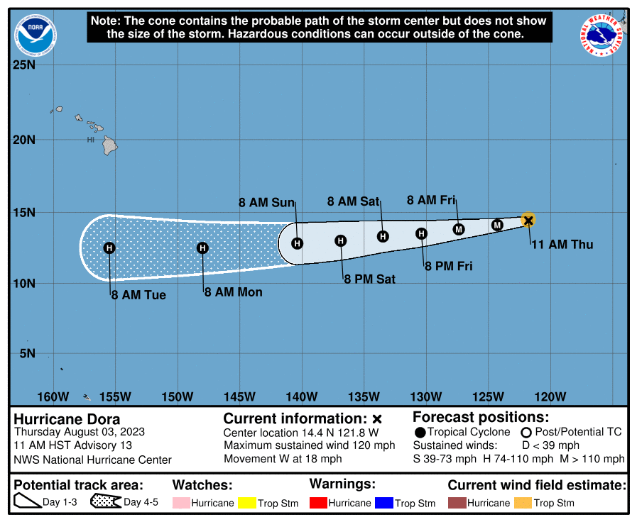
Major Hurricane Dora continues to get closer to Hawaii today, but the forecast from the National Hurricane Center still shows the hurricane will still miss making a direct impact.

As of the latest update from the National Hurricane Center, Major Hurricane Dora was a category 4 hurricane on the Saffir-Simpson scale with maximum sustained winds of 140 mph. The storm is moving due west at 18 mph while its minimum central pressure is down to 958 mb or 28.29″.

Dora has been getting stronger and weaker and stronger again over the last 24 hours, flipping between category 3 and 4 status as a major hurricane. The National Hurricane Center expects fluctuations in its strength over the next 24 hours but forecasts Dora to start weakening for good later on Friday and Saturday.

While Dora has fluctuated with its intensity, it’s motion to the west hasn’t changed much. The National Hurricane Center expects it to get closer to Hawaii in the coming days, but eventually pass well south of the island chain.

Hurricane Dora is forecast to track well to the south of Hawaii in the coming days. Image: NHC


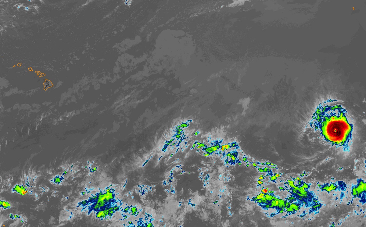
Dora is a small tropical cyclone with hurricane-force winds extending outward only up to 15 miles from the center while tropical-storm-force winds extend outward up to 45 miles from the center. Because it is so compact, its forecast path should keep all precipitation and even clouds from the hurricane away from Hawaii as it passes to the south.


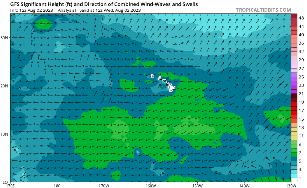
While rain and wind won’t be an issue for Hawaii, rough surf and high swells may become problematic. Model guidance shows that even with Dora heading well south of Hawaii, swells from the storm will advance north to the state early next week.

Simulated wave data from the American GFS computer forecast model shows that while the center of Dora should head well south of Hawaii, large waves and rough surf should lash the islands anyway. Image: tropicaltidbits.com

Primary Sidebar

Sponsored Ad

Search

Latest News

  • Gulf System Won’t Develop But Will Soak Coast
  • Tsunami Likely After 7.3 Magnitude Earthquake; U.S. On Alert
  • New Jersey and Pennsylvania Forecast to be Hot Mess: Damaging Storms, Floods, 105°+ Heat Index
  • Mid Atlantic Flash Flood Threat Persists
  • Hurricane Center Boost Odds of Tropical Cyclone in Gulf of America
  • National Hurricane Center & Computer Models Hint at Tropical Cyclone Forming in Gulf of America
  • Weak Earthquake Rattles North Carolina
  • Forecasters Update Atlantic Hurricane Season Outlook
About | Careers | Contact | Contests
Terms | Privacy | Ad Choices
Weatherboy is a (R) Registered Trademark of isarithm LLC, All Rights Reserved.
All content herein is Copyright by Isarithm LLC 1997-2022