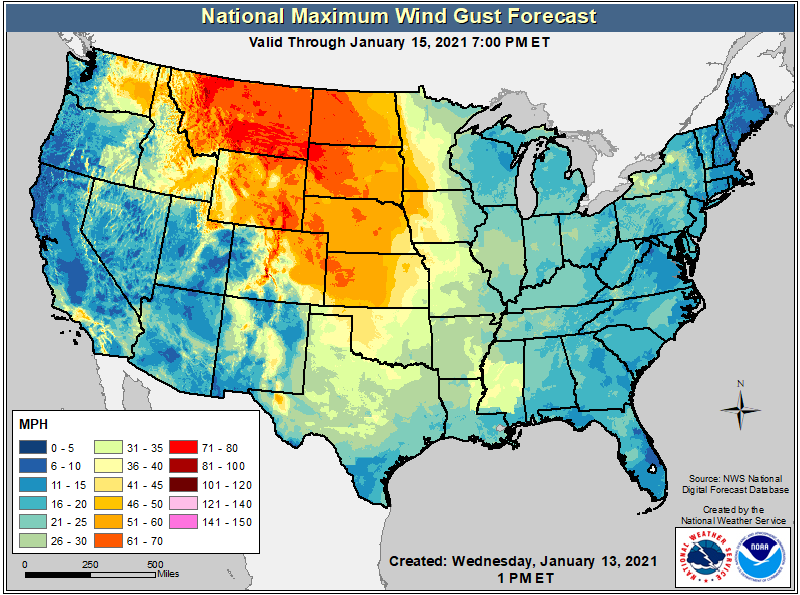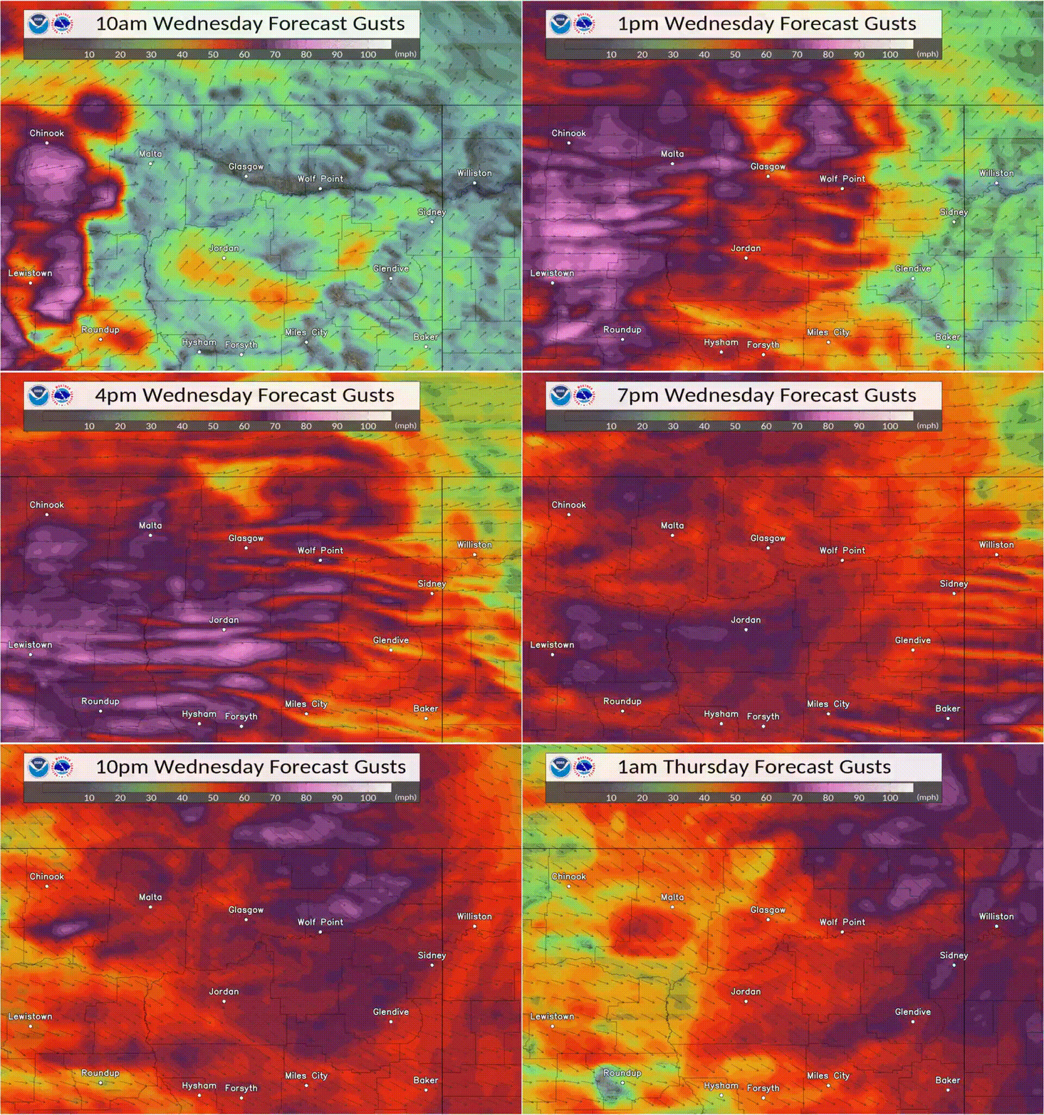
A powerful storm system moving across the country today will set the stage for a very significant wind event, with major winds expected across a broad area. Winds gusting higher than 60 mph will be likely this afternoon and evening across portions of Washington, Idaho, Wyoming, North and South Dakota, Nebraska, Montana, Colorado, and Kansas. In portions of Montana, winds could gust 81-100 mph or more, which is a hurricane force wind.
Mount Aeneas, located at 7,120 feet in the Swan Mountains, reported a wind gust of 101 mph at 7:00am local time today. That is the equivalent wind of a category 2 hurricane on the Saffir-Simpson scale. Other recent strong gusts so far today: 51 mph in Missoula, 59 mph in Polson, 65 mph in Grangeville, 67 mph in Stevensville, and 96 mph on Hornet Mountain.
[10:30am MST 1/13/2021] It’s an incredible sight to see “flagging” on top of Point 6 mountain, north of #Missoula. The 90+ mph winds are blowing the snow off the peak! #MTwx pic.twitter.com/76NYGfHOyY
— NWS Missoula (@NWSMissoula) January 13, 2021
The National Weather Service in Glasgow, Montana warned, “Imagine the strongest wind gust you’ve experienced from a thunderstorm, but instead of it lasting 5 minutes, it lasts for hours.”

Due to the severe winds, the National Weather Service has issued High Wind Warnings and Watches across the region seeing impacts today.