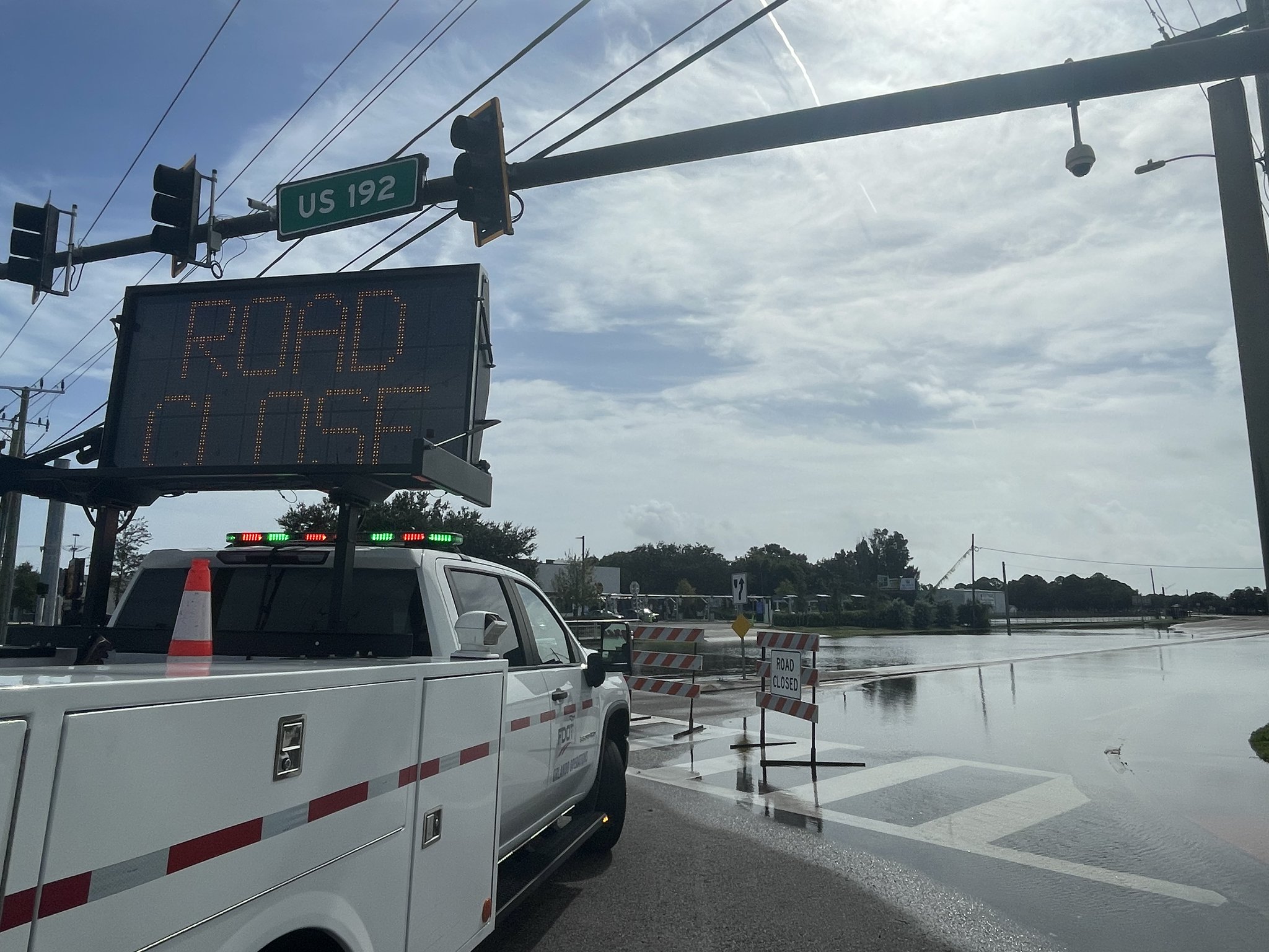
A week after more than 2 feet of rain fell on parts of Florida’s Space Coast, the water is still working its way north through the St. Johns River, keeping homes near Cocoa on the edge of major flooding and pushing the river toward flood stage in Seminole and Volusia counties.
The river near Cocoa in Brevard County stood at 16.98 feet at 6:15 a.m. EST Monday, according to the National Weather Service’s river gauge. Flood stage there is 16 feet, and major flood stage begins at 17 feet. The weather service forecast a rise to 17.1 feet by Tuesday morning.
“Exceptional rainfall over the headwaters of the St. Johns River has caused Moderate to Major flooding at the gauge west of Cocoa,” the weather service office in Melbourne said in a flood warning updated at 8:07 p.m. Sunday. “The river may rise slightly early this week and remain in Major flood stage through at least Friday.”
At 17.2 feet, the warning said, water enters homes along the river in the Lake Poinsett area west of Cocoa, along with low-lying homes in the Silver Pines subdivision in Rockledge and the Shakespeare Park area of Cocoa. The Providence Road area west of Cocoa becomes impassable at that level, cutting off access to homes in the Mullet Lane and Bass Road area, the warning said.
Why the Flood Keeps Moving
The St. Johns is one of the few major rivers that flow north, so water from the Nov. 1-2 deluge in southern Brevard County is draining slowly downstream toward Lake Harney, Lake Monroe and Lake George.
The rain was historic. Weather service totals reported by Florida Today included 23.69 inches in North Grant-Valkaria, 23.44 inches in east Malabar and 19.75 inches in Palm Bay. Two people died, ABC News reported.
“Now we’re dealing with the anomaly of this water flowing north and then causing some secondary flooding in some areas that either have already had flooding or escaped the first round,” Don Walker of Brevard County Emergency Management told Central Florida Public Media last week.
The Melbourne forecast office repeated that message Monday. “Extensive flooding continues along the St. Johns River due to exceptional rainfall in the upper reaches of the basin last week,” forecasters wrote in their 12:21 a.m. discussion.
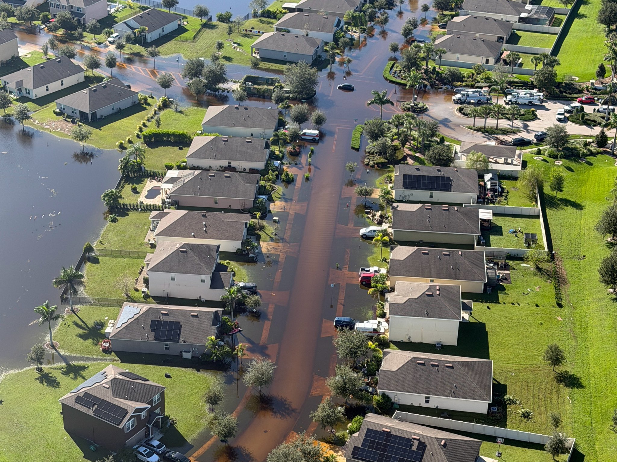
Image: Florida Division of Emergency Management
The Cocoa reading is among the highest at that gauge in decades. The National Water Prediction Service lists the highest crests there as 17.55 feet on Oct. 11, 1953, 17.43 feet on Oct. 6, 2017, and 17.11 feet on Aug. 31, 2008. The forecast crest of 17.1 feet would be close to the 2008 mark.
Lake Harney and Sanford Next in Line
Downstream, the river above Lake Harney near Geneva was at 9.11 feet at 6:30 a.m. Monday, in moderate flood stage. Flood stage is 8 feet and major flood stage is 10 feet.
The weather service said a steady rise in moderate flood stage is expected to continue this week, reaching 9.6 feet by Friday. “River levels have the potential to approach Major flood stage next weekend,” the warning said.
At 9.5 feet, water begins to move into homes in low-lying areas along the river, and flooding occurs around the Black Hammock area near Lake Jesup, according to the warning.
Near Sanford, where the river passes through Lake Monroe, the gauge read 5.35 feet at 6:30 a.m. Monday. Flood stage is 5.5 feet. The weather service expects the river to rise above flood stage early Tuesday afternoon and reach 5.9 feet Friday morning, with more rises possible after that. At 6 feet, water encroaches on low-lying roads and on pool enclosures and patios in the Stone Island area, the warning said.
Sanford officials are watching Seminole Boulevard, which runs along the lake. The Sanford Fire Department said Lake Monroe rose from 4.8 feet on Nov. 2 to 5.22 feet in a later update and was projected to reach 6.2 feet by Wednesday, WFTV reported. The city said it may close portions of the boulevard if water reaches the road, but no closures had been announced, WKMG reported Sunday.
“The safety of our residents remains our top priority,” Fire Chief Ronnie McNeil said, according to WFTV. “We encourage everyone to stay informed, use caution when traveling, and avoid flooded roadways.”
DeLand and Astor
Farther north, the river near DeLand was at 3.89 feet early Monday, just under its 4-foot flood stage. Forecasters expect it to top flood stage Monday afternoon and reach 4.2 feet Thursday evening. At 4 feet, docks and piers are completely submerged at Pier 44 Marina and many docks are partly underwater at Hontoon Landing Marina, the weather service said.
At Astor, on the Lake and Volusia county line, the river read 2.88 feet at 6:30 a.m., above the 2.3-foot flood stage. The weather service said heavy rain upstream “will maintain river levels within Moderate flood stage through early next week as a large volume of water works north through the basin.”
At 3 feet, water approaches or may enter the lowest homes on or near Wildhog Road, reaches the parking lot of the Juno Trail Apartments and covers parts of Alligator Road and Holiday Road, the warning said.
Volusia County spokesperson Clayton Jackson said last week that it was too early to say how individual properties would be affected. “While we anticipate the river will continue rising over the next several days, it’s still too early to determine exactly how individual properties and roadways may be affected,” he told Central Florida Public Media.
Self-service sandbag sites are open at Volusia County Fire Rescue Station 36 in Osteen and Lake County Fire Rescue Station 10 in Astor, and Seminole County has sites in Sanford and Geneva, WKMG reported.
Recovery Steps
As the river rises in some places, recovery is moving ahead in the areas hit first.
Brevard County Emergency Management said Sunday that debris removal for flood-impacted areas of unincorporated Brevard County will begin Tuesday, Nov. 10. The county also said it is completing damage assessments. “Over the coming days, we will compile damage into a disaster declaration request and submit to the State,” the county posted.
The Florida Division of Emergency Management said Sunday that initial damage assessments are nearing completion. Joint damage assessments with FEMA are “expected to begin this upcoming week as floodwaters recede,” the agency said.
Gov. Ron DeSantis amended his flooding emergency order Nov. 4 to add Lake, Seminole and Volusia counties, along with Glades, Hendry, Okeechobee and Palm Beach counties, according to Executive Order 26-228.
Dry Week, Then a Strong Cold Front
The weather should not add much water. The Melbourne office said tranquil weather continues through Tuesday, with scattered showers and a few storms returning Wednesday. A cold front will bring a few more showers late Thursday into early Friday.
“Widespread heavy rain is not expected, with a 10-20% chance of amounts exceeding a half inch,” forecasters wrote.
The coolest air of the fall so far is expected next weekend. From Greater Orlando north, there is a 30% to 40% chance of wind chills in the upper 30s Saturday and Sunday mornings, the office said. A high risk of rip currents continues at Central Florida’s Atlantic beaches.
The weather service urged people near the river not to drive around barricades or through flooded areas. “Caution is urged when walking near riverbanks,” the warnings said. The next river statements were scheduled for 11 a.m. EST Monday.
